Derwent Mouth

Derwent Mouth
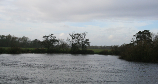
Derwent Mouth viewed from the Leicestershire bank of the River Trent

Derwent Mouth is a location on the River Trent, which at that point forms the border between the English counties of Derbyshire and Leicestershire. It is both the confluence of the River Derwent with the River Trent, and the point at which the Trent and Mersey Canal joins the natural River Trent.

Derwent Mouth is situated some 1-mile (1.6 km) east of Shardlow, and 2 miles (3.2 km) west of Trent Lock, where the navigable River Soar and Erewash Canal join the River Trent. It is about 9 miles (14 km) south-west of the centre of the city of Nottingham, and 7 miles (11 km) south-east of central Derby.

The River Trent is navigable, with the aid of locks, downstream of Derwent Mouth as far as the Humber Estuary. The Trent itself is also navigable for a short distance upstream, but most river traffic enters the parallel Trent and Mersey Canal, which provides connections to the River Mersey and the canal networks of the West Midlands region. The River Derwent is not navigable.

External links


Coordinates: 52°52′22″N 1°19′10″W / 52.872834°N 1.3193142°W / 52.872834; -1.3193142


Wikimedia Foundation. 2010.

Игры ⚽ Поможем написать реферат

Look at other dictionaries:

  • Derwent Valley Heritage Way — The Derwent Valley Heritage Way roundel. Length 88 kilometres (55 mi) Location Derbyshire Trailheads …   Wikipedia

  • Derwent River (Tasmania) — For other rivers called Derwent, see River Derwent (disambiguation). Derwent River River Sunrise over the Derwent River …   Wikipedia

  • Derwent River — River, Tasmania, Australia. Rising in Lake St. Clair, it flows 113 mi (182 km) southeast to enter Storm Bay through a 3.5 mi (5.5 km ) wide estuary. Its major upper course tributaries have been extensively developed for hydropower. The city of… …   Universalium

  • River Derwent, Yorkshire — Geobox River name = Derwent native name = other name = Darwent archaically other name1 = map size = map caption = Map of the Catchment Area of the River Derwent country = England country1 = region = Yorkshire region1 = city = city1 = length = 115 …   Wikipedia

  • River Derwent, Derbyshire — Geobox|River name = River Derwent native name = other name = other name1 = image size = image caption = The River Derwent, just south of Duffield etymology = country = England country country1 = state = state1 = region = Derbyshire region type =… …   Wikipedia

  • Derwentmouth — Derwent mouth Derwentmouth is the place in Derbyshire, England, UK, near Shardlow where the River Derwent joins the River Trent. The longest river in Derbyshire reaches its end at its confluence with the River Trent. The Derwent has flowed… …   Wikipedia

  • Trent and Mersey Canal — Infobox Canal name = Trent and Mersey Canal caption = The Trent and Mersey Canal near Branston Water Park o name = company = engineer = a engineer = James Brindley date act = 1766 date const = date use = 1777 date comp = date ext = date closed =… …   Wikipedia

  • Trent-und-Mersey-Kanal — Der Trent und Mersey Kanal bei Branston Water Park Lage Nordwestengland Länge 150 km …   Deutsch Wikipedia

  • Canals in Cheshire — A large number of canals were built in Cheshire, England during the early phases of the Industrial Revolution to transport goods and raw materials. This resulted in a significant canal network which is now enjoyed by holiday makers, anglers,… …   Wikipedia

  • Trent-Mersey-Kanal — Vorlage:Infobox Fluss/GKZ fehlt Trent Mersey Kanal Karte des Kanals (rot) aus der Zeit des Projektstadiums Lage Nordwestengland …   Deutsch Wikipedia

Share the article and excerpts

Direct link
Do a right-click on the link above
and select “Copy Link”