- Dellwood, Adams County, Wisconsin
-
Dellwood, Wisconsin — Census-designated place — 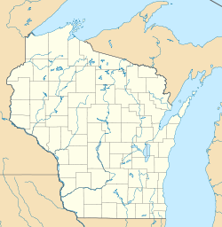
 Dellwood, Wisconsin
Coordinates: 43°59′03″N 89°56′19″W / 43.98417°N 89.93861°WCoordinates: 43°59′03″N 89°56′19″W / 43.98417°N 89.93861°W Country United States State Wisconsin County Adams Area - Total 5.364 sq mi (13.9 km2) - Land 5.236 sq mi (13.6 km2) - Water 0.128 sq mi (0.3 km2) Elevation 912 ft (278 m) Population (2010 census) - Total 563 - Density 105/sq mi (40.5/km2) Time zone Central (CST) (UTC-6) - Summer (DST) CDT (UTC-5) ZIP code 53927 Area code(s) 608 GNIS feature ID 1563891[1] Dellwood (also known as Delwood[2]) is an unincorporated census-designated place located in Adams County, Wisconsin, United States. Dellwood is west of Friendship, in the town of Strongs Prairie. Dellwood has a post office with ZIP code 53927.[3] As of the 2010 census, its population was 563.[4]
References
- ^ U.S. Geological Survey Geographic Names Information System: Dellwood, Adams County, Wisconsin
- ^ "Dellwood Census-Designated Place". Geographic Names Information System, U.S. Geological Survey. http://geonames.usgs.gov/pls/gnispublic/f?p=gnispq:3:::NO::P3_FID:2586473.
- ^ ZIP Code Lookup
- ^ "American FactFinder". U.S. Census Bureau. http://factfinder2.census.gov/main.html. Retrieved 30 March 2011.
Municipalities and communities of Adams County, Wisconsin County seat: Friendship Cities 
Village Towns Adams | Big Flats | Colburn | Dell Prairie | Easton | Jackson | Leola | Lincoln | Monroe | New Chester | New Haven | Preston | Quincy | Richfield | Rome | Springsville | Strongs Prairie
CDPs Arkdale | Dellwood | Grand Marsh | Lake Arrowhead | Lake Camelot | Lake Sherwood
Unincorporated
communitiesBig Flats | Big Spring | Brooks | Cottonville | Easton | Monroe Center | Plainville | White Creek
Footnotes ‡This populated place also has portions in an adjacent county or counties
Categories:- Populated places in Adams County, Wisconsin
- Census-designated places in Wisconsin
- Wisconsin geography stubs


Wikimedia Foundation. 2010.