Daviot — can refer to two villages in Scotland: Daviot, Aberdeenshire Daviot, Highland For the writer Gordon Daviot, see Josephine Tey This disambiguation page lists articles about distinct geographical locations with the same name. If an … Wikipedia
Daviot — ist der Name zweier Orte in Schottland: Daviot (Aberdeenshire) Daviot (Highland) Für den Schriftsteller Gordon Daviot, siehe Josephine Tey Diese Seite ist eine Begriffsklärung zur Unterscheidung mehrerer mit demselben … Deutsch Wikipedia
Daviot, Aberdeenshire — The prehistoric stone circle at Loanhead of Daviot This article is about the region in Scotland. For the writer Gordon Daviot, see Josephine Tey. For the village near Inverness, see Daviot, Highland. Daviot (Gaelic: Deimhidh) is a village in… … Wikipedia
Daviot and Dunlichty — DAVIOT and DUNLICHTY, a parish, chiefly in the county of Inverness, but partly in that of Nairn, 5 miles (S. E.) from Inverness, containing 1681 inhabitants. These two ancient parishes were united about the year 1618: the former received its… … A Topographical dictionary of Scotland
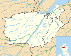
List of places in Highland — This article is a list of links for any town, village, hamlet and settlements, in the Highland council area in Scotland. The area encompassed by the Highland council is a slightly different area to that encompassed by the Scottish… … Wikipedia
Moy, Highland — Coordinates: 57°22′52″N 4°02′43″W / 57.38106°N 4.0452°W / 57.38106; 4.0452 … Wikipedia
GB-ABD — Aberdeenshire Siorrachd Obar Dheathain Verwaltungssitz Aberdeen Fläche 6.313 km² (4.) … Deutsch Wikipedia
Inverness and Aviemore Direct Railway — [v · d · … Wikipedia
Aberdeenshire — Siorrachd Obar Dheathain Verwaltungssitz Aberdeen Fläche 6.313 km² … Deutsch Wikipedia
Inverness-shire — County of Inverness until circa 1890 Missing map County of Inverness circa 1890 to 1975 … Wikipedia
 Daviot