- Moy, Highland
-
Coordinates: 57°22′52″N 4°02′43″W / 57.38106°N 4.0452°W
Moy Scottish Gaelic: A' Mhòigh
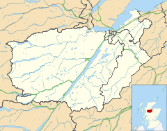
 Moy shown within the Inverness area
OS grid reference NH771337 Council area Highland Country Scotland Sovereign state United Kingdom Post town Tomatin Postcode district IV13 7 Police Northern Fire Highlands and Islands Ambulance Scottish EU Parliament Scotland List of places: UK • Scotland • The village of Moy (Scottish Gaelic: A' Mhòigh) is situated between the villages of Daviot and Tomatin, in the Highland region of Scotland. It sits beside Loch Moy and used to have a railway station on the Inverness and Aviemore Direct Railway.
History
On 16th February 1746 Charles Edward Stuart spent the night at Moy Hall. To prevent the troops from Inverness descending on the estate in surprise during the night, Lady Anne Farquharson-MacKintosh sent her youngest son along with the blacksmith[1] and two other retainers to watch the road from Inverness. Sure enough, during the night several hundred Hanoverian troops were detected marching down the road. The Mackintosh defenders started beating their swords on rocks, jumping from place to place and shouting the war cries of different clans in the Chattan Confederation. Thinking that they had been ambushed, the British troops retreated to Inverness, an event known as the Rout of Moy. There was only one casualty of this incident, the piper for the Hanoverian troops, possibly a famous McCrimmon, was killed.
Notes and references
- ^ Site Record for Rout of Moy, Royal Commission on the Ancient and Historical Monuments of Scotland, http://canmore.rcahms.gov.uk/en/site/85381/. The grid reference given by the RCAHMS is NH72983464, a little to the west of Moy at the pass between Meall Mor and Ben nan Cailleach.
Categories:- Highland geography stubs
- Populated places in Inverness committee area
Wikimedia Foundation. 2010.


