- Horn Island, Queensland
-
Horn Island
Queensland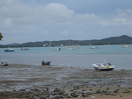
View of Horn Island from Thursday Island.
 Horn Island
Population: 585[1] Postcode: 4875 Coordinates: 10°36′S 142°17′E / 10.6°S 142.283°ECoordinates: 10°36′S 142°17′E / 10.6°S 142.283°E Elevation: 4 m (13 ft) LGA: Shire of Torres State District: Cook Federal Division: Leichhardt Mean max temp Mean min temp Annual rainfall 30.2 °C
86 °F24.5 °C
76 °F1,827.4 mm
71.9 inHorn Island (Narupai [Nœrupai/Nurupai]) is an island in the Torres Strait, in Queensland's north between the Australian mainland and Papua New Guinea. At the 2006 census, Horn Island had a population of 585.[1]
Church Influence: London Missionary Society up until 1915 when the Anglican Church assumed responsibility.
Horn Island is known as Nœrupai (colloquially Nurupai) to the Kaurareg [Islander] people and was given its English name by Matthew Flinders in 1802. After the 1871 massacre on Prince of Wales Island (Muralag) remnants of the people settled here for a short while, until the government relocated the Kaurareg to Hammond Island (Kœriri) where they remained until 1922. These islands (along with the other islands in the group are the lands of the Kaurareg, each island - or rather parts thereof - owned by different clans.
The language of the Kaurareg is Kala Lagaw Ya, in the form of Kaiwalgau Ya (called Kauraraigau Ya [colloquial variant Kauraregau Ya] in the 19th century).
The word Kaurareg means Islander, and is now in the modern language Kawalaig and Kaiwalaig (dialect variants). Kaurareg was a coloquial variant of the mid-19th century form Kauraraiga/Kauralaiga (kaura island and -laiga person who belongs to or has. The r was pronounced more or less like the r in American English, and disappeared from ordinary speech sometime in the 1900s. The Kauraraiga called themselves as such as a contrast from the Aboriginal Dhaidhaulaiga (mainlander) of the Australian mainland, such as the Gudang, Kartakartalaiga, Urradhi, Yadhaikana, and others.
Gold was mined on Horn Island in the 1890s. In the early 20th century, a town flourished as a result of the pearling industry, but declined when non-islander residents were evacuated to southern Queensland during World War II. A major Allied airbase, known as Horn Island Aerodrome, was constructed on the island and this was attacked several times by Japanese planes.
In 1946, some of the Kaurareg (Nœrupai) people moved back from (Kubin) on Moa Island to Horn and settled here in present-day Wasaga Village at the western end of the island. In the late 1980s, gold was mined again and Horn saw the rapid expansion of its population and building activity, as land on neighbouring Thursday Island became scarce.
Horn Island is the site of Horn Island Airport, which also serves Thursday Island. Therefore it is a gateway for travellers to the mainland and outer islands. The present day population consists of islanders drawn from all islands of the Torres Strait, as well as non-Islanders. Residents travel daily by ferry across the Ellis Channel to Thursday Island for work and school. Shire of Torres is the local government authority, providing the island community's municipal services.
The island is 53 km² in area.
See also
References
- ^ a b Australian Bureau of Statistics (25 October 2007). "Horn Island (L) (Urban Centre/Locality)". 2006 Census QuickStats. http://www.censusdata.abs.gov.au/ABSNavigation/prenav/LocationSearch?collection=Census&period=2006&areacode=UCL327850&producttype=QuickStats&breadcrumb=PL&action=401. Retrieved 2008-05-04.
External links
Categories:- Towns in Queensland
- Torres Strait Islands
- Indigenous Australian communities
- Far North Queensland
- Torres Strait Island culture
- Torres Strait Island communities


Wikimedia Foundation. 2010.