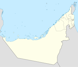
- Daftah, RAK
-
Daftah location of Daftah Coordinates: 25°16′27″N 56°11′0″E / 25.27417°N 56.183333°ECoordinates: 25°16′27″N 56°11′0″E / 25.27417°N 56.183333°E Country United Arab Emirates Emirate Ras al-Khaimah Elevation 629 m (2,066 ft) Dafta is a village near Masafi in the United Arab Emirates and ruled by Ras al-Khaimah Emirate. It is surrounded by mountains. Dafta is in the middle of the road that leads to Fujairah. It is located in the middle of the Valley of Ham (وادي حام). The Sharjah government is connecting Dafta with Khor Fakkan by a new Road with a tunnel under the mountains; which opens in 2010. The village is mostly populated by Al Naqbi tribe.
Categories:- United Arab Emirates geography stubs
- Populated places in Ras al-Khaimah
Wikimedia Foundation. 2010.

