- Da Lat Railway Station
-
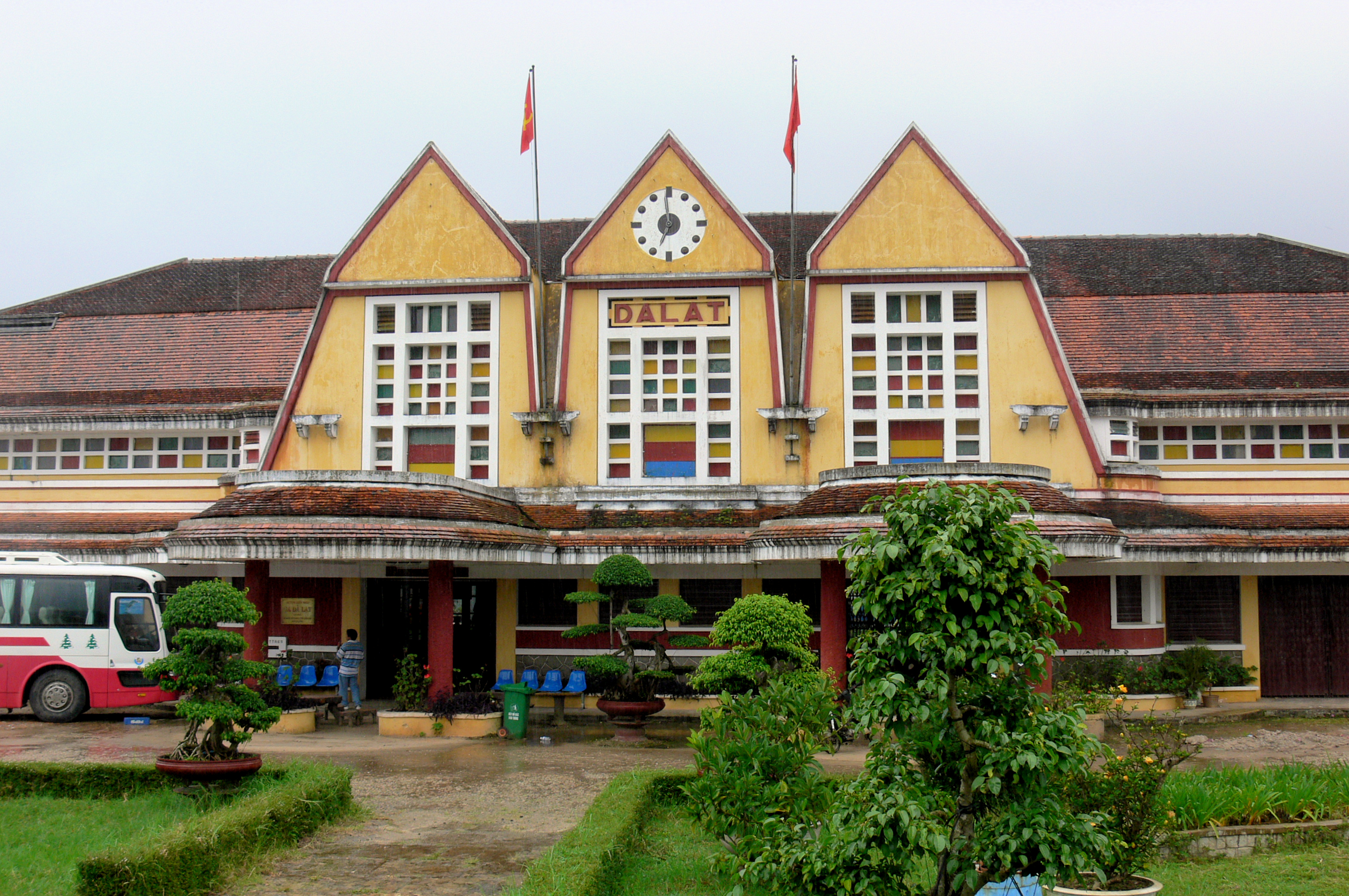
 Da Lat Railway Station.
Da Lat Railway Station (Vietnamese: Ga Đà Lạt) is a railway station on the Da Lat–Thap Cham Railway line in Vietnam, serving the town of Da Lat in Lam Dong Province. It was designed in 1932 by French architects Moncet and Reveron, and opened in 1938. Largely unused since abandonment of the railway during the later years of the Vietnam War, it was returned to a limited level of service in the 1990s with the reopening of a 7 km (4.3 mi) section of track leading to the nearby village of Trai Mat, operated as a tourist attraction. It is notable for its unique architectural style, which incorporates an overall Art Deco theme with elements of native Cao Nguyen communal houses from Vietnam's Central Highlands.[1][2][3]
Contents
History
Construction of the Da Lat–Thap Cham Railway began in 1908, a decade after it had first been proposed by Paul Doumer, then Governor General of French Indochina, and proceeded in stages. Due to the difficulty of the mountainous terrain west of Song Pha—where the Ngoan Muc Pass rose into the Central Highlands—construction proceeded slowly, requiring several rack railway sections and tunnels to be built. The railway was 84 km (52 mi) long, and rose almost 1,400 metres (4,600 ft) along a winding route with three rack rail sections and five tunnels.[4] The railway tracks finally reached Da Lat in 1932, 24 years after construction had begun. Another railway station existed at the time, operated by the SGAI, a company that had managed the operation of the railway until that time.[5] The job of designing and constructing a new railway station to replace the old one was given to French architects Moncet and Reveron, who submitted a proposal designed by Reveron in 1932. The new station would follow the Art Deco style popular at the time, but would incorporate some characteristics of a Cao Nguyen communal house of Vietnam's Central Highlands, specifically with its high, steep roofs.[2][3] Construction of the new station began in 1935, directly supervised by Moncet, and was completed three years later in 1938, becoming one of the first colonial-style buildings to be erected in the area.[1][3][6]
 A steam locomotive at Da Lat Railway Station.
Throughout the Vietnam War, the Da Lat–Thap Cham line—as with the entire Vietnamese railway network—was a target of bombardments and sabotage.[7] Relentlessly sabotaged and mined by the Viet Cong, the line gradually fell out of use, with regular operations coming to an end in 1968. Following the Fall of Saigon in April 1975, the railway was dismantled to provide materials for the repair of the main line.[3] In the 1990s, however, a 7 km (4.3 mi) section of the line between Da Lat Railway Station and the nearby village of Trại Mát was restored and returned to active use as a tourist attraction.[6]
A 2002 planning document listed the restoration of the entire Da Lat–Thap Cham railway as a priority for infrastructure development for Da Lat and Lam Dong Province, including the upgrading of Da Lat Railway Station to handle passenger and cargo transportation.[8] The proposed renewal received the backing of provincial and local governments, and the national government indicated that private companies would also be allowed to participate in the reconstruction of the railway. The project would also include a connection to the North–South Railway at Thap Cham, allowing trains to circulate between Da Lat and the rest of the country for the first time since the Vietnam War.[9] In December 2009, four rail cars restored to look like the rail cars used on the Da Lat–Thap Cham line in the 1930s were put into use on the Da Lat–Trai Mat tourist railroad, carrying signage reading "Dalat Plateau Rail Road".[6]
Architecture
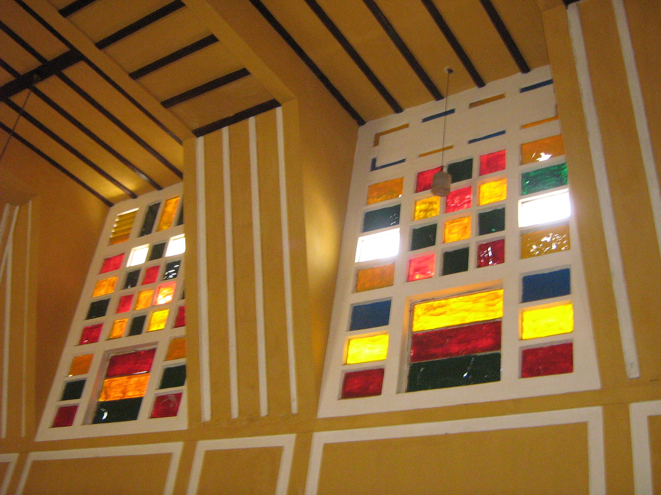
 The station's coloured glass windows.
Built in 1938, Da Lat Railway Station was designed in the Art Deco architectural style by French architects Moncet and Reveron, although it incorporates the high, pointed roofs characteristic of the Cao Nguyen communal buildings of ethnic minorities from Vietnam's Central Highlands. The three roofs, said to represent the three peaks of Dalat's iconic Lang Biang mountain, are also reminiscent of Normandy's Trouville-Deauville Station.[10]
Under each roof is a multicoloured glass window, and under the central roof is a large clock, which has recently been restored. Inside the station, the elevated roofs create a raised ceiling. At the front of the station is a Porte-cochère, or coach gate, supported by two rows of twelve columns each.[1] The station's unique design earned it recognition as a national historical monument in 2001.[2][3][11]
See also
Notes and references
- References
- ^ a b c Nguyen Dat (2008-08-11). "Coming around the mountain". Timeout. Vietnam Investment Review. http://www.vir.com.vn/Client/TimeOut/index.asp?url=content.asp&doc=17056. Retrieved 2010-07-28.
- ^ a b c John Colet, Joshua Eliot (2002). Vietnam handbook. Footprint Travel Guides. ISBN 1903471311. http://books.google.com/books?id=U47MPXg315UC&lpg=PA252&pg=PA252#v=onepage&f=false. Retrieved 2010-07-28.
- ^ a b c d e "A Brief History of Dalat Railroad". Viet Nam Air Force Model Aircraft of Minnesota. 2007-10-07. http://www.vnafmamn.com/tracing_shangrila.html. Retrieved 2010-07-28.
- ^ Dalat–Song Pha Cog Railway Map / Vertical Map. From "A Brief History of Dalat Railroad". Viet Nam Air Force Model Aircraft of Minnesota. 2007-10-07. http://www.vnafmamn.com/tracing_shangrila.html. Retrieved 2010-07-28.
- ^ Old Station of Dalat. From "A Brief History of Dalat Railroad". Viet Nam Air Force Model Aircraft of Minnesota. 2007-10-07. http://www.vnafmamn.com/tracing_shangrila.html. Retrieved 2010-07-28.
- ^ a b c "Chugging down history lane". Vietnam News Agency. Vietnamnet. 2010-01-02. http://english.vietnamnet.vn/travel/201001/Chugging-down-history-lane-887446/. Retrieved 2010-07-28.[dead link]
- ^ "Proposed Loan and Administration of Loan from Agence Française de Développement: Yen Vien–Lao Cai Railway Upgrading Project" (pdf). November 2006. http://www.adb.org/Documents/RRPs/VIE/39175-VIE-RRP.pdf. Retrieved 2010-06-27.
- ^ Government of Vietnam 2002.
- ^ "1928 Thap Cham-Da Lat Railway returns". Vietnam News Agency. Vietnamnet. 2007-10-07. Archived from the original on 2008-02-10. http://web.archive.org/web/20080210044649/http://english.vietnamnet.vn/travel/2007/10/748034/. Retrieved 2008-03-14.
- ^ Paradise by the Dashboard Light
- ^ Minh Thu (2009-02-22). "Little Paris charms visitors". Asia News Network. http://www.asianewsnet.net/news.php?sec=10&id=4134. Retrieved 2010-07-16.
- Bibliography
- Nguyễn Tấn Dũng (2002-05-27). "Ratifying the Readjusted General Planning of Da Lat City, Lam Dong Province, and its Adjacent Areas to 2020". AsianLII. http://www.asianlii.org/vn/legis/laws/rtrgpodlcldpaiaat2020802/. Retrieved 2010-06-22.
External links
Coordinates: 11°56′31″N 108°27′18″E / 11.942°N 108.455°E
Railway stations in Vietnam North–South Railway 
Yunnan–Vietnam Railway Hanoi–Dong Dang Railway Thai Nguyen–Ha Long Railway Hanoi–Thai Nguyen Railway Saigon–Loc Ninh Railway1 Đà Lạt–Tháp Chàm Railway1 Đà Lạt · Trai Mat · Tháp Chàm** Connection to different railway line. 1 Defunct or partially defunct line. Related: List of railway lines in Vietnam · Rail transport in Vietnam Categories:- Railway stations in Vietnam
- Da Lat
- Art Deco buildings
- French Colonial architecture in Vietnam

Wikimedia Foundation. 2010.