- D400 road (Croatia)
-
D400 state road
Route information Length: 1.6 km (1.0 mi) Major junctions From:  D66 west of A9/B9 Pula interchange
 D21 in Pula
To: Pula ferry port Location Counties: Istria Major cities: Pula Highway system State roads in Croatia
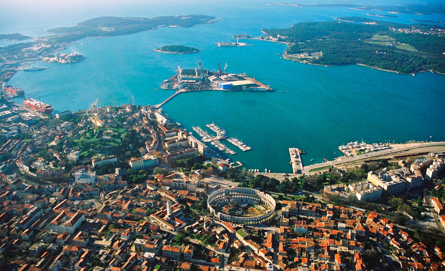
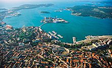 Pula, at the western terminus of D400
D400 is a state road connecting D66 and D21 state roads to Pula city centre and Pula ferry port. The road is only 1.6 km (0.99 mi) long.[1] Urban planning documents of the city of Pula, indicate that the road may be expanded from its current two traffic lanes to four.[2]
The road, as well as all other state roads in Croatia, is managed and maintained by Hrvatske ceste, state owned company.[3]
No car ferries operate from Pula ferry port.
Contents
Traffic volume
There are no official published data on volume of traffic carried by the D400 road, however, the volume may be inferred from traffic volumes on the southernmost traffic counting sites of the state roads terminating at the D400 route, namely D21 and D66.[4] Additionally the road carries an unspecified volume of urban traffic of the city of Pula, therefore it may be safely concluded that average annual daily traffic (AADT) and average summer daily traffic (ASDT) of the D400 road exceed 15,000 and 20,000 vehicles per day respectively.
D400 volume of traffic Road Counting site AADT ASDT Notes D213905 Pula north 7,136 9,464 The southernmost traffic counting site on D21, effectively counting traffic between D21 and D400. D663904 Loborika 6,229 8,345 The southernmost traffic counting site on D66, effectively counting traffic between D66 and D400. Road junctions and populated areas
D400 junctions/populated areas Type Slip roads/Notes  D66 to Pula Airport, A9/B9 expressway Pula interchange and Labin.
The eastern terminus of the road.
Pula
D21 to Bale.
Pula ferry port. The western terminus of the road. Sources
- ^ "Decision on categorization of public roads as state roads, county roads and local roads" (in Croatian). Narodne novine. February 17, 2010. http://narodne-novine.nn.hr/clanci/sluzbeni/2010_02_17_410.html.
- ^ "Spatial development plan of the city of Pula (page 32)" (in Croatian). Grad Pula. March 17, 2009. http://gis.pula.hr/mambo/dmdocuments/gup_plan.pdf.
- ^ "Public Roads Act" (in Croatian). Narodne novine. December 14, 2004. http://narodne-novine.nn.hr/clanci/sluzbeni/2004_12_180_3130.html.
- ^ "Traffic counting on the roadways of Croatia in 2009 - digest". Hrvatske ceste. May 1, 2010. http://www.hrvatske-ceste.hr/WEB%20-%20Legislativa/brojenje-prometa/CroDig2009.pdf.
See also
- State roads in Croatia
- Hrvatske ceste
Categories:- State roads in Croatia
- Istria County

Wikimedia Foundation. 2010.