- D33 road (Croatia)
-
D33 state road
Route information Length: 75.1 km (46.7 mi) Major junctions From:  Strmica border crossing to Bosnia and Herzegovina
 D1 in Knin
 D56 in Drniš and Lozovac
 D533 in Tromilja
 D8 in Šibenik
To:  Šibenik ferry port
Location Counties: Šibenik-Knin Major cities: Knin, Šibenik Highway system State roads in Croatia
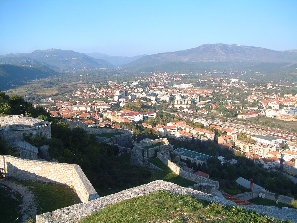
 Knin, located on D33 route
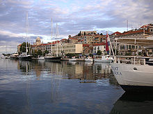 Šibenik, where D33 terminates
D33 connects Šibenik to Drniš and Knin. Furthermore the road has junctions to major state roads, namely D8 in Šibenik, connecting to Biograd na Moru and Trogir, and D1 state road in Knin, which in turn connects to Sinj to the south and to Gračac to the north. The southern terminus of the road is found in Šibenik ferry port, from where Jadrolinija ferries fly to Žirje, Kaprije and Zlarin islands.[1] The road also connects to A1 motorway Šibenik interchange via D533.[2] The road is 75.1 km (46.7 mi) long. The northern terminus of the road is at Strmica border crossing to Bosnia and Herzegovina, where the road proceeds to Drvar.[3]
The road, as well as all other state roads in Croatia, is managed and maintained by Hrvatske ceste, a state-owned company.[4]
Contents
Traffic volume
Traffic is regularly counted and reported by Hrvatske ceste, operator of the road.[5] Substantial variations between annual (AADT) and summer (ASDT) traffic volumes are attributed to the fact that the road serves as a connection to A1 motorway (via D533) and it carries substantial tourist traffic.
D33 traffic volume Road Counting site AADT ASDT Notes  D33
D335001 Knin north 1,352 1,692 Adjacent to Ž6080 junction. D335003 Knin south 3,327 4,121 Between D1 and Ž6074 junctions. D335004 Vrbnik south 2,187 2,460 Between Ž6056 and Ž6079 junctions. D335412 Pakovo Selo 2,100 2,850 Between Ž6094 and Ž6078 junctions. D335307 Bilice 2,515 n/a Adjacent to D533 junction.
ADT figure available only.Road junctions and populated areas
D33 junctions/populated areas Type Slip roads/Notes 
Strmica border crossing to Bosnia and Herzegovina.[6]
The northern terminus of the road.
Ž6080 to Kninsko Polje. 
Knin
D1 to Gračac (to the north) and Sinj (to the south).Vrbnik
Ž6056 to Oklaj.Ž6079 to Ramljane. Zvjerinac
Ž6058 to Riđane.Ž6247 to Uzdolje. Ž6081 to Miočić. Siverić
Ž6082 to Vrlika.Drniš
D56 to Muć and Sinj (to the east). D33 and D56 to the south are concurrent.
Ž6058 to Oklaj.
Ž6246 to Đevrske.Ž6094 to Žitnić. Ž6078 to Pakovo Selo. Ž6093 to Pokrovnik. Konjevrate
Ž6092 to Unešić.Lozovac
D56 to Benkovac (to the west). D33 and D56 to the north are concurrent. D533 to A1 motorway Šibenik interchange and to Šibenik (Ražine interchange).Lugović. Bilice. Šibenik
D8 to Biograd na Moru (to the west) and Trogir to the east.
Ž6016 and Ž6259.
Šibenik ferry port - Jadrolinija ferry access to Žirje (D128), Kaprije and Zlarin islands.
The southern terminus of the road.See also
- Highways in Croatia
- Hrvatske ceste
- Hrvatske autoceste
- Jadrolinija
Sources
- ^ "Jadolinija ferry service" (in English). May 11, 2010. http://www.jadrolinija.hr/default.aspx?lang=2.
- ^ "Regulation on motorway markings, chainage, interchange/exit/rest area numbers and names" (in Croatian). Narodne novine. May 6, 2003. http://narodne-novine.nn.hr/clanci/sluzbeni/305463.html.
- ^ "Decision on categorization of public roads as state roads, county roads and local roads" (in Croatian). Narodne novine. February 17, 2010. http://narodne-novine.nn.hr/clanci/sluzbeni/2010_02_17_410.html.
- ^ "Public Roads Act" (in Croatian). Narodne novine. December 14, 2004. http://narodne-novine.nn.hr/clanci/sluzbeni/2004_12_180_3130.html.
- ^ "Traffic counting on the roadways of Croatia in 2009 - digest" (in English). Hrvatske ceste. May 1, 2010. http://www.hrvatske-ceste.hr/WEB%20-%20Legislativa/brojenje-prometa/CroDig2009.pdf.
- ^ "Map of border crossings and customs office areas" (in Croatian). Customs Administration of the Republic of Croatia. March 6, 2008. http://www.carina.hr/CURH/Dokumenti/Globalni/Karta_Carinarnica_RH.pdf.
Categories:- State roads in Croatia
- Šibenik-Knin County


Wikimedia Foundation. 2010.