- D118 road (Croatia)
-
D118 state road
Route information Length: 43.5 km (27.0 mi) Major junctions From:  Vela Luka ferry port
To: Korčula ferry portLocation Counties: Dubrovnik-Neretva Major cities: Vela Luka, Korčula Highway system State roads in Croatia
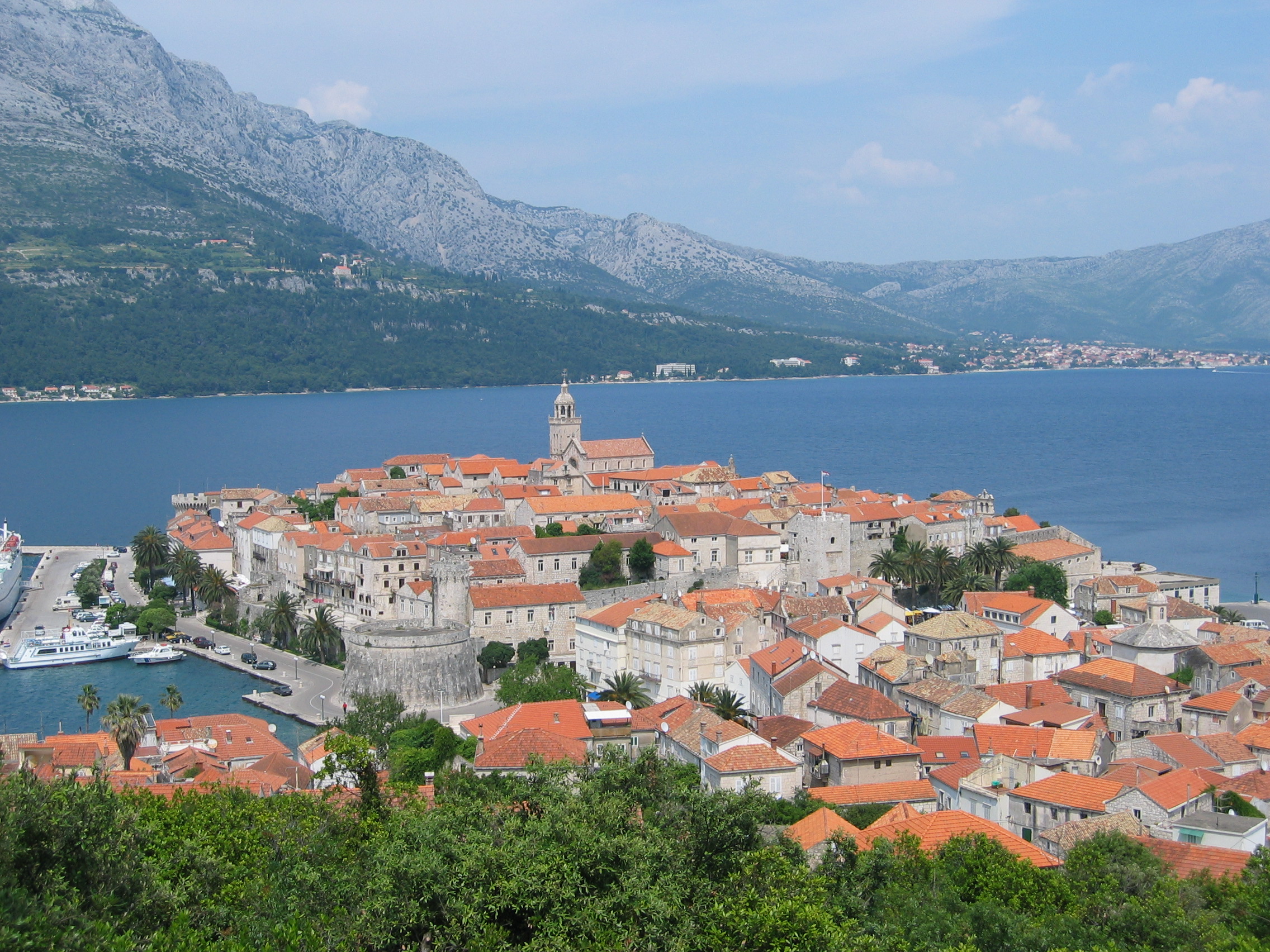
 Korčula, at the eastern terminus of the D118 road
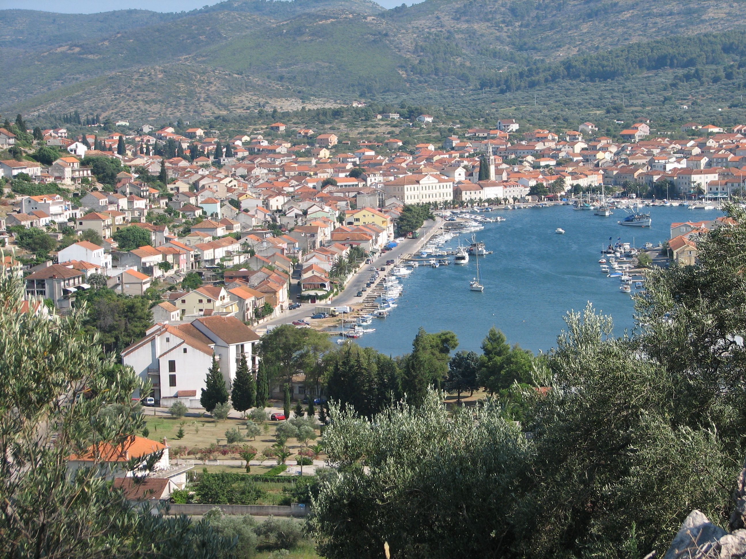
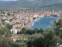 Vela Luka, at the western terminus the D118 road
D118 is the main state road on island of Korčula in Croatia connecting towns of Vela Luka and Korčula and ferry ports in those two towns, from where Jadrolinija ferries fly to the mainland, docking in Split and the D410 state road (from Vela Luka) and Orebić and the D414 state road (from Korčula).[1] The road is 43.5 km (27.0 mi) long.[2]
The road, as well as all other state roads in Croatia, is managed and maintained by Hrvatske ceste, a state-owned company.[3]
Contents
Traffic volume
Traffic is regularly counted and reported by Hrvatske ceste (HC), operator of the road.[4] Substantial variations between annual (AADT) and summer (ASDT) traffic volumes are attributed to the fact that the road connects a number of island resorts to the mainland.
D118 traffic volume Road Counting site AADT ASDT Notes  D118
D1186301 Korčula - west 1,766 3,427 Adjacent to the Ž6244 junction. Road junctions and populated areas
D118 junctions/populated areas Type Slip roads/Notes 
Vela Luka ferry port – access to the mainland port of Split (by Jadrolinija)[1] and D410 to Split and A1 motorway Dugopolje interchange.[5]
The western terminus of the road.
Vela Luka
Ž6221 to Plitvine.
Ž6222 to Blato. The road loops to the town and back forming two intersections with the D118. Ž6222 to Blato. The second intersection of the D118 and Ž6222 roads. Ž6268 to Smokvica and Čara. The road loops to the two towns and back forming two intersections with the D118. Ž6268 to Čara and Smokvica. The second intersection of the D118 and Ž6268 roads. Pupnat Žrnovo Ž6225 to Lumbarda. Korčula
Ž6224 to Račišće.
Ž6244 to the port.Korčula ferry port – access to the mainland port of Orebić (by Jadrolinija)[1] and D414 to Ploče (via the D415) and Dubrovnik (via the D8 state road)
The eastern terminus of the road.Sources
- ^ a b c "Jadrolinija ferry service" (in English). May 11, 2010. http://www.jadrolinija.hr/default.aspx?lang=2.
- ^ "Decision on categorization of public roads as state roads, county roads and local roads" (in Croatian). Narodne novine. February 17, 2010. http://narodne-novine.nn.hr/clanci/sluzbeni/2010_02_17_410.html.
- ^ "Public Roads Act" (in Croatian). Narodne novine. December 14, 2004. http://narodne-novine.nn.hr/clanci/sluzbeni/2004_12_180_3130.html.
- ^ "Traffic counting on the roadways of Croatia in 2009 - digest" (in English). Hrvatske ceste. May 1, 2010. http://www.hrvatske-ceste.hr/WEB%20-%20Legislativa/brojenje-prometa/CroDig2009.pdf.
- ^ "Regulation on motorway markings, chainage, interchange/exit/rest area numbers and names" (in Croatian). Narodne novine. May 6, 2003. http://narodne-novine.nn.hr/clanci/sluzbeni/305463.html.
See also
- State roads in Croatia
- Hrvatske ceste
- Jadrolinija
Categories:- State roads in Croatia
- Dubrovnik-Neretva County
- Korčula

Wikimedia Foundation. 2010.