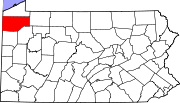
- Custards, Pennsylvania
-
Custards, Pennsylvania — Unincorporated settlement — Coordinates: 41°31′49″N 80°09′33″W / 41.53028°N 80.15917°WCoordinates: 41°31′49″N 80°09′33″W / 41.53028°N 80.15917°W Country United States State Pennsylvania County Crawford Elevation 1,089 ft (332 m) Time zone Eastern (EST) (UTC-5) - Summer (DST) EDT (UTC-4) Area code(s) 814 GNIS feature ID 1172870[1] Custards is an unincorporated community in Crawford County, Pennsylvania, United States. Custards is located on Pennsylvania Route 285 west of Cochranton and is near Interstate 79 and U.S. Route 19.
References
- ^ "US Board on Geographic Names". United States Geological Survey. 2007-10-25. http://geonames.usgs.gov. Retrieved 2008-01-31.
Municipalities and communities of Crawford County, Pennsylvania County seat: Meadville Cities Boroughs Blooming Valley | Cambridge Springs | Centerville | Cochranton | Conneaut Lake | Conneautville | Hydetown | Linesville | Saegertown | Spartansburg | Springboro | Townville | Venango | Woodcock
Townships Athens | Beaver | Bloomfield | Cambridge | Conneaut | Cussewago | East Fairfield | East Fallowfield | East Mead | Fairfield | Greenwood | Hayfield | North Shenango | Oil Creek | Pine | Randolph | Richmond | Rockdale | Rome | Sadsbury | South Shenango | Sparta | Spring | Steuben | Summerhill | Summit | Troy | Union | Venango | Vernon | Wayne | West Fallowfield | West Mead | West Shenango | Woodcock
CDPs Unincorporated
communitiesBuells Corners | Custards | Frenchtown
Categories:- Unincorporated communities in Pennsylvania
- Populated places in Crawford County, Pennsylvania
- Western Pennsylvania geography stubs
Wikimedia Foundation. 2010.


