- Mount Margaret, Western Australia
-
Mount Margaret
Western AustraliaEstablished: 1897 Postcode: 6440 Elevation: 418 m (1,371 ft) Location: - 900 km (559 mi) North East of Perth
- 28 km (17 mi) South West of Laverton, Western Australia
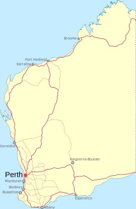
LGA: Shire of Laverton State District: Kalgoorlie Federal Division: O'Connor Mount Margaret also once known as Craiggiemore is an abandoned town in Western Australia located 900 kilometres (559 mi) east of Perth situated North of Lake Carey and south West of Laverton in the Goldfields-Esperance region of Western Australia.
The first European through the area was the explorer John Forrest who visited the area in 1869. He named a nearby hill Mount Margaret after Margaret Elvire Hamersley whom he later married in 1876. The Indigenous Australian name for the same hill is Kalgara..[1]
Gold was discovered in the area in the 1880s and was discovered close to the town in 1894 by James Ross and R. McKenzie. The main mines name was Craiggiemore which is situated on the Eastern side of the town.[2] By 1896 the local progress association began campaigning for the townsite to be declared. By 1897 lots had been surveyed and the townsite was gazetted in the same year.
A police station opened in the town in 1898 but was closed in 1899.
Following a drought in the area in 1921 Rod Schenk[3] established the Mount Margaret Aboriginal Mission in 1922. In 1924 many Aboriginal people were forced to came to Mount Morgans for food following another drought and hostility towards them by local station owners. When the Mount Morgans and Linden food depots were closed in 1927, the Aboriginal peoples moved to the Mission at Mount Margaret.
References
- ^ Western Australian Land Information Authority. "History of country town names". http://www.landgate.wa.gov.au/corporate.nsf/web/History+of+country+town+names. Retrieved 2011-01-26.
- ^ "Morowa Historical Society". 2011. http://members.westnet.com.au/caladenia/ghosttowns/Mo-Mz.pdf. Retrieved 2011-01-26.
- ^ "Wongatha Native title claim". 2006. http://www.aiatsis.gov.au/ntru/nativetitleconference/conf2007/papers%20and%20presentations/muller.pdf. Retrieved 2011-01-26.
Towns in the Goldfields-Esperance region of Western Australia Major centres Kalgoorlie · Boulder · Coolgardie · Esperance · Hopetoun · Kambalda · Kambalda West · Laverton · Leonora · Norseman · Ravensthorpe
Other towns Agnew · Balagundi · Balgarri · Bardoc · Beria · Black Flag · Bonnie Vale · Boorara · Broad Arrow · Buldania · Bullabulling · Bulong · Burbanks · Burtville · Callion · Cascade · Comet Vale · Condingup · Coonana · Cosmo Newbery · Cundeelee · Dalyup · Davyhurst · Duketon · Dundas · Dunnsville · Eucla · Eulaminna · Euro · Feysville · Forrest · Gibson · Gindalbie · Golden Ridge · Goongarrie · Grass Patch · Gudarra · Gwalia · Higginsville · Israelite Bay · Jerdacuttup · Kanowna · Kathleen · Kintore · Kookynie · Kurnalpi · Kunanalling · Kundana · Kurrajong · Kurrawang · Lakewood · Lawlers · Leinster · Linden · Londonderry · Loongana · Malcolm · Menzies · Mertondale · Mount Burges · Mount Ida · Mount Margaret · Mount Morgans · Mulgarrie · Mulwarrie · Mulline · Mungari · Munglinup · Murrin Murrin · Niagara · Ora Banda · Princess Royal · Rawlinna · Salmon Gums · Scaddan · Sir Samuel · Tampa · Vivien · Warburton · Waverley · Widgiemooltha · Windanya · Wingellina · Woodarra · Yarri · Yerilla · Yunndaga · Yundamindera · Zanthus
Categories:- Towns in Western Australia
- Goldfields-Esperance
- Ghost towns in Western Australia
Wikimedia Foundation. 2010.

