South West Coast Path — The starting point at Minehead Length 630 miles (1,014 km) Location England: Somerset, Devon, Cornwall … Wikipedia
Suffolk County, New York — Infobox U.S. County county = Suffolk County state = New York map size = 200 founded = 1683 seat = Riverhead area total sq mi =2373 area land sq mi =912 area water sq mi =1461 area percentage = 61.56% census yr = 2000 pop = 1419369 density km2… … Wikipedia
List of county routes in Suffolk County, New York (51–75) — The following is a list of county routes in Suffolk County, New York from Routes 51 to 75. Contents 1 County Route 51 1.1 Route description 1.2 Major junctions 2 County Route 52 … Wikipedia
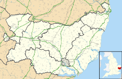
List of civil parishes in Suffolk — This is a list of civil parishes in Suffolk, England.BaberghBabergh is entirely parished.Forest HeathForest Heath is entirely parished.IpswichIpswich is entirely unparished.Mid SuffolkMid Suffolk is entirely parished.*Akenham *Ashbocking… … Wikipedia
List of places in Suffolk — This is a list of cities, towns and villages in the ceremonial county of Suffolk, England. See the list of places in England for places in other counties.compactTOC NOTOC A* Acton, Aldeburgh, Aldham,Aldringham, Alpheton, Ampton, Ashby,… … Wikipedia
List of county routes in Suffolk County, New York (26–50C) — The following is a list of county routes in Suffolk County, New York from Routes 26 to 50, including former suffixed routes of Suffolk CR 50. Contents 1 County Route 26 1.1 Route description 1.2 Major intersections 2 … Wikipedia
North Fork, Suffolk County, New York — The North Fork is a 30 mile long peninsula in the northeast part of Suffolk County, New York, roughly parallel with an even longer peninsula known as the South Fork. Although the peninsula begins east of Riverhead hamlet, the term North Fork can… … Wikipedia
Chinatown, Boston — Chinatown Neighborhood of Boston A view from within Chinatown looking towards the paifang, 2008 … Wikipedia
Neighborhoods in Boston — A map showing the location of 19 of Boston s 21 official neighborhoods (Bay Village and West End not pictured) Boston is sometimes called a city of neighborhoods. There are 21 designated neighborhood areas in Boston used by the city.[1]… … Wikipedia
North Hertfordshire College — Coordinates: 51°53′49″N 0°12′00″W / 51.897°N 0.200°W / 51.897; 0.200 North Hertfordshire College ( NHC ) … Wikipedia
 South Cove