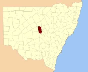
Flinders County

Flinders County
Flinders
New South Wales
Flinders NSW.PNG
Location in New South Wales
Lands administrative divisions around Flinders
Robinson Canbelego Oxley
Mouramba Flinders Kennedy
Blaxland Cunningham Kennedy

Flinders County is one of the 141 Cadastral divisions of New South Wales. It is located to the south west of the Bogan River.

Flinders County was named in honour of the navigator, hydrographer, and scientist Matthew Flinders (1774-1814).[1]

Parishes within this county

A full list of parishes found within this county; their current LGA and mapping coordinates to the approximate centre of each location is as follows:

Parish LGA Coordinates
Babego Bogan Shire 31°57′54″S 146°32′04″E / 31.965°S 146.53444°E / -31.965; 146.53444 (Babego)
Babinda Bogan Shire 31°57′54″S 146°30′04″E / 31.965°S 146.50111°E / -31.965; 146.50111 (Babinda)
Balgay Bogan Shire 32°07′54″S 147°00′04″E / 32.13167°S 147.00111°E / -32.13167; 147.00111 (Balgay)
Barrow Bogan Shire 31°51′54″S 146°30′04″E / 31.865°S 146.50111°E / -31.865; 146.50111 (Barrow)
Bebri Bogan Shire 31°49′54″S 146°38′04″E / 31.83167°S 146.63444°E / -31.83167; 146.63444 (Bebri)
Belah Lachlan Shire 32°08′54″S 147°10′04″E / 32.14833°S 147.16778°E / -32.14833; 147.16778 (Belah)
Birrigan Bogan Shire 31°37′54″S 146°50′04″E / 31.63167°S 146.83444°E / -31.63167; 146.83444 (Birrigan)
Boree Bogan Shire 31°33′54″S 146°42′04″E / 31.565°S 146.70111°E / -31.565; 146.70111 (Boree)
Budgery Bogan Shire 31°33′54″S 146°34′04″E / 31.565°S 146.56778°E / -31.565; 146.56778 (Budgery)
Budtha Bogan Shire 32°02′54″S 147°09′04″E / 32.04833°S 147.15111°E / -32.04833; 147.15111 (Budtha)
Bulbodny Lachlan Shire 32°14′54″S 147°10′04″E / 32.24833°S 147.16778°E / -32.24833; 147.16778 (Bulbodny)
Bulga Bogan Shire 31°43′39″S 146°23′59″E / 31.7275°S 146.39972°E / -31.7275; 146.39972 (Bulga)
Bumbaldry Lachlan Shire 32°23′54″S 147°07′04″E / 32.39833°S 147.11778°E / -32.39833; 147.11778 (Bumbaldry)
Burra Lachlan Shire 32°23′54″S 147°00′04″E / 32.39833°S 147.00111°E / -32.39833; 147.00111 (Burra)
Cameron Bogan Shire 32°19′37″S 146°44′07″E / 32.32694°S 146.73528°E / -32.32694; 146.73528 (Cameron)
Condon Bogan Shire 31°45′54″S 146°34′04″E / 31.765°S 146.56778°E / -31.765; 146.56778 (Condon)
Coolibah Bogan Shire 31°55′54″S 146°56′04″E / 31.93167°S 146.93444°E / -31.93167; 146.93444 (Coolibah)
Crowie Bogan Shire 31°57′54″S 146°36′04″E / 31.965°S 146.60111°E / -31.965; 146.60111 (Crowie)
Cumbine Bogan Shire 32°06′28″S 146°30′25″E / 32.10778°S 146.50694°E / -32.10778; 146.50694 (Cumbine)
Currajong Bogan Shire 32°04′21″S 146°52′02″E / 32.0725°S 146.86722°E / -32.0725; 146.86722 (Currajong)
Delby Bogan Shire 32°15′57″S 146°43′29″E / 32.26583°S 146.72472°E / -32.26583; 146.72472 (Delby)
Egeria Bogan Shire 31°43′54″S 146°30′04″E / 31.73167°S 146.50111°E / -31.73167; 146.50111 (Egeria)
Firbank Bogan Shire 31°53′54″S 146°32′04″E / 31.89833°S 146.53444°E / -31.89833; 146.53444 (Firbank)
Foster Bogan Shire 31°33′54″S 146°46′04″E / 31.565°S 146.76778°E / -31.565; 146.76778 (Foster)
Geweroo Bogan Shire 31°38′34″S 146°23′38″E / 31.64278°S 146.39389°E / -31.64278; 146.39389 (Geweroo)
Gilgai Bogan Shire 31°37′54″S 147°01′04″E / 31.63167°S 147.01778°E / -31.63167; 147.01778 (Gilgai)
Gilgai Bogan Shire 31°35′54″S 146°58′04″E / 31.59833°S 146.96778°E / -31.59833; 146.96778 (Gilgai)
Grahway Bogan Shire 32°14′21″S 146°33′05″E / 32.23917°S 146.55139°E / -32.23917; 146.55139 (Grahway)
Grayrigg Bogan Shire 31°39′54″S 146°40′04″E / 31.665°S 146.66778°E / -31.665; 146.66778 (Grayrigg)
Hermitage Bogan Shire 31°55′54″S 146°48′04″E / 31.93167°S 146.80111°E / -31.93167; 146.80111 (Hermitage)
Hermitage Plains Bogan Shire 31°53′54″S 146°42′04″E / 31.89833°S 146.70111°E / -31.89833; 146.70111 (Hermitage Plains)
Honeybugle Bogan Shire 31°49′54″S 146°56′04″E / 31.83167°S 146.93444°E / -31.83167; 146.93444 (Honeybugle)
Honeybugle Bogan Shire 31°51′54″S 147°01′04″E / 31.865°S 147.01778°E / -31.865; 147.01778 (Honeybugle)
Howgill Bogan Shire 31°47′54″S 146°30′04″E / 31.79833°S 146.50111°E / -31.79833; 146.50111 (Howgill)
Keenan Bogan Shire 31°41′54″S 146°56′04″E / 31.69833°S 146.93444°E / -31.69833; 146.93444 (Keenan)
Keenan Bogan Shire 31°43′54″S 147°02′04″E / 31.73167°S 147.03444°E / -31.73167; 147.03444 (Keenan)
Kinnear Bogan Shire 32°07′56″S 146°43′28″E / 32.13222°S 146.72444°E / -32.13222; 146.72444 (Kinnear)
Lambrigg Bogan Shire 31°39′54″S 146°34′04″E / 31.665°S 146.56778°E / -31.665; 146.56778 (Lambrigg)
Merrilba Bogan Shire 31°55′54″S 147°04′04″E / 31.93167°S 147.06778°E / -31.93167; 147.06778 (Merrilba)
Miamley North Lachlan Shire 32°20′52″S 146°54′39″E / 32.34778°S 146.91083°E / -32.34778; 146.91083 (Miamley North)
Miandetta Bogan Shire 31°37′54″S 147°06′04″E / 31.63167°S 147.10111°E / -31.63167; 147.10111 (Miandetta)
Minalong Lachlan Shire 32°18′54″S 147°10′04″E / 32.315°S 147.16778°E / -32.315; 147.16778 (Minalong)
Mogille Lachlan Shire 32°18′38″S 146°50′52″E / 32.31056°S 146.84778°E / -32.31056; 146.84778 (Mogille)
Mogille Plain Lachlan Shire 32°20′54″S 147°00′04″E / 32.34833°S 147.00111°E / -32.34833; 147.00111 (Mogille Plain)
Mogundale Lachlan Shire 32°15′04″S 146°51′07″E / 32.25111°S 146.85194°E / -32.25111; 146.85194 (Mogundale)
Mullah Bogan Shire 31°45′54″S 146°36′04″E / 31.765°S 146.60111°E / -31.765; 146.60111 (Mullah)
Murrabudda Bogan Shire 31°43′54″S 147°06′04″E / 31.73167°S 147.10111°E / -31.73167; 147.10111 (Murrabudda)
Myall Cowall Bogan Shire 32°02′54″S 147°04′04″E / 32.04833°S 147.06778°E / -32.04833; 147.06778 (Myall Cowall)
Nangerybone Bogan Shire 32°19′57″S 146°35′48″E / 32.3325°S 146.59667°E / -32.3325; 146.59667 (Nangerybone)
Nardoo Bogan Shire 31°41′54″S 146°48′04″E / 31.69833°S 146.80111°E / -31.69833; 146.80111 (Nardoo)
Oberon Lachlan Shire 32°17′54″S 147°03′04″E / 32.29833°S 147.05111°E / -32.29833; 147.05111 (Oberon)
Pangee Bogan Shire 31°57′54″S 146°42′04″E / 31.965°S 146.70111°E / -31.965; 146.70111 (Pangee)
Pangee Creek Bogan Shire 31°49′54″S 146°46′04″E / 31.83167°S 146.76778°E / -31.83167; 146.76778 (Pangee Creek)
Quanda Bogan Shire 31°43′54″S 146°42′04″E / 31.73167°S 146.70111°E / -31.73167; 146.70111 (Quanda)
Quondong Bogan Shire 31°45′54″S 146°52′04″E / 31.765°S 146.86778°E / -31.765; 146.86778 (Quondong)
Red Gilgais Bogan Shire 31°57′54″S 146°56′04″E / 31.965°S 146.93444°E / -31.965; 146.93444 (Red Gilgais)
Red Gilgais Bogan Shire 32°01′54″S 147°00′04″E / 32.03167°S 147.00111°E / -32.03167; 147.00111 (Red Gilgais)
Regan Bogan Shire 31°51′54″S 146°52′04″E / 31.865°S 146.86778°E / -31.865; 146.86778 (Regan)
Talgong Bogan Shire 32°10′30″S 146°52′11″E / 32.175°S 146.86972°E / -32.175; 146.86972 (Talgong)
The Bluff Lachlan Shire 32°27′42″S 146°53′02″E / 32.46167°S 146.88389°E / -32.46167; 146.88389 (The Bluff)
The Overflow Bogan Shire 32°12′05″S 146°38′31″E / 32.20139°S 146.64194°E / -32.20139; 146.64194 (The Overflow)
Umang Bogan Shire 32°07′54″S 147°04′04″E / 32.13167°S 147.06778°E / -32.13167; 147.06778 (Umang)
Walkers Hill Bogan Shire 32°23′45″S 146°47′29″E / 32.39583°S 146.79139°E / -32.39583; 146.79139 (Walkers Hill)
Walton Bogan Shire 32°10′26″S 146°34′16″E / 32.17389°S 146.57111°E / -32.17389; 146.57111 (Walton)
Walwa Bogan Shire 32°06′04″S 146°36′55″E / 32.10111°S 146.61528°E / -32.10111; 146.61528 (Walwa)
Wharfdale Bogan Shire 32°12′54″S 147°02′04″E / 32.215°S 147.03444°E / -32.215; 147.03444 (Wharfdale)
Wharfdale North Bogan Shire 32°11′33″S 146°57′19″E / 32.1925°S 146.95528°E / -32.1925; 146.95528 (Wharfdale North)
Whitbarrow Bogan Shire 31°33′54″S 146°50′04″E / 31.565°S 146.83444°E / -31.565; 146.83444 (Whitbarrow)
Wicklow Bogan Shire 31°57′54″S 146°58′04″E / 31.965°S 146.96778°E / -31.965; 146.96778 (Wicklow)
Wicklow Bogan Shire 31°59′54″S 147°00′04″E / 31.99833°S 147.00111°E / -31.99833; 147.00111 (Wicklow)
Widgeland Bogan Shire 31°49′54″S 147°02′04″E / 31.83167°S 147.03444°E / -31.83167; 147.03444 (Widgeland)
Wilmatha Lachlan Shire 32°27′54″S 147°03′04″E / 32.465°S 147.05111°E / -32.465; 147.05111 (Wilmatha)
Winfell Bogan Shire 31°39′54″S 146°30′04″E / 31.665°S 146.50111°E / -31.665; 146.50111 (Winfell)
Yamma Bogan Shire 31°37′54″S 146°44′04″E / 31.63167°S 146.73444°E / -31.63167; 146.73444 (Yamma)
Yarrow Bogan Shire 31°55′54″S 146°36′04″E / 31.93167°S 146.60111°E / -31.93167; 146.60111 (Yarrow)
Yoongee Bogan Shire 31°33′54″S 146°30′04″E / 31.565°S 146.50111°E / -31.565; 146.50111 (Yoongee)

References

  1. ^ Geographical Names Board of NSW

Wikimedia Foundation. 2010.

Игры ⚽ Поможем написать курсовую

Look at other dictionaries:

  • Flinders County, New South Wales — Infobox Australian cadastral name = Flinders state = New South Wales caption = Location in New South Wales near nw = Robinson near n = Canbelego near ne = Oxley near e = Kennedy near se = Kennedy near s = Cunningham near sw = Blaxland near w =… …   Wikipedia

  • County of Churchill, Queensland — Churchill Queensland Location within Queensland Lands administrative divisions around …   Wikipedia

  • Flinders — Recorded in a wide variety of spellings including: Flander, Flanders, Flaunders, Flenders, Flinders and Flounders, this is an English surname, but of medieval continental origins. It originates from the former state and province of Flanders now… …   Surnames reference

  • County of Cook, Queensland — Cook Queensland Location within Queensland Lands administrative divisions around Cook …   Wikipedia

  • County of Mornington — Mornington Victoria Location in Victoria Lands administrative divisions around Mornington …   Wikipedia

  • Mouramba County — Map of all coordinates from Google Map of all coordinates from Bing Export all coordinates as KML …   Wikipedia

  • Scott Flinders — Football player infobox playername = Scott Flinders fullname = Scott Liam Flinders height = height|meters=1.93 dateofbirth = birth date and age|1986|6|12 cityofbirth = Rotherham countryofbirth = England currentclub = Falkirk (on loan from Crystal …   Wikipedia

  • Mouramba County, New South Wales — Infobox Australian cadastral name = Mouramba state = New South Wales caption = Location in New South Wales near nw = Robinson near n = Canbelego near ne = Flinders near e = Flinders near se = Flinders near s = Blaxland near sw = Mossgiel near w …   Wikipedia

  • Shire of Flinders — Infobox Australian Place | type = lga name = Shire of Flinders state = vic region = Mornington Peninsula area = 324 est = 1858 seat = Rosebud pop = 40,000 (1992) [cite book|title=Victorian Year Book|author=Australian Bureau of Statistics,… …   Wikipedia

  • Kennedy County, New South Wales — Infobox Australian cadastral name = Kennedy state = New South Wales caption = Location in New South Wales near nw = Flinders near n = Oxley near ne = Narromine near e = Gordon near se = Ashburnham near s = Cunningham near sw = Cunningham near w …   Wikipedia

Share the article and excerpts

Direct link
Do a right-click on the link above
and select “Copy Link”