County of Elphinstone

County of Elphinstone
Elphinstone
Queensland
Elphinstone Qld.PNG
Location within Queensland
Lands administrative divisions around Elphinstone
Wilkie Gray Pacific Ocean Pacific Ocean
Wilkie Gray Elphinstone Gladstone
Davenport Davenport Murray

The County of Elphinstone is a cadastral division of Queensland which contains the city of Townsville. It was named after George Elphinstone Dalrymple (1826-1876), a politician and explorer.[1] Townsville is mentioned as being in the county of Elphinstone in the 1911 Britannica. [2] It is bounded by the Haughton River in the east, and part of the Burdekin River in the south-west.[3]

Parishes

Elphinstone is divided into parishes, listed as follows:

Parish LGA Coordinates
Abbotsford Burdekin 19°27′S 147°03′E / 19.45°S 147.05°E / -19.45; 147.05 (Abbotsford Parish)
Beor Townsville 19°22′S 146°52′E / 19.367°S 146.867°E / -19.367; 146.867 (Beor Parish)
Bohle Townsville 19°15′S 146°40′E / 19.25°S 146.667°E / -19.25; 146.667 (Bohle Parish)
Cardington Charters Towers 19°49′S 146°48′E / 19.817°S 146.8°E / -19.817; 146.8 (Cardington Parish)
Coonambelah Townsville 19°14′S 146°47′E / 19.233°S 146.783°E / -19.233; 146.783 (Coonambelah Parish)
Crimea Charters Towers 19°45′S 146°40′E / 19.75°S 146.667°E / -19.75; 146.667 (Crimea Parish)
Ettrick Townsville 19°19′S 147°00′E / 19.317°S 147°E / -19.317; 147 (Ettrick Parish)
Granite Townsville 19°30′S 146°37′E / 19.5°S 146.617°E / -19.5; 146.617 (Granite Parish)
Halifax Townsville 19°13′S 146°33′E / 19.217°S 146.55°E / -19.217; 146.55 (Halifax Parish)
Hervey Townsville 19°21′S 146°30′E / 19.35°S 146.5°E / -19.35; 146.5 (Hervey Parish)
Lansdowne Townsville 19°30′S 146°47′E / 19.5°S 146.783°E / -19.5; 146.783 (Lansdowne Parish)
Magenta Townsville 19°38′S 146°52′E / 19.633°S 146.867°E / -19.633; 146.867 (Magenta Parish)
Magnetic Townsville 19°07′S 146°49′E / 19.117°S 146.817°E / -19.117; 146.817 (Magnetic Parish)
Rokeby Townsville 19°32′S 146°56′E / 19.533°S 146.933°E / -19.533; 146.933 (Rokeby Parish)
Ross Townsville 19°23′S 146°40′E / 19.383°S 146.667°E / -19.383; 146.667 (Ross Parish)
Scott Burdekin 19°34′S 147°03′E / 19.567°S 147.05°E / -19.567; 147.05 (Scott Parish)
Stuart Townsville 19°22′S 146°48′E / 19.367°S 146.8°E / -19.367; 146.8 (Stuart Parish)
Woodstock Townsville 19°42′S 146°59′E / 19.7°S 146.983°E / -19.7; 146.983 (Woodstock Parish)
Wyoming Townsville 19°38′S 146°47′E / 19.633°S 146.783°E / -19.633; 146.783 (Wyoming Parish)

References


Wikimedia Foundation. 2010.

Игры ⚽ Нужно решить контрольную?

Look at other dictionaries:

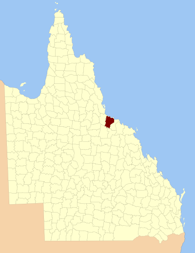
  • County of Elphinstone, Queensland — Infobox Australian cadastral name = Elphinstone state = Queensland imagesize= 180px caption = Location within Queensland near nw = Cavendish near n = Pacific Ocean near ne = Pacific Ocean near e = Gladstone near se = Murray near s = Davenport… …   Wikipedia

  • Elphinstone —    ELPHINSTONE, a village, in the parish of Tranent, county of Haddington, 2 miles (S. by W.) from Tranent; containing 236 inhabitants. This village lies in the southern extremity of the parish, on the road from Dalkeith, by Penston, to… …   A Topographical dictionary of Scotland

  • Elphinstone Baronets — There have been three Baronetcies created for personswith the surname Elphinstone, two in the Baronetage of Nova Scotia and one in the Baronetage of the United Kingdom. As of 2008 two of the creations are extant while one is dormant.The… …   Wikipedia

  • Elphinstone-Dalrymple Baronets — The Dalrymple Horn Elphinstone, later Elphinstone Dalrymple Baronetcy, of Horn and of Logie Elphinstone in the County of Aberdeen, is a dormant title in the Baronetage of the United Kingdom. It was created on 16 January 1828 for Robert Dalrymple… …   Wikipedia

  • County of Aubigny — Aubigny Queensland Location within Queensland Lands administrative divisions around Aubigny …   Wikipedia

  • Elphinstone railway station, Victoria — VictorianClosedRailwayStation NAME= Elphinstone LINE=Echuca Swan Hill DISTANCE=113.04 km PLATFORMS= 2 TRACKS= 2 STATUS=Closed OPENED= CLOSED=October 4, 1981 |Elphinstone is a closed station located in the town of Elphinstone on the Melbourne… …   Wikipedia

  • County of Talbot — Infobox Australian cadastral name = Talbot state = Victoria caption = Location in Victoria near nw = Gladstone near n = Gladstone near ne = Bendigo near e = Dalhousie near se = Bourke near s = Grant near sw = Ripon near w = GladstoneThe County of …   Wikipedia

  • County of Talbot, Victoria — Talbot Victoria Location in Victoria Lands administrative divisions around Talbot …   Wikipedia

  • Lord Elphinstone — Lord Elphinstone, of Elphinstone in the County of Stirling, is a title in the Peerage of Scotland. It was created in 1510 for Alexander Elphinstone who was killed at the Battle of Flodden three years later. He was succeeded by his son, the second …   Wikipedia

  • William Elphinstone, 15th Lord Elphinstone — William Buller Fullerton Elphinstone, 15th Lord Elphinstone (18 November 1828 18 January 1893), known as William Elphinstone until 1861, was a Scottish Conservative politician.Elphinstone was the son of Lieutenant Colonel James Drummond Buller… …   Wikipedia

Share the article and excerpts

Direct link
Do a right-click on the link above
and select “Copy Link”