- Burdekin River
Infobox River
river_name = Burdekin River
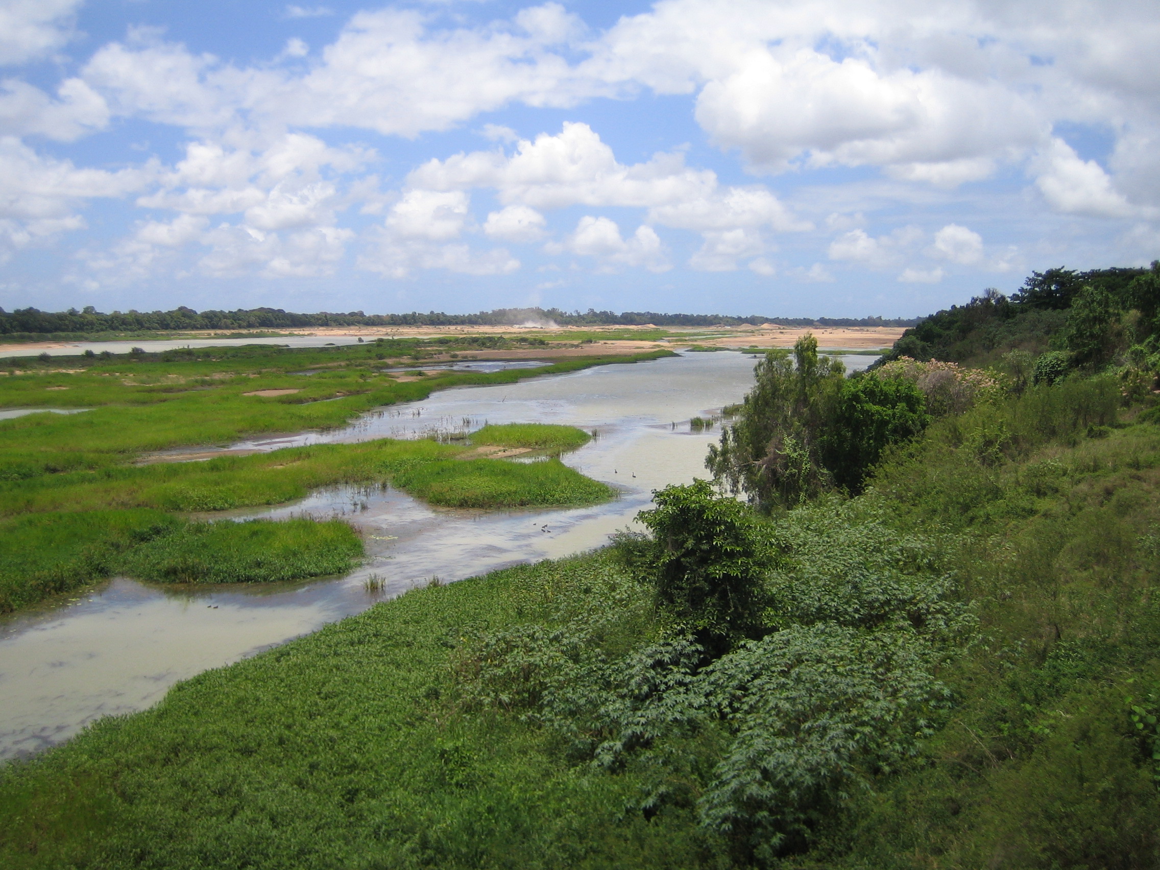
caption = Burdekin River, November 2005, taken from the Burdekin Bridge (Bruce Highway )
origin = Seaview Range nearIngham, Queensland
mouth =Pacific Ocean atUpstart Bay , nearAyr, Queensland
basin_countries =Australia
length = 710km
elevation = 1200m (3800 feet)
discharge = 380m3/s (mean ) 240/3/s (median annual) - "can range from nothing to over 40,000m3/s"
watershed = 129,700 km²The Burdekin River in
Queensland ,Australia rises on the western slope of theSeaview Range and flows into thePacific Ocean atUpstart Bay over 200 km to the southeast of the source. The river was discovered by the expedition led byLudwig Leichhardt in 1845 and named for Mrs. Thomas Burdekin, who had provided assistance to the expedition.Apart from the
Murray River , it is economically the most important river in Australia, and has the fourth-largest watershed of anyexorheic drainage system in Australia. It is also the fourth-largest river in Australia by volume of flow [Brown, John Alexander Henstridge; Australia’s Surface Water Resources; published 1983 by Australian Government Publication Service, Canberra] , but is so erratic that its discharge can reach the mean discharge of the "Yangtze" (after two severe cyclones in 1958) or have as many as seven months with "no flow" whatsoever (as in 1923). This exceedingly erriatic flow is due to the extreme variability of precipitation throughout the entire basin. Annual rainfall at most gauges within the basin can range from 200mm (8 inches) to over 1,600mm (64 inches) depending on the monsoon and the number of cyclones that cross the coast [Willcocks, Jacqui; Queensland's rainfall history: graphs of rainfall averages, 1880-1988; published 1991 by Queensland Department of Primary Industries] . On the coast itself, the variability is even higher: at Bowen not far from the river's mouth, the annual rainfall has ranged from 216mm in 1915 to over 2,200m in 1950.Major tributaries feeding the Burdekin River include the Clarke, Sutter, Bowen, Belyando and Cape rivers. The source of the Belyando river in central western
Queensland is almost 500 km from the mouth of the Burdekin River, and extends into the typical black-soil grassland of Central Queensland. The Burdekin itself almost reaches theWet Tropics in its upper reaches.The Burdekin falls dam, the largest
dam inQueensland was constructed west of Ayr and Home Hill and completed in 1987 to form what is also known as Lake Dalrymple. In the delta around Ayr and Home Hill,groundwater is used extensively to irrigate crops ofsugar cane , which produce the highest qualitysugar from anywhere in Australia. This groundwater is recharged artificially during the extreme flood events that occasionally occur, usually due to aLa Niña event.Although on paper most of the basin of the Burdekin appears perfect for rainfed crops like
cotton andmaize , in fact the rainfall is so erratic that in almost every year a would-be farmer will experience either too little or too much rain for the crop to mature properly. Thus, most of the basin of the Burdekin can be used only for low-density grazing of sheep and cattle which is less likely to be damaged economically and ecologically by the extreme risks of an extraordinarily erratic climate. The natural vegetation away from the coast is a grassland dominated by perennial Mitchell and annual Flinders grasses, whilst near the coast there are patches of dryeucalypt forest on the typically infertile laterised soils characteristic of most of Australia.Notes
External links
* [http://enc.slq.qld.gov.au/logicrouter/servlet/LogicRouter?PAGE=object&OUTPUTXSL=object_enc36ui.xslt&pm_RC=PICTQLD&pm_OI=30640&pm_GT=Y&pm_IAC=Y&api_1=GET_OBJECT_XML&num_result=0 Burdekin River in flood 1875] This photo is held by John Oxley Library, State Library of Queensland. Image number: raw00143
Wikimedia Foundation. 2010.