Canbelego County

Canbelego County
Canbelego
New South Wales
Canbelego NSW.PNG
Location in New South Wales

Canbelego County is one of the 141 Cadastral divisions of New South Wales.

Canbelego is believed to be derived from a local Aboriginal word.[1]

Parishes within this county

A full list of parishes found within this county; their current LGA and mapping coordinates to the approximate centre of each location is as follows:

Parish LGA Coordinates
Antares Bogan Shire 31°05′54″S 146°54′04″E / 31.09833°S 146.90111°E / -31.09833; 146.90111 (Antares)
Bannan Bogan Shire 31°05′54″S 146°43′59″E / 31.09833°S 146.73306°E / -31.09833; 146.73306 (Bannan)
Berry Bogan Shire 31°06′37″S 146°40′10″E / 31.11028°S 146.66944°E / -31.11028; 146.66944 (Berry)
Boree Bogan Shire 31°27′54″S 147°04′04″E / 31.465°S 147.06778°E / -31.465; 147.06778 (Boree)
Carnbilly Bogan Shire 31°23′54″S 146°46′04″E / 31.39833°S 146.76778°E / -31.39833; 146.76778 (Carnbilly)
Caro Bogan Shire 31°23′54″S 146°54′04″E / 31.39833°S 146.90111°E / -31.39833; 146.90111 (Caro)
Coreen Bogan Shire 31°27′54″S 147°02′04″E / 31.465°S 147.03444°E / -31.465; 147.03444 (Coreen)
Courebone Bogan Shire 31°13′54″S 147°00′04″E / 31.23167°S 147.00111°E / -31.23167; 147.00111 (Courebone)
Currawong Bogan Shire 31°27′54″S 146°46′04″E / 31.465°S 146.76778°E / -31.465; 146.76778 (Currawong)
Eton Cobar Shire 31°15′26″S 146°25′13″E / 31.25722°S 146.42028°E / -31.25722; 146.42028 (Eton)
Florida Cobar Shire 31°27′03″S 146°18′18″E / 31.45083°S 146.305°E / -31.45083; 146.305 (Florida)
Gidalambone Bogan Shire 31°11′54″S 146°48′04″E / 31.19833°S 146.80111°E / -31.19833; 146.80111 (Gidalambone)
Gilgies Bogan Shire 31°30′49″S 146°25′03″E / 31.51361°S 146.4175°E / -31.51361; 146.4175 (Gilgies)
Gilgoenbon Bogan Shire 31°25′54″S 147°02′04″E / 31.43167°S 147.03444°E / -31.43167; 147.03444 (Gilgoenbon)
Glenariff Bogan Shire 31°00′05″S 146°45′45″E / 31.00139°S 146.7625°E / -31.00139; 146.7625 (Glenariff)
Goyder Cobar Shire 31°21′45″S 146°21′06″E / 31.3625°S 146.35167°E / -31.3625; 146.35167 (Goyder)
Grahweed Bogan Shire 31°17′54″S 147°02′04″E / 31.29833°S 147.03444°E / -31.29833; 147.03444 (Grahweed)
Hall Bogan Shire 31°05′54″S 147°02′04″E / 31.09833°S 147.03444°E / -31.09833; 147.03444 (Hall)
Hermitage Bogan Shire 31°25′54″S 146°40′04″E / 31.43167°S 146.66778°E / -31.43167; 146.66778 (Hermitage)
Kelley Cobar Shire 31°19′45″S 146°27′18″E / 31.32917°S 146.455°E / -31.32917; 146.455 (Kelley)
Kidgery Bogan Shire 31°25′54″S 147°02′04″E / 31.43167°S 147.03444°E / -31.43167; 147.03444 (Kidgery)
King Bogan Shire 31°23′54″S 146°30′04″E / 31.39833°S 146.50111°E / -31.39833; 146.50111 (King)
Langtree Cobar Shire 31°23′41″S 146°24′50″E / 31.39472°S 146.41389°E / -31.39472; 146.41389 (Langtree)
Lincoln Bogan Shire 31°15′54″S 146°44′04″E / 31.265°S 146.73444°E / -31.265; 146.73444 (Lincoln)
Lynch Bogan Shire 31°27′54″S 147°08′04″E / 31.465°S 147.13444°E / -31.465; 147.13444 (Lynch)
Meeson Bogan Shire 31°12′05″S 146°33′21″E / 31.20139°S 146.55583°E / -31.20139; 146.55583 (Meeson)
Mepunga Bogan Shire 31°07′57″S 146°29′28″E / 31.1325°S 146.49111°E / -31.1325; 146.49111 (Mepunga)
Merri Bogan Shire 31°11′59″S 146°40′01″E / 31.19972°S 146.66694°E / -31.19972; 146.66694 (Merri)
Monkellan Bogan Shire 31°23′54″S 146°34′04″E / 31.39833°S 146.56778°E / -31.39833; 146.56778 (Monkellan)
Mulga Cobar Shire 31°16′36″S 146°10′30″E / 31.27667°S 146.175°E / -31.27667; 146.175 (Mulga)
Muriel Bogan Shire 31°27′54″S 146°34′04″E / 31.465°S 146.56778°E / -31.465; 146.56778 (Muriel)
Narrama Cobar Shire 31°23′50″S 146°16′33″E / 31.39722°S 146.27583°E / -31.39722; 146.27583 (Narrama)
Neiley Bogan Shire 31°17′54″S 147°00′04″E / 31.29833°S 147.00111°E / -31.29833; 147.00111 (Neiley)
Nirranda Bogan Shire 31°27′54″S 146°52′04″E / 31.465°S 146.86778°E / -31.465; 146.86778 (Nirranda)
Nullawarra Cobar Shire 31°18′55″S 146°16′05″E / 31.31528°S 146.26806°E / -31.31528; 146.26806 (Nullawarra)
Orion Bogan Shire 31°15′54″S 146°38′04″E / 31.265°S 146.63444°E / -31.265; 146.63444 (Orion)
Quandong Cobar Shire 31°14′10″S 146°16′17″E / 31.23611°S 146.27139°E / -31.23611; 146.27139 (Quandong)
Sturt Bogan Shire 31°01′54″S 146°56′04″E / 31.03167°S 146.93444°E / -31.03167; 146.93444 (Sturt)
The Brothers Bogan Shire 31°09′54″S 146°44′04″E / 31.165°S 146.73444°E / -31.165; 146.73444 (The Brothers)
The Pines Bogan Shire 31°07′54″S 146°54′04″E / 31.13167°S 146.90111°E / -31.13167; 146.90111 (The Pines)
Tootalally Bogan Shire 31°05′54″S 146°48′04″E / 31.09833°S 146.80111°E / -31.09833; 146.80111 (Tootalally)
Tooram Bogan Shire 31°10′26″S 146°22′12″E / 31.17389°S 146.37°E / -31.17389; 146.37 (Tooram)
Tritton Bogan Shire 31°19′54″S 146°38′04″E / 31.33167°S 146.63444°E / -31.33167; 146.63444 (Tritton)
Vega Bogan Shire 31°00′51″S 146°39′39″E / 31.01417°S 146.66083°E / -31.01417; 146.66083 (Vega)
Warong Bogan Shire 31°27′54″S 146°30′04″E / 31.465°S 146.50111°E / -31.465; 146.50111 (Warong)
Warranbilla Bogan Shire 31°09′54″S 146°58′04″E / 31.165°S 146.96778°E / -31.165; 146.96778 (Warranbilla)
Warrego Bogan Shire 31°17′54″S 146°32′04″E / 31.29833°S 146.53444°E / -31.29833; 146.53444 (Warrego)
Warungo Bogan Shire 30°59′54″S 146°50′04″E / 30.99833°S 146.83444°E / -30.99833; 146.83444 (Warungo)
Waveney Bogan Shire 31°04′21″S 146°34′09″E / 31.0725°S 146.56917°E / -31.0725; 146.56917 (Waveney)
Wilgabone Bogan Shire 31°17′54″S 146°50′04″E / 31.29833°S 146.83444°E / -31.29833; 146.83444 (Wilgabone)
Willeroon Bogan Shire 31°01′54″S 147°02′04″E / 31.03167°S 147.03444°E / -31.03167; 147.03444 (Willeroon)
Yarran Bogan Shire 31°06′39″S 146°19′09″E / 31.11083°S 146.31917°E / -31.11083; 146.31917 (Yarran)

References


Wikimedia Foundation. 2010.

Игры ⚽ Нужна курсовая?

Look at other dictionaries:

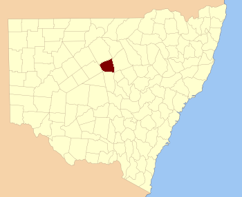
  • Canbelego County, New South Wales — is one of the 141 Cadastral divisions of New South Wales.Canbelego is believed to be derived from a local Aboriginal word. [ [http://www.gnb.nsw.gov.au/name search/extract?id=JPjLZxUlan Geographical Names Board of NSW] ] = Parishes within this… …   Wikipedia

  • Mouramba County — Map of all coordinates from Google Map of all coordinates from Bing Export all coordinates as KML …   Wikipedia

  • Clyde County, New South Wales — Infobox Australian cadastral name = Clyde state = New South Wales caption = Location in New South Wales near nw = Gunderbooka near n = Narran near ne = Finch near e = Leichardt near se = Gregory near s = Canbelego near sw = Cowper near w =… …   Wikipedia

  • Cowper County, New South Wales — Infobox Australian cadastral name = Cowper state = New South Wales caption = Location in New South Wales near nw = Gunderbooka near n = Gunderbooka near ne = Clyde near e = Clyde near se = Canbelego near s = Robinson near sw = Yanda near w =… …   Wikipedia

  • Flinders County, New South Wales — Infobox Australian cadastral name = Flinders state = New South Wales caption = Location in New South Wales near nw = Robinson near n = Canbelego near ne = Oxley near e = Kennedy near se = Kennedy near s = Cunningham near sw = Blaxland near w =… …   Wikipedia

  • Gregory County, New South Wales — Infobox Australian cadastral name = Gregory state = New South Wales caption = Location in New South Wales near nw = Cowper near n = Clyde near ne = Leichardt near e = Gowen near se = Ewenmar near s = Oxley near sw = Flinders near w =… …   Wikipedia

  • Oxley County, New South Wales — Infobox Australian cadastral name = Oxley state = New South Wales caption = Location in New South Wales near nw = Canbelego near n = Gregory near ne = Gregory near e = Ewenmar near se = Narromine near s = Kennedy near sw = Flinders near w =… …   Wikipedia

  • Robinson County, New South Wales — Infobox Australian cadastral name = Robinson state = New South Wales caption = Location in New South Wales near nw = Yanda near n = Yanda near ne = Cowper near e = Canbelego near se = Flinders near s = Mouramba near sw = Booroondarra near w =… …   Wikipedia

  • Clyde County — Map of all coordinates from Google Map of all coordinates from Bing Export all coordinates as KML …   Wikipedia

  • Cowper County — Cowper New South Wales Location in New South Wales Lands administrative divisions around Cowper …   Wikipedia

Share the article and excerpts

Direct link
Do a right-click on the link above
and select “Copy Link”