- County Road 4050 (Volusia County, Florida)
-
County Road 4050
Route information Length: 2.4 mi[1][2] (3.9 km) Major junctions West end:  SR 5A in Daytona Beach
 U.S. Route 1
East end:  SR A1A in Daytona Beach
Highway system Florida State and County Roads
Interstate • US • SR (Pre-1945) • Toll • County (Volusia)←  CR 4047
CR 4053  →
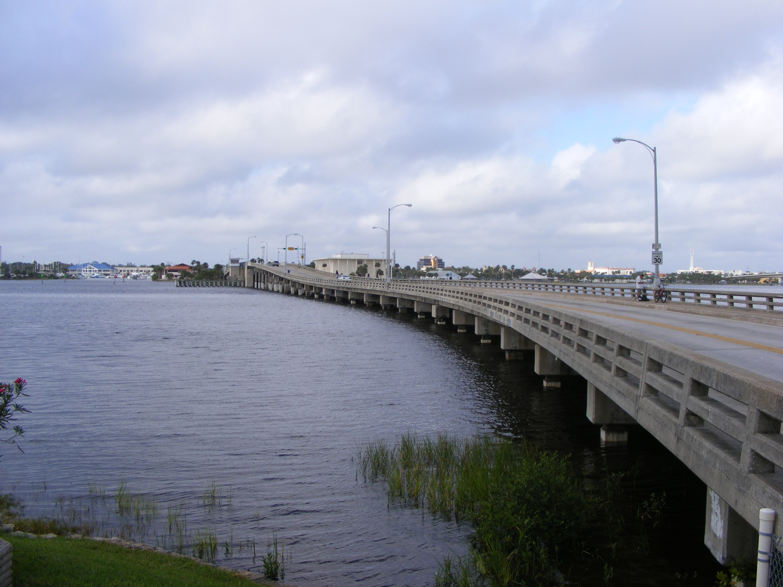
→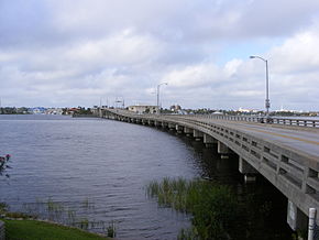 County Road 4050 crosses the Halifax River via the Veterans Memorial Bridge
Volusia County Road 4050 (locally known as Orange Avenue and Silver Beach Avenue) is a county road located entirely within Daytona Beach, Florida. It is 2.4 miles (3.9 km) long, from SR 5A (South Nova Road) to SR A1A (South Atlantic Avenue). It is a two-lane historic road, which links old Daytona and old Daytona Beach, which were two separate cities before consolidating in 1926.
Contents
Route description
Beginning at SR 5A, it begins as a two-lane road, known locally as Orange Avenue. It proceeds East through a residential neighborhood and crosses the Florida East Coast Railway track. It continues East through an intersection with US 1 (South Ridgewood Avenue). After crossing US 1, the highway continues through a commercial zone and crosses the Halifax River and Intracoastal Waterway via the Veterans Memorial Bridge.
East of the Halifax River, CR 4050 is known locally as Silver Beach Avenue. The road intersects with SR 441 (South Peninsula Drive) and proceeds to its eastern terminus with SR A1A (South Atlantic Avenue).
Some of the local landmarks that the road passes include Daytona Beach City Hall, City Island, Jackie Robinson Ballpark (home of the Daytona Cubs), and the city's courthouse.
Historic District
The Silver Beach Avenue section of CR 4050 is part of the South Peninsula Historic District, a U.S. Historic District (designated as such on November 19, 1998). The district is bounded by Halifax Road on the west and the Atlantic Ocean on the east. Some of the Orange Avenue section of CR 4050 is part of the South Beach Street Historic District, which is bounded by Volusia Ave. (International Speedway Blvd), South Beach St., South St., and US 1 (Ridgewood Ave.). [3][4]
Major intersections
- SR 5A (South Nova Road)
- Florida East Coast Railway
- U.S. Route 1 (South Ridgewood Avenue)
 SR 441 (South Peninsula Drive)
 Florida State Road A1A (South Atlantic Avenue)
See also
References
- ^ FDOT GIS data
- ^ State of Florida, Dept. of Transportation, Survey and Mapping Office: General Highway Map of Volusia County, Florida
- ^ Gold, Pleasant Daniel (1927). History of Volusia County, Florida. Deland, FL: The E. O. Painter Printing Co.. [page needed].
- ^ Centennial History of Volusia County, Florida (1854–1954) Volusia County Historical Commission[page needed]
External links
Categories:- County roads in Volusia County, Florida

Wikimedia Foundation. 2010.