Derby-Shelton Bridge

Derby-Shelton Bridge
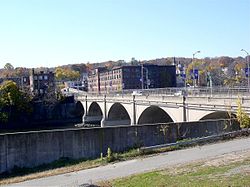
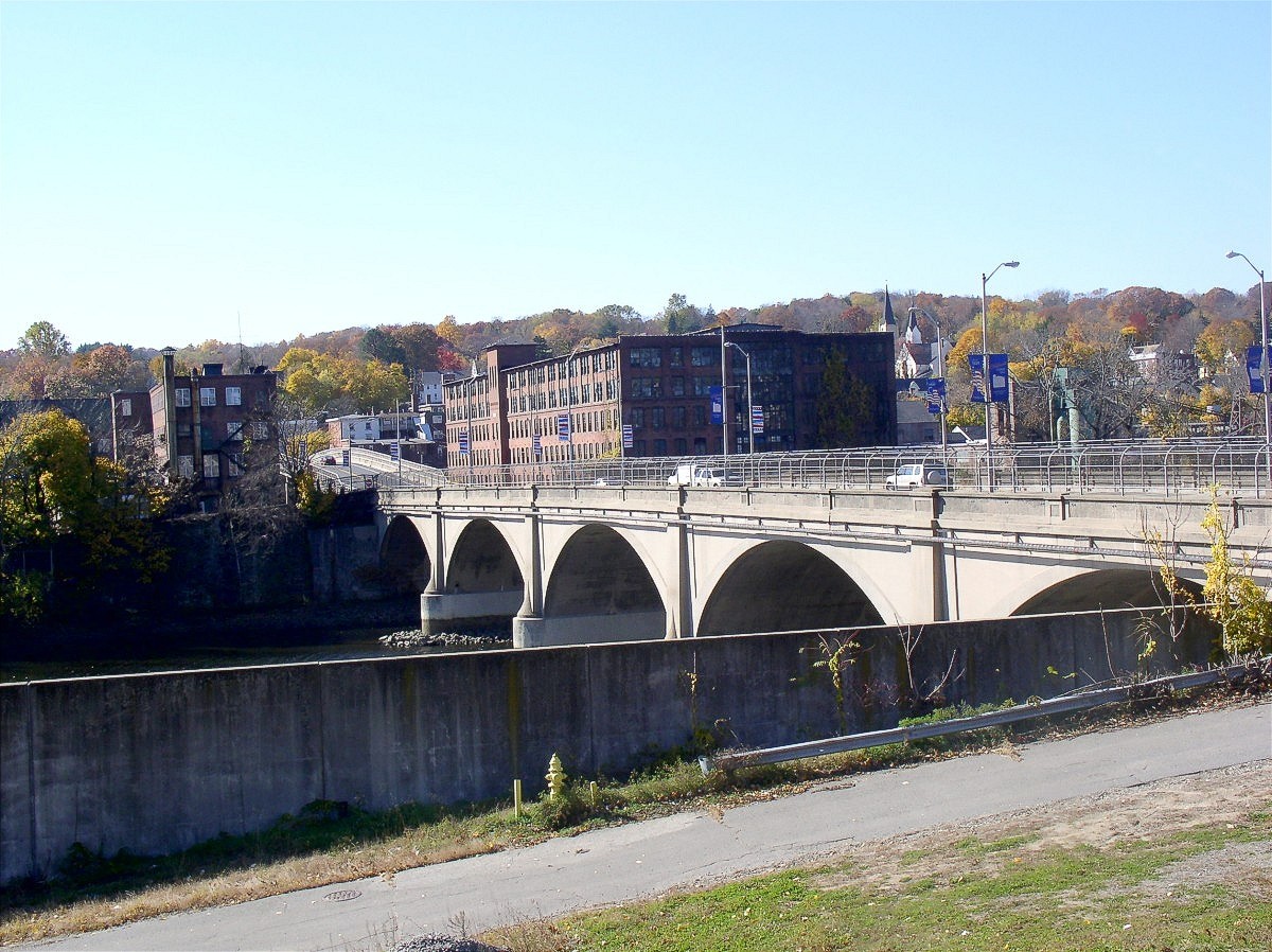
Carries 2 lanes of Bridge Street (SR 712)
Crosses Housatonic River
Locale Shelton and Derby (Connecticut)
Maintained by Connecticut Department of Transportation[1]
Design concrete arch bridge
Total length 142 m
Opened 1918
Daily traffic 14,000
Coordinates 41°19′08″N 73°05′27″W / 41.31889°N 73.09083°W / 41.31889; -73.09083

The Derby-Shelton Bridge is a road crossing over the Housatonic River in the U.S. state of Connecticut, connecting the cities of Derby and Shelton. It connects Route 34 in downtown Derby with Route 110 in downtown Shelton. The bridge and approaches are designated but not signed as State Road 712. The current bridge was built in 1918 by the Connecticut State Highway Department to replace a former steel-arch bridge built in 1891 known as the Huntington Bridge. Prior to that, an even older wooden covered bridge (built in 1857) was at this site. The Derby-Shelton Bridge used to carry two street railway tracks until the 1930s.

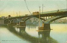
Bridge over the Housatonic in Derby, from a postcard sent in 1908

References


Wikimedia Foundation. 2010.

Игры ⚽ Нужно решить контрольную?

Look at other dictionaries:

  • Derby, Connecticut —   City   Annual fireworks display from the Derby Shelton Bridge …   Wikipedia

  • Shelton, Connecticut — Infobox Settlement official name = Shelton, Connecticut settlement type = City imagesize = image caption = mapsize = 250px map caption = Location in Connecticut established title = Incorporated (town) established date = 1789 established title2 =… …   Wikipedia

  • Derby railway station — Derby station redirects here. For the station in Derby, Connecticut, see Derby Shelton (Metro North station). Derby Derby railway station …   Wikipedia

  • Derby Canal — The Shacklecross Lock (Borrowash Bottom Lock) undergoing restoration in 2006 Original owner Derby Canal Co Principal engineer …   Wikipedia

  • Commodore Isaac Hull Memorial Bridge — Commodore Hull Bridge Official name Commodore Isaac Hull Memorial Bridge Carries 6 lanes of Route 8 Crosses …   Wikipedia

  • Derby — This article is about the city in England. For other uses, see Derby (disambiguation). City of Derby   City Unitary authority   Derby Cathedr …   Wikipedia

  • Shelton Lock — infobox UK place official name= Allenton country = England latitude= 52.877982 longitude= 1.44199 map type= Derbyshire population = shire district= Derby shire county = Derbyshire region= East Midlands constituency westminster= Mid Derbyshire… …   Wikipedia

  • New Zealand, Derby — This article is about the suburb of Derby. For other uses, see New Zealand (disambiguation). Cobden Street in New Zealand The New Zealand Suburb/Area of Derby is situated about 1 mile from Derby City Centre. The suburb is surrounded by the… …   Wikipedia

  • Osmaston, Derby — Not to be confused with Osmaston, Derbyshire Dales. Coordinates: 52°53′52″N 1°27′32″W / 52.89771°N 1.45886°W / 52.89771; …   Wikipedia

  • Connecticut Route 8 — Route 8 Route information Maintained by …   Wikipedia

Share the article and excerpts

Direct link
Do a right-click on the link above
and select “Copy Link”