Colwyn Rural District

Colwyn Rural District

Coordinates: 52°08′56″N 3°24′14″W / 52.149°N 3.404°W / 52.149; -3.404

Colwyn
Colwyn Rural District within Radnorshire
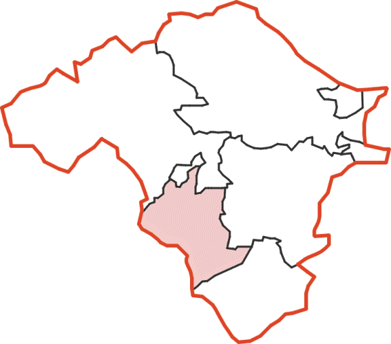
Geography
Status Rural district
1911 area 29,579 acres (119.70 km2)
1931 area 29,579 acres (119.70 km2)
1961 area 29,579 acres (119.70 km2)
HQ Builth Wells
History
Origin Sanitary district
Created 1894
Abolished 1974
Succeeded by Radnorshire
Demography
1901 population 1,882
1931 population 2,043
1971 population 1,682
Politics
Governance Colwyn Rural District Council
Subdivisions
Type Civil parishes

Colwyn was, from 1894 to 1974, a rural district in the administrative county of Radnorshire, Wales.

The district was formed by the Local Government Act 1894, when the existing Builth Rural Sanitary District was divided into two: the section in Breconshire was reconstituted as Builth Rural District and that in Radnorshire as Colwyn Rural District.[1] [2] The new district took its name from the ancient hundred of Colwyn. The council continued to be based in Builth Wells in Breconshire.

The rural district comprised ten civil parishes:[3]

  • Aberbedw
  • Bettws Disserth
  • Cregrina
  • Disserth and Trecoed
  • Llanbadarn y Garreg
  • Llandrindod Rural
  • Llanelwedd
  • Llanfaredd
  • Llansaintfraed in Elvel
  • Rhulen

The district was abolished in 1974 under the Local Government Act 1972, which completely reorganised local administration in England and Wales. Its area became part of the District of Radnor in the new county of Powys.

References

  1. ^ Census of England and Wales 1901, County Report, Brecknockshire
  2. ^ Census of England and Wales 1901, County Report, Radnorshire
  3. ^ "Relationships / unit history of Colwyn". Vision of Britain. University of Portsmouth. http://www.visionofbritain.org.uk/relationships.jsp?u_id=10175483&c_id=10001043. Retrieved 2009-02-09. 

Wikimedia Foundation. 2010.

Игры ⚽ Поможем написать курсовую

Look at other dictionaries:

  • Hiraethog Rural District — infobox historic subdivision Name= Hiraethog HQ= Llanrwst Status= Rural District Start= 1935 End= 1974 Replace= Colwyn Civic= PopulationFirst= 6,061 PopulationFirstYear= 1931 PopulationLast= 4,180 PopulationLastYear= 1971 AreaFirst=… …   Wikipedia

  • Aled Rural District — infobox historic subdivision Name= Aled HQ= Rhyl Status= Rural District Start= 1935 End= 1974 Replace= Aberconwy, Colwyn Civic= PopulationFirst= 6,870 PopulationFirstYear= 1931 PopulationLast= 6,559 PopulationLastYear= 1971 AreaFirst=… …   Wikipedia

  • Conway Rural District — infobox historic subdivision Name= Conway HQ= Conway Status= Rural District Start= 1894 End= 1934 Replace= Nant Conway Rural District Civic= PopulationFirst= 6,364 PopulationFirstYear= 1901 PopulationLast= 4,529 PopulationLastYear= 1931 AreaFirst …   Wikipedia

  • Conwy Rural District — Conwy Geography Status Rural District 1901 area 26,135 acres (105.76 km2) 1931 area 23,883 acres (96.65 km2) HQ …   Wikipedia

  • Glan Conway Rural District — infobox historic subdivision Name= Glan Conway HQ= Conwy Status= Rural District (partial) Start= 1894 End= 1935 Replace= Aled Rural District Civic= PopulationFirst= 1,515 PopulationFirstYear= 1901 PopulationLast= 1,853 PopulationLastYear= 1931… …   Wikipedia

  • Colwyn — Geography Status Borough 1974 area 136,566.2 acres (552.66 …   Wikipedia

  • Aberconwy (district) — infobox historic subdivision Name= Aberconwy HQ= Llandudno Status= Borough Start= 1974 End= 1996 Replace= Conwy county borough Civic= The Borough of Aberconwy was one of five districts of Gwynedd, north west Wales, from 1974 to 1996.It was formed …   Wikipedia

  • Monmouth (district) — Monmouth Welsh: Trefynwy Geography Status Borough …   Wikipedia

  • Delyn (district) — Coordinates: 53°16′01″N 3°10′34″W / 53.267°N 3.176°W / 53.267; 3.176 …   Wikipedia

  • Radnorshire (district) — infobox historic subdivision Name= District of Radnorshire HQ= Llandrindod Wells Status= District Start= 1974 End= 1996 Replace= Powys Civic= PopulationFirst= 18,271Fact|date=September 2008 PopulationFirstYear= 1971 PopulationLast=… …   Wikipedia

Share the article and excerpts

Direct link
Do a right-click on the link above
and select “Copy Link”