- Col de la Core
-
Col de la Core 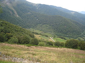
The view to the west from the Col de la CoreElevation 1,395 m (4,577 ft) Traversed by D17 Location Location of Col de la Core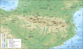
 Col de la Core
Location Ariège  France
Range Pyrenees Coordinates 42°51′32″N 1°6′18″E / 42.85889°N 1.105°ECoordinates: 42°51′32″N 1°6′18″E / 42.85889°N 1.105°E The Col de la Core (elevation 1395 m) is a high mountain pass in the Ariège department of France in the Pyrenees. It connects Audressein with Seix.
Contents
Details of climb
Starting from Audressein, the climb is 17.5 km long. Over this distance, the climb is 885 m. (an average of 5.1%). The climb proper starts at Les Bordes-sur-Lez, from where it is 14.1 km at 5,7 %, with the steepest section being at 8.0%.[1]
Starting from Seix, the climb is 13.8 km long. Over this distance, the climb is 885 m. (an average of 6.4%), with the steepest section being at 8.0%.[2]
Appearances in Tour de France
The Col de la Core was first used in the Tour de France in 1984, since when it has featured six times, most recently in 2011, when the leader over the summit was Mickaël Delage.[3]
Year Stage Category Leader at the summit 2011 14 1 Mickaël Delage 2004 13 1 Sylvain Chavanel 2003 14 1 Richard Virenque 2002 12 1 Laurent Jalabert 1998 11 2 Roland Meier 1984 11 1 Jean-René Bernaudeau References
- ^ "Col de la Core – Audressein". www.climbbybike.com. http://www.climbbybike.com/profile.asp?Climbprofile=Col-de-la-Core&MountainID=6097. Retrieved 18 September 2011.
- ^ "Col de la Core – Seix". www.climbbybike.com. http://www.climbbybike.com/profile.asp?Climbprofile=Col-de-la-Core&MountainID=6097. Retrieved 18 September 2011.
- ^ "Le col de la Core dans le Tour de France" (in French). http://ledicodutour.perso.sfr.fr/montagnes/cols__c/core.htm. Retrieved 18 September 2011.
External links
Categories:- Mountain passes of France
- Mountain passes of the Pyrenees
- Climbs in cycle racing
- 2002 Tour de France
- 2003 Tour de France
- 2004 Tour de France
- 2011 Tour de France


Wikimedia Foundation. 2010.