- Coipasa Lake
-
Lago Coipasa 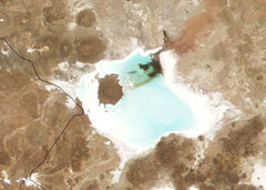
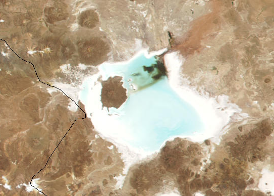
Location Atahuallpa Province, Oruro Department Coordinates 19°12′S 68°07′W / 19.2°S 68.117°WCoordinates: 19°12′S 68°07′W / 19.2°S 68.117°W Primary inflows Río Lauca Basin countries Bolivia Surface area 806 km² Max. depth 3.5 m Surface elevation 3657 m Lago Coipasa or Salar de coipasa is a lake in Atahuallpa Province, Oruro Department, Bolivia. At an elevation of 3657 m, its surface area is 806 km². It's on the western part of Altiplano, 20 km north of Salar de Uyuni and south of the main road linking Oruro and Huara (Chile) [1].
Coipasa Lake is a tectonic lake with a depth of 3.5 meters that surrounds to Salar de Coipasa, and to the volcanic cone of Villa Pucarani.
Thousands of flamingos have settled on the shores of Lake Coipasa.
References
- ^ "Travel map of the Andes". Nelles Map. http://andes.zoom-maps.com/. Retrieved 2010-12-10.
- This article incorporates information from the Spanish Wikipedia.
- {{http://www.boliviatravelsite.com/attractions.php?attraction=Coipasa%20Lake}}
- Template:Http://gsabulletin.gsapubs.org/content/118/5-6/515.abstract
Categories:- Lakes of Bolivia
- Oruro Department
- Salt flats of Bolivia
Wikimedia Foundation. 2010.