- Coal Aston Airfield
-
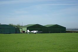
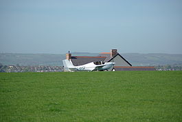
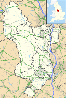
Coal Aston Airfield Hangers at Coal Aston Airfield Turning onto runway 11 at Coal Aston Airfield in front of farmhouse/ops centre. IATA: none – ICAO: EGCA Summary Airport type Private Owner/Operator Bill and Richard Valle Elevation AMSL 750 ft / 229 m Coordinates 53°18′17″N 001°25′50″W / 53.30472°N 1.43056°WCoordinates: 53°18′17″N 001°25′50″W / 53.30472°N 1.43056°W Map Location in Derbyshire Runways Direction Length Surface m ft 11/29 732 2,402 grass Coal Aston Airfield (ICAO: EGCA) is located 4 NM (7.4 km; 4.6 mi) north of Chesterfield, Derbyshire, England. It is a grass strip on high ground east of and above Dronfield, some 10 km (6.2 mi) south of central Sheffield. It is operated from a nearby farmhouse and prior permission is required. The field is grazed by cattle. Overnight parking is possible and hangarage may be available. A range of aircraft types may be accepted at the owners' discretion, including NORDO (no radio) traffic. It is very much a general aviation airfield.[1]
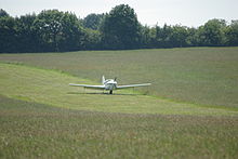
The strip, approximately 730 metres (2,400 ft) long,[2] has a dip in the middle and a hump at the 11 end.[1]
References
- ^ a b "UKGA - Coal Aston". http://ukga.com/airfield/coal-aston. Retrieved 2011-03-21.
- ^ "VFR - Coal Aston". http://ukvfrflightguide.com/index.php?option=com_sobi2&sobi2Task=sobi2Details&sobi2Id=76&Itemid=. Retrieved 2011-03-21.
Categories:- Airports in England
- Buildings and structures in Derbyshire
- Transport in Derbyshire
- United Kingdom airport stubs
Wikimedia Foundation. 2010.


