Church of St James, Winscombe

Church of St James, Winscombe
Church of St James
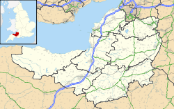
Church of St James, Winscombe is located in Somerset
Location within Somerset
General information
Town or city Winscombe
Country England
Coordinates 51°18′42″N 2°50′03″W / 51.3116°N 2.8342°W / 51.3116; -2.8342
Completed 15th century

The Church of St James in Winscombe, Somerset, England has 12th or 13th century origins but the present building dates from the 15th century. It is designated as a Grade I listed building.[1]

There are no records remaining of the Norman church on the site, but there evidence of the building of the church which was consecrated by Bishop Jocelin on 26 August 1236. The 4 stage 100 feet (30.5 m) tower was added around 1435,[2] by Bishop John Harewell, and at the same time stained glass was added.[3]

The church was restored and a new Chancel added in 1863.[1]

The bells of St James have long called people to worship, the original bells being cast in 1773 by local founders, the Bilbie family.[4] Two newer bells were added in 1903 by Taylors Founders. The eight bells are in the key of E flat and the tenor weighs 18-1-8 – 18 hundredweight, 1 quarter of a hundredweight and 8 lb (930 kg). St James holds regular services on Sundays, with bell ringing being provided for both the morning service and evensong.

See also

References

  1. ^ a b "Church of St James". Images of England. English Heritage. http://www.imagesofengland.org.uk/Details/Default.aspx?id=33275. Retrieved 2008-12-16. 
  2. ^ Poyntz Wright, Peter (1981). The Parish Church Towers of Somerset, Their construction, craftsmanship and chronology 1350 - 1550. Avebury Publishing Company. ISBN 0861275020. 
  3. ^ Robinson, W.J. (1916). West Country Churches. IV. Bristol Times and Mirror Ltd. pp. 154–158. 
  4. ^ Moore, J. Rice, R. and Hucker, E. (1995). Bilbie and the Chew Valley clockmakers: the story of the renowned family of Somerset bellfounder-clockmakers. The authors. ISBN 0952670208. 

External links


Wikimedia Foundation. 2010.

Игры ⚽ Нужна курсовая?

Look at other dictionaries:

  • Winscombe — infobox UK place country = England latitude= 51.3136 longitude= 2.8263 official name= Winscombe population = unitary england= North Somerset lieutenancy england=Somerset region= South West England constituency westminster= Weston Super Mare post… …   Wikipedia

  • List of Grade I listed buildings in Somerset — There are over 6000 Grade I listed buildings in England. This page is a list of these buildings in the county of Somerset.Bath North East Somerset* Abbey Church, Bath (Grade A) * Abbey Church Yard, Bath: No 14 * Grand Pump Room, Bath * Grand Pump …   Wikipedia

  • List of towers in Somerset — The Somerset Towers, built in the 14th to 16th centuries, have been describe as among England s finest contributions to medieval art.cite book |last= Jenkins|first=Simon|title= England s Thousand Best Churches|year= 2000|publisher= Penguin… …   Wikipedia

  • Sandford, Somerset — infobox UK place country = England official name= Sandford latitude= 51.33167 longitude= 2.82671 civil parish= population = unitary england= North Somerset lieutenancy england= Somerset region= South West England constituency westminster=… …   Wikipedia

  • List of schools in the South West of England — The following is a partial list of currently operating schools in the South West region of England. You may also find of use to find a particular school. See also the List of the oldest schools in the United Kingdom.Listed by local education… …   Wikipedia

  • Wells — For other uses, see Wells (disambiguation). Coordinates: 51°12′26″N 2°39′07″W / 51.2073°N 2.6519°W / 51.2073; 2.6519 …   Wikipedia

  • Bilbie family — The Bilbie family were bell founders and clockmakers based initially in Chew Stoke, Somerset and later at Cullompton, Devon in south west England from the late 1600s to the early 1800s.Their importance to the local economy and in local history is …   Wikipedia

  • Redhill, Somerset — infobox UK place country = England latitude= 51.366979 longitude= 2.725859 official name= Redhill civil parish= population = unitary england= North Somerset lieutenancy england=Somerset region= South West England constituency westminster=… …   Wikipedia

  • Cheddar — This article is about the settlement in Somerset, England. For the cheese, see Cheddar cheese. For other uses, see Cheddar (disambiguation). Coordinates …   Wikipedia

  • Chewton Mendip — Coordinates: 51°16′32″N 2°34′37″W / 51.2755°N 2.5770°W / 51.2755; 2.5770 …   Wikipedia

Share the article and excerpts

Direct link
Do a right-click on the link above
and select “Copy Link”