- Qumarlêb County
-
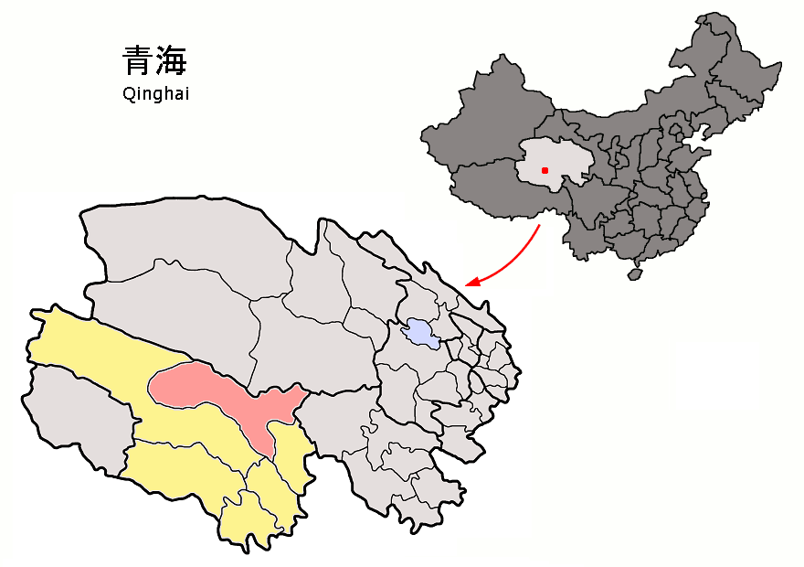
Qumarlêb County — County — Chinese transcription(s) - Simplified 曲麻莱县 - Traditional 曲麻萊縣 - Hanyu Pinyin Qūmálái Xiàn Tibetan transcription(s) - Tibetan script ཆུ་དམར་ལེབ་རྫོང - Wylie chu dmar leb rdzong - Tibetan pinyin Qumarlêb Zong Location of Qumarlêb County (red) in Yushu Prefecture (yellow), Qinghai province, and the PRC Location in Qinghai
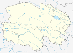
 Qumarlêb
Coordinates: 34°08′N 95°48′E / 34.133°N 95.8°ECoordinates: 34°08′N 95°48′E / 34.133°N 95.8°E Country People's Republic of China Province Qinghai Autonomous prefecture Yushu Area - Total 47,000 km2 (18,146.8 sq mi) Elevation 4,191 m (13,750 ft) Population - Total 20,000 - Density 0.4/km2 (1.1/sq mi) Time zone China Standard (UTC+8) Postal code 815500 Qumarlêb County (Tibetan pinyin: ཆུ་དམར་ལེབ་རྫོང; Chinese: 曲麻莱县 is a county in the northeast of the Yushu Tibetan Autonomous Prefecture, south-central Qinghai province, Western China. It is under the administration of Yushu Tibetan Autonomous Prefecture.
Geography and climate
With an elevation of around 4,200 metres (14,000 ft), Qumarlêb County has an alpine climate (Köppen EH), with long, very cold and winters, and short, rainy, and cool summers. The monthly daily mean temperature in January, the coldest month, is −14.5 °C (5.9 °F), while the same figure for July, the warmest month, is 8.9 °C (48.0 °F); the year averages out at −2.13 °C (28.2 °F). Most of the annual precipitation is delivered from June to September.
Climate data for Qumarlêb County (1971–2000) Month Jan Feb Mar Apr May Jun Jul Aug Sep Oct Nov Dec Year Average high °C (°F) −5.1
(22.8)−2.4
(27.7)2.1
(35.8)6.3
(43.3)10.7
(51.3)13.3
(55.9)15.6
(60.1)15.4
(59.7)11.8
(53.2)6.3
(43.3)0.4
(32.7)−3.7
(25.3)5.89
(42.61)Average low °C (°F) −22.8
(−9)−19.1
(−2.4)−13.5
(7.7)−8.9
(16.0)−3.6
(25.5)1.2
(34.2)3.2
(37.8)1.8
(35.2)−0.6
(30.9)−7.7
(18.1)−16.7
(1.9)−21.8
(−7.2)−9.04 Precipitation mm (inches) 3.0
(0.118)3.9
(0.154)7.2
(0.283)11.8
(0.465)37.7
(1.484)90.8
(3.575)92.2
(3.63)71.6
(2.819)65.5
(2.579)17.9
(0.705)2.3
(0.091)2.5
(0.098)406.4
(16)% humidity 48 43 42 47 58 67 68 67 71 61 49 46 55.6 Avg. precipitation days (≥ 0.1 mm) 5.2 6.3 7.9 9.7 16.8 21.1 21.0 16.5 19.3 10.3 3.4 3.4 140.9 Sunshine hours 220.1 204.5 227.9 243.7 254.5 218.9 240.3 243.8 211.9 243.7 242.9 229.6 2,781.8 Source: China Meteorological Administration References
External links
Qinghai Province county-level divisions Xining (capital) Xining: Chengzhong District · Chengdong District · Chengxi District · Chengbei District · Datong County · Huangyuan County · Huangzhong County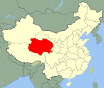 Qinghai in China
Haidong: Ping'an County · Ledu County · Minhe County · Huzhu County · Hualong County · Xunhua County
Haibei: Haiyan County · Qilian County · Gangca County · Menyuan County
Hainan: Gonghe County · Tongde County · Guide County · Xinghai County · Guinan County
Huangnan: Tongren County · Jainca County · Zêkog County · Henan County
Golog: Maqên County · Baima County · Gadê County · Darlag County · Jigzhi County · Madoi County
Yushu: Yushu County · Zadoi County · Chindu County · Zhidoi County · Nangqên County · Qumarleb County
Haixi: Delingha City · Golmud City · Wulan County · Dulan County · Tianjun CountyAdministrative Committees: Lenghu · Da Qaidam · Mangya1
^1 — The administrative committees are not standard units of local government, though they do function as such.
■ = Prefecture-level city ■ = Prefecture ■ = Autonomous prefecturesCategories:- County-level divisions of Qinghai
- Northwestern China geography stubs


Wikimedia Foundation. 2010.