- Mezőtúr
-
Mezőtúr Town hall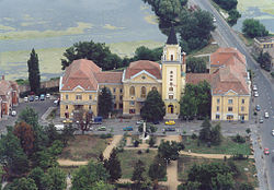

 Mezőtúr
Coordinates: 47°00′N 20°38′E / 47°N 20.633°E Country  Hungary
County Jász-Nagykun-Szolnok Area – Total 289.72 km2 (111.9 sq mi) Population (2001) – Total 19,483 – Density 67/km2 (173.5/sq mi) Time zone CET (UTC+1) – Summer (DST) CEST (UTC+2) Postal code 5400 Area code(s) 56 Mezőtúr is a town of Hungary, in the county of Jász-Nagykun-Szolnok, 88 m. southeast of Budapest by rail. It possesses important potteries. Large herds of cattle are reared on the communal lands, which are productive also of wheat, rapeseed and maize. Several well-attended fairs are held here annually.
Contents
Location
Mezőtúr lies in the centre of the Great Hungarian Plain, on the banks of the Hortobágy-Berettyó, near the Budapest–Szolnok–Békéscsaba railway line.
History
The town was founded in the Middle Ages and it was called Túr after the river Berettyó, which was formerly named Túr. Later it was named Mezőtúr (mező means field, referring to the good soil of the Great Plain.) The town was first mentioned under King Andrew II (1205–1235) as villa Tur. The shortest road between Buda and Transylvania led through Mezőtúr, which was the only town in the area having a ferry. Because of this advantage the town prospered and King Louis the Great made it a market town. In the 15th century it held famous markets, and its importance grew. Mezőtúr was royal estate until 1378, later it had various owners, and under King Matthias the town was divided into two parts because it was donated to two different persons.
During the Ottoman occupation of Hungary Mezőtúr fell under Ottoman rule in 1562 and was freed in 1692. After the expelling of the Ottomans and during the revolution led by Prince Rákóczi the citizens had to leave the town twice (1692–1699 and 1705–1710.)
In the 18th century the town began to prosper again, mainly as an agricultural town.
References
 Chisholm, Hugh, ed (1911). "Mezötúr". Encyclopædia Britannica (11th ed.). Cambridge University Press.
External links
Coordinates: 47°00′N 20°38′E / 47°N 20.633°E
Categories:- Populated places in Jász-Nagykun-Szolnok county
- Jász-Nagykun-Szolnok geography stubs


Wikimedia Foundation. 2010.