- Range Regional Airport
-
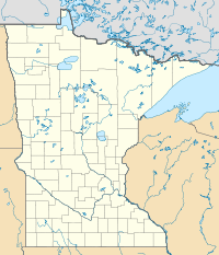
Range Regional Airport IATA: HIB – ICAO: KHIB – FAA LID: HIB Location of the Airport in Minnesota Summary Airport type Public Owner Chisholm/Hibbing Airport Authority Serves Hibbing, Minnesota Elevation AMSL 1,354 ft / 413 m Coordinates 47°23′12″N 092°50′20″W / 47.38667°N 92.83889°W Website Runways Direction Length Surface ft m 13/31 6,760 2,060 Asphalt 4/22 3,096 944 Asphalt Statistics (2009) Aircraft operations 30,365 Based aircraft 52 Source: Federal Aviation Administration[1] Range Regional Airport (IATA: HIB, ICAO: KHIB, FAA LID: HIB) is a public use airport located four nautical miles (7 km) southeast of the central business district of Hibbing, a city in St. Louis County, Minnesota, United States.[1] It was formerly known as Chisholm-Hibbing Airport or Chisholm-Hibbing Municipal Airport. The airport is mostly used for general aviation but is also served by one commercial and one charter airline. Service is subsidized by the Essential Air Service program.
Contents
Facilities and aircraft
Range Regional Airport covers an area of 1,600 acres (650 ha) at an elevation of 1,354 feet (413 m) above mean sea level. It has two asphalt paved runways: 13/31 is 6,760 by 150 feet (2,060 x 46 m) and 4/22 is 3,096 by 75 feet (944 x 23 m).[1]
For the 12-month period ending August 31, 2009, the airport had 30,365 aircraft operations, an average of 83 per day: 82% general aviation, 9% scheduled commercial, 9% air taxi, and <1% military. At that time there were 52 aircraft based at this airport: 77% single-engine, 4% multi-engine and 19% helicopter.[1]
Airline and scheduled destinations
Airlines Destinations Delta Connection operated by Mesaba Airlines Thief River Falls, Minneapolis/St.Paul Charter airline
Airlines Destinations Sun Country Laughlin, Nevada Incidents
On December 1, 1993, Northwest Airlink Flight 5719, crashed while on approach to Range Regional Airport. All 18 passengers and crew on board were killed.[2]
References
- ^ a b c d FAA Airport Master Record for HIB (Form 5010 PDF). Federal Aviation Administration. Effective 29 July 2010.
- ^ "18 Killed in Commuter Plane Crash in Minn.". Chicago Sun-Times. December 2, 1993. http://www.highbeam.com/doc/1P2-4202916.html. Retrieved 03 July 2010.
External links
- Range Regional Airport, official web site
- Range Regional Airport (HIB)PDF at Minnesota DOT Airport Directory
- Aerial image as of 10 May 1992 from USGS The National Map
- FAA Terminal Procedures for HIB, effective 20 October 2011
- Resources for this airport:
- AirNav airport information for KHIB
- ASN accident history for HIB
- FlightAware airport information and live flight tracker
- NOAA/NWS latest weather observations
- SkyVector aeronautical chart, Terminal Procedures for KHIB
Categories:- Airports in Minnesota
- Essential Air Service
- Buildings and structures in St. Louis County, Minnesota
- Transportation in St. Louis County, Minnesota
Wikimedia Foundation. 2010.

