- Arieș River (Mureș)
-
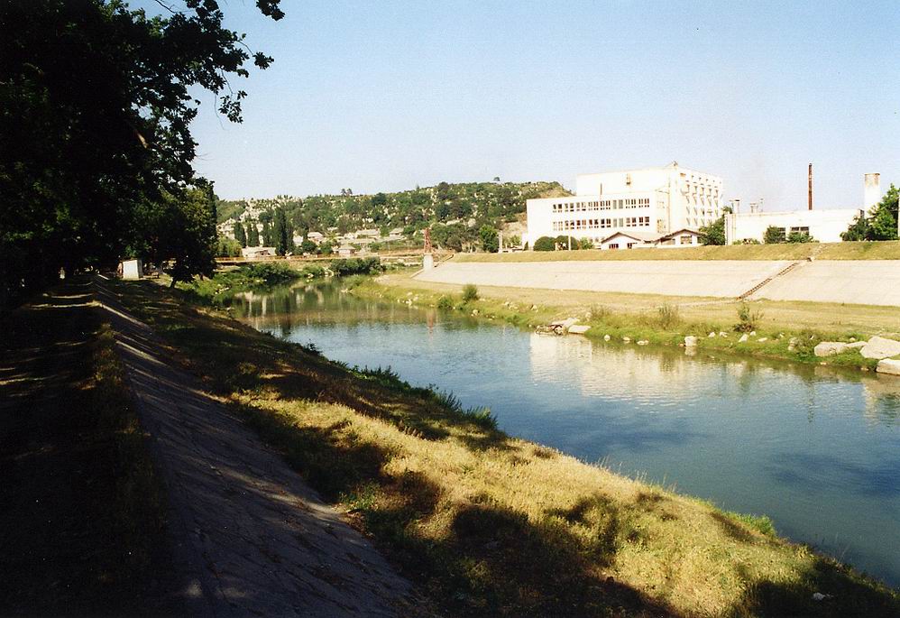
Arieș Aranyos River 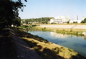 The Arieș River in Turda
Countries Romania Region Transylvania Counties Alba County,
Cluj CountyTowns Turda, Câmpia Turzii Source - location Lake Mihoeşti, at the junction of headwaters: Arieșul Mare and Arieşul Mic. - elevation 570 m (1,870 ft) - coordinates 46°22′20″N 23°01′01″E / 46.37222°N 23.01694°E Mouth Mureş River - location Upstream of Gura Arieșului - elevation 263 m (863 ft) - coordinates 46°25′45″N 23°58′38″E / 46.42917°N 23.97722°E Length 164 km (102 mi) The Arieș (Hungarian: Aranyos) is a tributary of Mureș River in Transylvania, Romania.
Most probably "Arieș" means "Gold River" in Dalmatian which is thought to be very similar to the Dacian language. It is concluded that the Romanian name most probably derives from the Dacian name of the river. The Hungarian name "Aranyos" means "Golden" and it was first mentioned in 1177.[1]
Contents
Course
The source of the river is in the Bihor Mountains, part of the Apuseni Mountains, which translates as The Western Mountains. The Arieș is formed near the village of Mihoiești at the junction of two headwaters: Arieșul Mare and Arieșul Mic. Its length is approximately 164 km. It flows through Alba and Cluj Counties and flows into the Mureș near the village of Gura Arieșului, which is close to the town of Luduș.
The towns of Câmpeni, Baia de Arieș, Turda, and Câmpia Turzii lie on the river Arieş. The upper valley of the river, Țara Moților, is a beautiful rustic region and an important mining region (Roșia Montană), rich in gold, silver and uranium. Those mines of Apuseni Mountains (also known as "Metaliferi") were exploited since Dacian reign, and later on they attracted the Roman invasion.
Towns and villages
The following towns and villages are situated along the river Arieş, from source to mouth: Mihoești, Gura Sohodol, Câmpeni, Boncești, Lunca Merilor, Bistra, Gârde, Lunca Largă, Pițiga, Lupșa, Hădărău, Lunca, Valea Lupșii, Valea Șesii, Muncelu, Baia de Arieș, Sartăș, Brăzești, Sălciua de Jos, Poșaga de Jos, Lunca, Vidolm, Lungești, Buru, Moldovenești, Cornești, Cheia, Mihai Viteazu, Turda, Câmpia Turzii, Luna, Luncani, Hădăreni, Gligorești
Tributaries
The following rivers are tributaries to the river Arieş (from source to mouth):
Left: Arieşul Mare, Valea Caselor, Bistra, Bistrişoara, Dobra, Valea Caselor, Izvorul Călugărului, Lupşa, Sartăş, Sălciuţa, Poşaga, Ocoliş, Ocolişel, Iara, Borzeşti, Pârâul Muntelui, Hăşdate, Pordei, Sănduleşti, Valea Racilor, Valea Sărată, Pârâul Florilor, Valea Largă
Right: Arieşul Mic, Sohodol, Abrud, Râul Luteştilor, Ştefanca, Râul Maşcanilor, Valea Şesei, Hermăneasa, Cioara, Ponor, Huda lui Papară, Vidolm, Rimetea, Nadeş, Văleni, Plăieşti, Bădeni
References
- ^ Vistai András János. "Erdélyi helynévkönyv". http://www.fatornyosfalunk.com/html/erdelyi_helynevkonyv.html. Retrieved 2009-12-28.
- Administraţia Naţională Apelor Române - Cadastrul Apelor - Bucureşti
- Institutul de Meteorologie şi Hidrologie - Rîurile României - Bucureşti, 1972
- Trasee turistice - Judeţul Alba [1]
- Trasee turistice - judeţul Cluj [2]
- Kniezsa István- Erdély földrajzi nevei [3]
Maps
Categories:- Rivers of Romania
- Rivers of the Mureş subbasin
- Rivers of Alba County
- Rivers of Cluj County
Wikimedia Foundation. 2010.