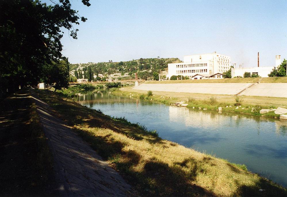
- Arieş River (Mureş)
Geobox River
name =Arieş River
native_name =
other_name =
other_name1 =

image_size = 300
image_caption = The Arieş River in Turda
country_type = Countries
state_type =
region_type =
district_type = Counties
city_type = Villages
country =Romania
country1 =
state =
state1 =
region =
region1 =
district =Alba County ,Cluj County
district1 =
city = Mihoeşti,Câmpeni ,
Bistra,
Piţiga,
Lupşa,
Hădărău,
Lunca,
Valea Lupşii,
Muncelu,Baia de Arieş ,
Sartăş,
Brăzeşti,
Sălciua de Sus,
Sălciua de Jos,
Poşaga de Jos,
Lunca,
Vidolm,
Buru,
Moldoveneşti,
Corneşti,
Cheia
Mihai Viteazu,Turda ,Câmpia Turzii ,
Luna,
Luncani,
Gligoreşti
city1 =
length = 164
watershed =
discharge_location =
discharge =
discharge_max =
discharge_min =
discharge1_location =
discharge1 =
source_name =
source_location =Bihor Mountains at the junction of headwaters: Arieşul Mare and Arieşul Mic.
source_district =
source_region =
source_state =
source_country =
source_lat_d =
source_lat_m =
source_lat_s =
source_lat_NS =
source_long_d =
source_long_m =
source_long_s =
source_long_EW =
source_elevation =
source_length =
mouth_name =Mureş River
mouth_location = Downstream ofLuduş
mouth_district =
mouth_region =
mouth_state =
mouth_country =
mouth_lat_d =
mouth_lat_m =
mouth_lat_s =
mouth_lat_NS =
mouth_long_d =
mouth_long_m =
mouth_long_s =
mouth_long_EW =
mouth_elevation =
tributary_left = Arieşul Mare,
Valea Caselor,
Bistra,
Bistrişoara,
Dobra,
Valea Caselor,
Izvorul Călugărului,
Lupşa,
Sartăş,
Sălciuţa,
Poşaga,
Valea Coşegii,
Ocoliş,
Ocolişel,
Iara,
Borzeşti,
Pârâul Muntelui,
Hăşdate,
Pordei,
Sănduleşti,
Valea Racilor,
Valea Sărată,
Pârâul Florilor,
Valea Largă
tributary_left1 =
tributary_right = Arieşul Mic,
Sohodol
Abrud,
Râul Luteştilor ,
Ştefanca,Râul Maşcanilor ,
Valea Şesei,
Hermăneasa,
Cioara,
Ponor,
Huda lui Papară
Valea Morilor,
Vidolm,
Rimetea,
Nadeş,
Văleni,
Plăieşti,
Bădeni
tributary_right1 =
free =
free_type = Official River Code
map_size =
map_caption =The Arieş ( _hu. Aranyos) is a
river inTransylvania ,Romania that flows through the Alba and Cluj Counties.The source of the river is in the
Bihor Mountains , part of theApuseni Mountains . The Arieş is formed near the village of Mihoieşti at the junction of twoheadwater : Arieşul Mare and Arieşul Mic. and its length is approximately 164 km. It flows into the Mureş near the village of Gura Arieşului ("Székelykocsárd" in Hungarian), which is close to the town ofLuduş ("Marosludas" in Hungarian).The towns of
Câmpeni ("Topánfalva" in Hungarian),Baia de Arieş ("Aranyosbánya" in Hungarian),Turda ("Torda" in Hungarian), andCâmpia Turzii ("Aranyosgyéres" in Hungarian) lie on the river Arieş. The upper valley of the river,Ţara Moţilor , is a beautiful rustic region and an important mining region (Roşia Montană ), rich in gold, silver and uranium.Hydronomy
The name in Dalmatian, which is very similar to Dacian, means "Gold River". The Romanian name, most probably derives from the Dacian name of the river. The Hungarian name, Aranyos, means "golden river", as well.
However a more common view, that the Romanian name (which means nothing in Romanian) derives from the Hungarian word "Aranyos".
In Romanian language the Hungarian letter "ny" becomes "i" very often. Enyed-Aiud,Belényes-Beius,Szekrényes-Sacries,Köröstárkány-Tarcaia
The name of the river was first mentioned in 1075 as "Aranas".
References
* Administraţia Naţională Apelor Române - Cadastrul Apelor - Bucureşti
* Institutul de Meteorologie şi Hidrologie - Rîurile României - Bucureşti, 1972
* Trasee turistice - Judeţul Alba [http://www.e-calauza.ro/index.php?afiseaza=trasee-turistice-alba]
* Trasee turistice - judeţul Cluj [http://www.harta-turistica.ro/map.php?ID=21]
* Kniezsa István- Erdély földrajzi nevei [http://mek.oszk.hu/04700/04729/html/11.html]Maps
* Munţii Trascău [http://harti.mielu.ro/trascau.html]
* Harta Munţilor Apuseni [http://www.harta-turistica.ro/map.php?ID=10]
* Harta judeţului Alba [http://www.harta-turistica.ro/map.php?ID=28&harta=Judetul%20Alba]
Wikimedia Foundation. 2010.
