- Chippewa City, Minnesota
-
Chippewa City, Minnesota — Unincorporated settlement — 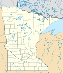
 Chippewa City, Minnesota
Coordinates: 47°45′35″N 90°18′07″W / 47.75972°N 90.30194°WCoordinates: 47°45′35″N 90°18′07″W / 47.75972°N 90.30194°W Country United States State Minnesota County Cook Elevation 669 ft (204 m) Time zone Central (CST) (UTC-6) - Summer (DST) CDT (UTC-5) Area code(s) 218 GNIS feature ID 655713[1] Chippewa City is an unincorporated community in Cook County, Minnesota, United States. Chippewa City is located on Minnesota State Highway 61 east of Grand Marais.
History
Chippewa City thrived in the 1890s. with about 100 families living in the village, it was thought that this town would never dwindle. However, much of this community's room for housing was buried when Highway 61 entered here. The land was opened up to white settlement in 1854 with the signing of the Treaty of LaPointe by the Chiefs of the Indian Peace Commission. As part of and in accordance with the treaty, the land was given to Chippewa native Francis Rousain, who then sold it to another Chippewa, D. George Morrison, who then sold it to Eber E. Bly, who by 1873 sold it to Henry Mayhew. ("Pioneers in the wilderness" Fourth printing, July 1999, Willis H. Raff)
The St. Francis Xavier Church, maintained by the Cook County Historical Society, and on the National Register of Historic Places, is located within the community.[2]
References
- ^ "US Board on Geographic Names". United States Geological Survey. 2007-10-25. http://geonames.usgs.gov. Retrieved 2008-01-31.
- ^ Wurzer, Cathy (2008). Tales of the Road: Highway 61. pp. 17-18.
Municipalities and communities of Cook County, Minnesota City 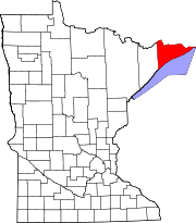
Townships Unorganized
territoriesUnincorporated
communitiesChippewa City | Covill | Croftville | Grand Portage | Hovland | Lutsen | Mineral Center | Pigeon River | Schroeder | Taconite Harbor | Tofte
Indian
reservationCategories:- Populated places in Cook County, Minnesota
- Unincorporated communities in Minnesota
- Arrowhead region geography stubs


Wikimedia Foundation. 2010.