- Chicoutimi/Saint-Honoré Aerodrome
-
Chicoutimi/Saint-Honoré Aerodrome 
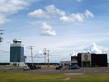
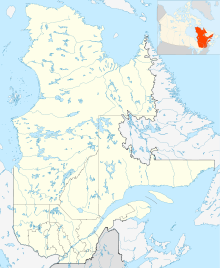
NAV CANADA control tower at Saint-Honore. IATA: YRC – ICAO: CYRC Summary Airport type Public Operator Government of Quebec Serves Chicoutimi, Quebec Location Saint-Honoré, Quebec Elevation AMSL 543 ft / 166 m Coordinates 48°31′15″N 071°03′02″W / 48.52083°N 71.05056°WCoordinates: 48°31′15″N 071°03′02″W / 48.52083°N 71.05056°W Map Location in Quebec Runways Direction Length Surface ft m 06/24 3,734 1,138 Asphalt 12/30 6,087 1,855 Asphalt 18/36
(day)3,769 1,149 Asphalt 18/36 (night) 3,598 1,097 Asphalt Statistics (2010) Aircraft Movements 67,792 Sources: Canada Flight Supplement[1]
Movements from Statistics Canada[2]Chicoutimi/Saint-Honoré Aerodrome (IATA: YRC[3], ICAO: CYRC), is located 1.5 NM (2.8 km; 1.7 mi) east southeast of Saint-Honoré and approximately 5.6 NM (10.4 km; 6.4 mi) from Chicoutimi in Quebec, Canada.
History
The site, north of the Saguenay River, was selected by the Royal Canadian Air Force in the summer of 1941 and construction began shortly thereafter with the aerodrome opening in June 1942 as RCAF Station St-Honoré. It was operated as a sub-base to RCAF Station Bagotville and supported pilot training during the Second World War under the British Commonwealth Air Training Plan. It was closed on January 5, 1945 and was subsequently transferred to the local community after it ceased to have a military purpose; RCAF Station Bagotville was reactivated in 1951 as a training and operational base and continues to this day as CFB Bagotville.
References
- ^ Canada Flight Supplement. Effective 0901Z 20 October 2011 to 0901Z 15 December 2011
- ^ Total aircraft movements by class of operation — NAV CANADA towers
- ^ Accident history for Saint-Honoré Airport, QC (IATA: YRC) at Aviation Safety Network
External links
- Page about this airport on COPA's Places to Fly airport directory
Airports in Canada By name A–B · C–D · E–G · H–K · L–M · N–Q · R–S · T–ZBy location indicator CA · CB · CC · CD · CE · CF · CG · CH · CI · CJ · CK · CL · CM · CN · CO · CP · CR · CS · CT · CV · CW · CY · CZBy province/territory National Airports System Calgary · Charlottetown · Edmonton · Fredericton · Gander · Halifax · Iqaluit · Kelowna · London · Moncton · Montréal-Mirabel · Montréal-Trudeau · Ottawa · Prince George · Québec · Regina · Saint John · St. John's · Saskatoon · Thunder Bay · Toronto · Vancouver · Victoria · Whitehorse · Winnipeg · YellowknifeRelated List of airports by ICAO code: C · List of defunct airports in Canada · List of heliports in Canada · List of international airports in Canada · National Airports System · Operation Yellow RibbonCategories:- Airports in Quebec
- Royal Canadian Air Force stations
- Airports of the British Commonwealth Air Training Plan
- Transportation in Saguenay, Quebec
- Quebec airport stubs
Wikimedia Foundation. 2010.

