- Chester–Hadlyme Ferry
-
Chester–Hadlyme Ferry 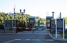
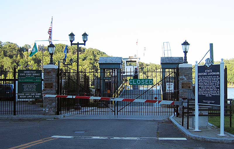
Chester–Hadlyme Ferry after closing time Route Crosses Connecticut River Locale Chester, Connecticut to the village of Hadlyme from
41°25′09″N 72°25′59″W / 41.419272°N 72.433142°W to
41°25′13″N 72°25′43″W / 41.420152°N 72.428622°WRoute  Route 148
Service Operator Connecticut State Ferry Service Authority Connecticut Department of Transportation (ConnDOT) Ferry(s) Seldan III Frequency as needed Daily vehicles 100 History Opened 1769 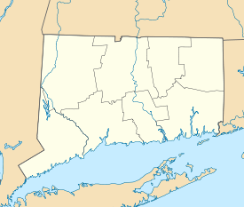

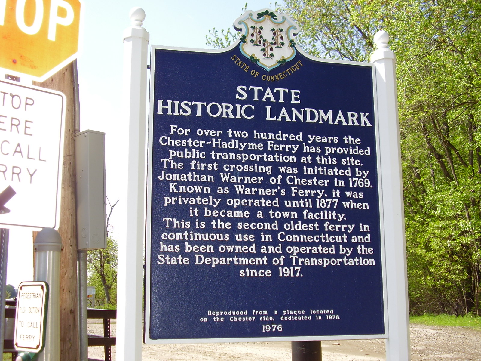
 Connecticut historical marker found at the loading areas on both sides of the river. Above image is on the Lyme side.
The Chester–Hadlyme Ferry is a seasonal ferry crossing the Connecticut River between the town of Chester, Connecticut and the village of Hadlyme (in the town of Lyme, Connecticut). It is the second oldest continuously operating ferry service in the state of Connecticut and is a designated state historical landmark. The ferry is part of the scenic portion of Route 148 and provides a convenient link between two of Connecticut's tourist attractions: Gillette Castle State Park in Hadlyme and the Essex Steam Train, which runs between Essex and Chester.
Contents
Operations
The Chester–Hadlyme Ferry operates during the daytime between April 1st and November 30th.[1] The toll for cars is $3, but it is $1 for cyclists and pedestrians.[1] The current ferry boat is called Seldan III, measuring 65 feet by 30 feet, and can accommodate 8 to 9 cars and 49 passengers. The crossing usually takes about five minutes. An average of 100 vehicles use the ferry every day.
History
Jonathan Warner of Chester, who owned land on both sides of the river, started a ferry service at this location in 1769. It was then known as Warner's Ferry and utilized a raft propelled using a nail and long poles.[1] Warner's Ferry was the seventh ferry that was established in the Lower Connecticut River Valley.[2] Before it was established, travelers and goods needing to be ferried across this reach of the river could cross downstream between Saybrook and Old Lyme, which were connected by ferry as early as 1662, or upstream at Haddam and East Haddam, where a ferry began operating as early as 1664.[3]
The ferry was often used throughout the American Revolution to transport supplies across the Connecticut River.
Between 1834 and 1846, Warner's Ferry became the terminus for two turnpikes – the Hadlyme Turnpike and the Chester and North Killingworth Second Turnpike – both chartered with the hope of creating a direct, straight-line route between New Haven and Norwich.[4]
In 1877, Warner's Ferry came under the supervision of the Town of Chester. Soon after this, a steam-powered barge was put in service and the ferry was renamed the Chester–Hadlyme Ferry.[1] The Connecticut state government took over operations in 1917 after the Connecticut General Assembly passed laws assigning all river crossings to the Highway Department in 1915; currently the Connecticut Department of Transportation operates the ferry.[3]
The Hadlyme Ferry Historic District, which includes the ferry slip and 6 buildings on the east side of the crossing, was listed on the National Register of Historic Places in 1994.[5]
The Ferry may be closed by the state by August 25, 2011 as part of the state budget cuts. The move to close the ferry has become widely unpopular in surrounding towns and grassroots efforts are currently under way to save the ferry. Some residents believe that there are several state statutes that could possibly prevent the ferry from being closed.[6]
See also
- List of crossings of the Connecticut River
- Rocky Hill – Glastonbury Ferry - the oldest continuously operating ferry service in the U.S.
References
- ^ a b c d Connecticut Department of Transportation: Chester-Hadlyme Ferry
- ^ G.S. Roberts, Historic Towns of the Connecticut River Valley, (Robson & Adee, Schenectady, 1906), p.127
- ^ a b History of the Connecticut Department of Transportation, Chapter 1
- ^ F.J. Wood, The Turnpikes of New England, (Marshall Jones, Boston, 1919), p.405-406
- ^ "National Register Information System". National Register of Historic Places. National Park Service. 2009-08-27. http://nrhp.focus.nps.gov/natreg/docs/All_Data.html.
- ^ Cho, Jenna (July 15, 2011). "Governor drydocks state ferries, eliminates all eight ferry-worker jobs". The Day. New London, Connecticut: The Day Publishing Company. http://www.theday.com/article/20110715/NWS12/307159953/1070/FRONTPAGE. Retrieved July 15, 2011.
External links
- Connecticut Commission on Culture and Tourism - Pictures of the ferry
- Video of the ferry crossing
Crossings of the Connecticut River Upstream
East Haddam Bridge

Chester–Hadlyme Ferry
Downstream
Baldwin Bridge


Coordinates: 41°25′11″N 72°25′50″W / 41.419722°N 72.430556°W
Categories:- Ferries of Connecticut
- Chester, Connecticut
- Lyme, Connecticut
- Transportation in Middlesex County, Connecticut
- Transportation in New London County, Connecticut

Wikimedia Foundation. 2010.