- Gare de Châtelet
-
Châtelet – Les Halles is a major commuter train hub in Paris. Taken together with the Paris Métro stations Châtelet and Les Halles, to which it is directly connected, hosts 750,000 travellers per week day (including interchanges), 493,000 for the RER only.[1] It is named after the Châtelet monument and the former market of Les Halles.
 RER lines on the lowest level
Contents
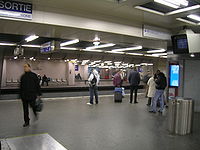
The station
The station is served by lines A, B, and D of the RER, and is therefore directly accessible from many stations in Île-de-France. A large underground network is formed in conjunction with the Châtelet and Les Halles Métro stations. This network brings together three of the five RER lines and five Métro lines, and is the central node of the network of transit of the Ile-de-France metropolitan area. Every day, 750,000 travelers pass through Châtelet–Les Halles, including 493,000 just for the RER. At peak hours, the station can see 120 trains in just one hour.
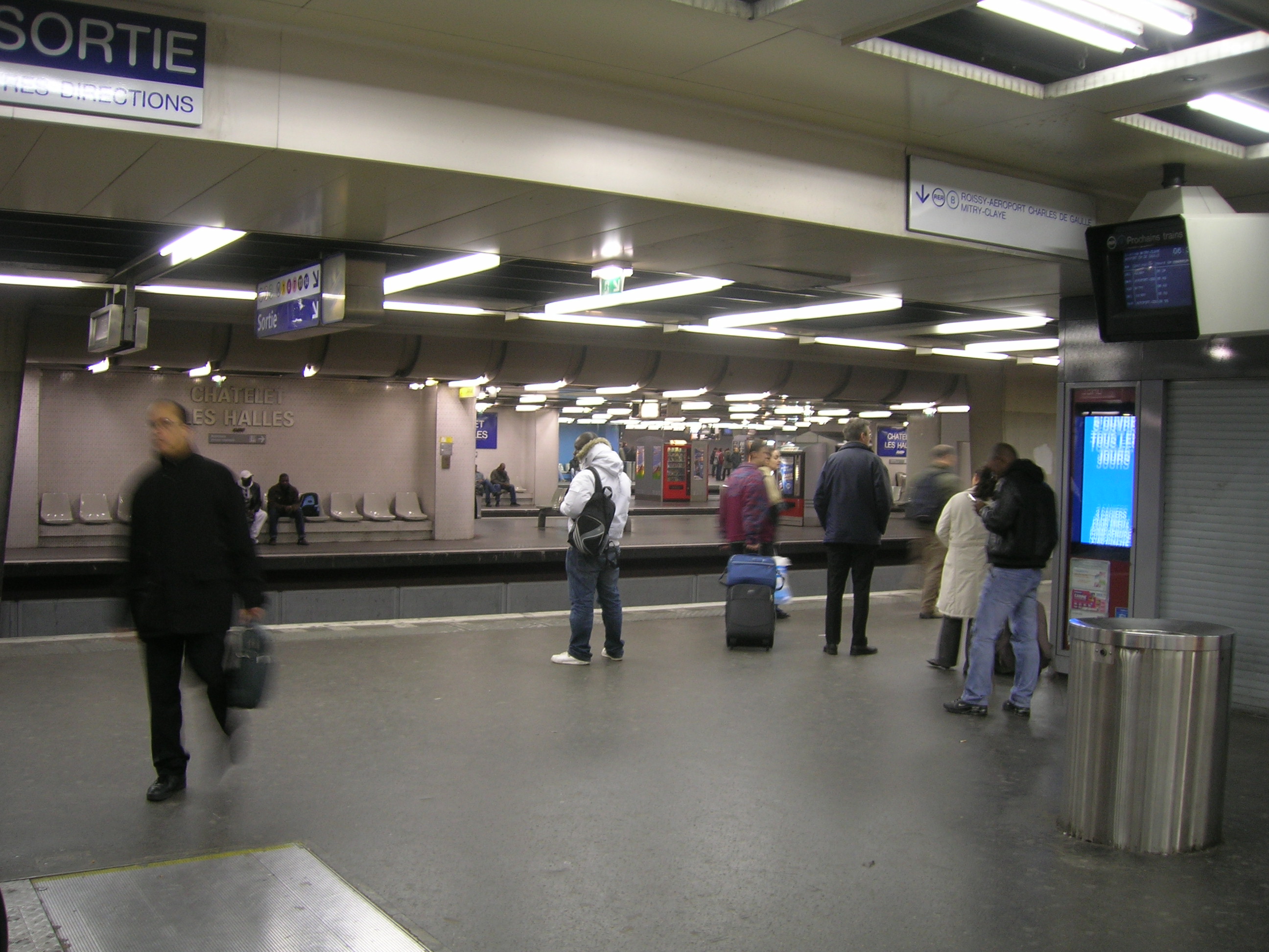
Châtelet–Les Halles is also the station where the second part of the RATP-managed IMAGE project was installed, which consisted of 10 flat screens containing information on local traffic from all carriers (RATP, SNCF, etc.). The purpose of the project was to provide local information on rail traffic (next trains, traffic conditions, delays, etc.) that will eventually replace all previously existing information systems.
Station structure
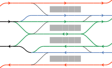 Track direction of RER Lines A (red), B (blue), and D (green).
The tracks of the three RER lines are all oriented parallel in an east-west direction. The seven tracks are grouped on four platforms. Both central platforms are reserved for Line D. The benefit is that connections to RER Lines A and B can be made on the same platform as the destinations. Line A’s track towards Gare de Lyon and Line B’s track to Saint-Michel are both located on the north platform. Conversely, Line B to the Gare du Nord and Line A towards Auber are both located on the south platform. While the tracks of Line B run parallel to those of Line D, the tracks of Line A are located on the north and south. On each platform, the trains travel in the same direction. For example, trains to Gare de Nord run east-west and those towards Saint-Michel run west-east.
Adjacent stations
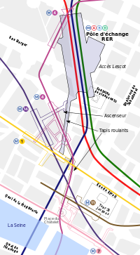
The southern end of Châtelet – Les Halles is connected to the Métro station of Châtelet, and the northern end is connected to the Métro station of Les Halles. The walking distance from the RER lines at Châtelet – Les Halles to Métro Line 7 at the far end of Châtelet is about 750 metres.
Preceding station RER Following station toward Saint Germain-en-Laye, Cergy-le-Haut or Poissy
 toward Boissy-Saint-Léger or Marne-la-Vallée - Chessytoward Aéroport Charles de Gaulle 2 – TGV or Mitry - Claye
  St-Michel – Notre-Dametoward Robinson or Saint-Rémy-lès-Chevreusetoward Creil
  toward Melun or Malesherbes
Renovation
The main problem of the subway station is that it is accessible only through the Forum des Halles shopping centre -- the restricted access slows down circulation.
The redesign of Les Halles include major redevelopment of the transit station.[2] Redevelopment includes:
- Creating new access from Rue des Halles / Rue Saint-Honoré (Saint-Honoré exit)[3] in addition to the renovated Lescot entrance.
- Extension of the escalator system at the Berger Rambuteau entrance at levels -3 and -4, facilitating circulation between the mall and the subway station.
- Expansion and renovation of the subway station; demolition of the false ceiling, improved lighting and communication, and adding a side gallery.
The renovation is scheduled to begin in 2011; no major interruption of subway traffic is expected. The renovation is scheduled to be finished by 2016.[4]
Notes and references
- ^ http://www.ratp.fr/common/ressources/concertation_p1.pdf
- ^ STIF - Redevelopment of the hub RER Châtelet - Les HallesPDF (4.04 MB)(French)
- ^ Future exit Saint-Honoré to rue des Halles / rue Saint Honoré (rue de Rivoli)(French)
- ^ RATP - Pôle RER Châtelet - Les Halles(French)
See also
Paris rail stations Termini Paris Saint Lazare • Paris Nord • Paris Est • Paris Lyon • Paris Bercy • Paris Austerlitz • Paris Montparnasse • Bastille • Invalides • Orsay
SNCF stations Pont CardinetRER stations Gare du Nord • Châtelet – Les Halles • St-Michel-Notre-Dame • Luxembourg • Port-Royal • Denfert-Rochereau • Cité UniversitairePorte de Clichy • Pereire – Levallois • Neuilly – Porte Maillot • Avenue Foch • Avenue Henri Martin • Boulainvilliers • Avenue du Président Kennedy • Pont du Garigliano • Javel • Champ de Mars - Tour Eiffel • Pont de l'Alma • Invalides • Musée d'Orsay • Saint-Michel-Notre-Dame • Gare d'Austerlitz • Bibliothèque François MitterrandGare du Nord • Châtelet – Les Halles • Gare de LyonClosed stations are in italics.
See also: List of stations of the Paris Métro, Tramways in Paris & Transport in Paris. There is also an external interactive map.Categories:- Paris Métro
- Paris Métro stations in the 1st arrondissement of Paris
- Paris RER stations


Wikimedia Foundation. 2010.