- Paris Métro Line 1
Infobox Paris Network
Line=Line 1
ColourName=#ffcd09
TextColour=Black
YearOpened=1900
LastExtension=1992
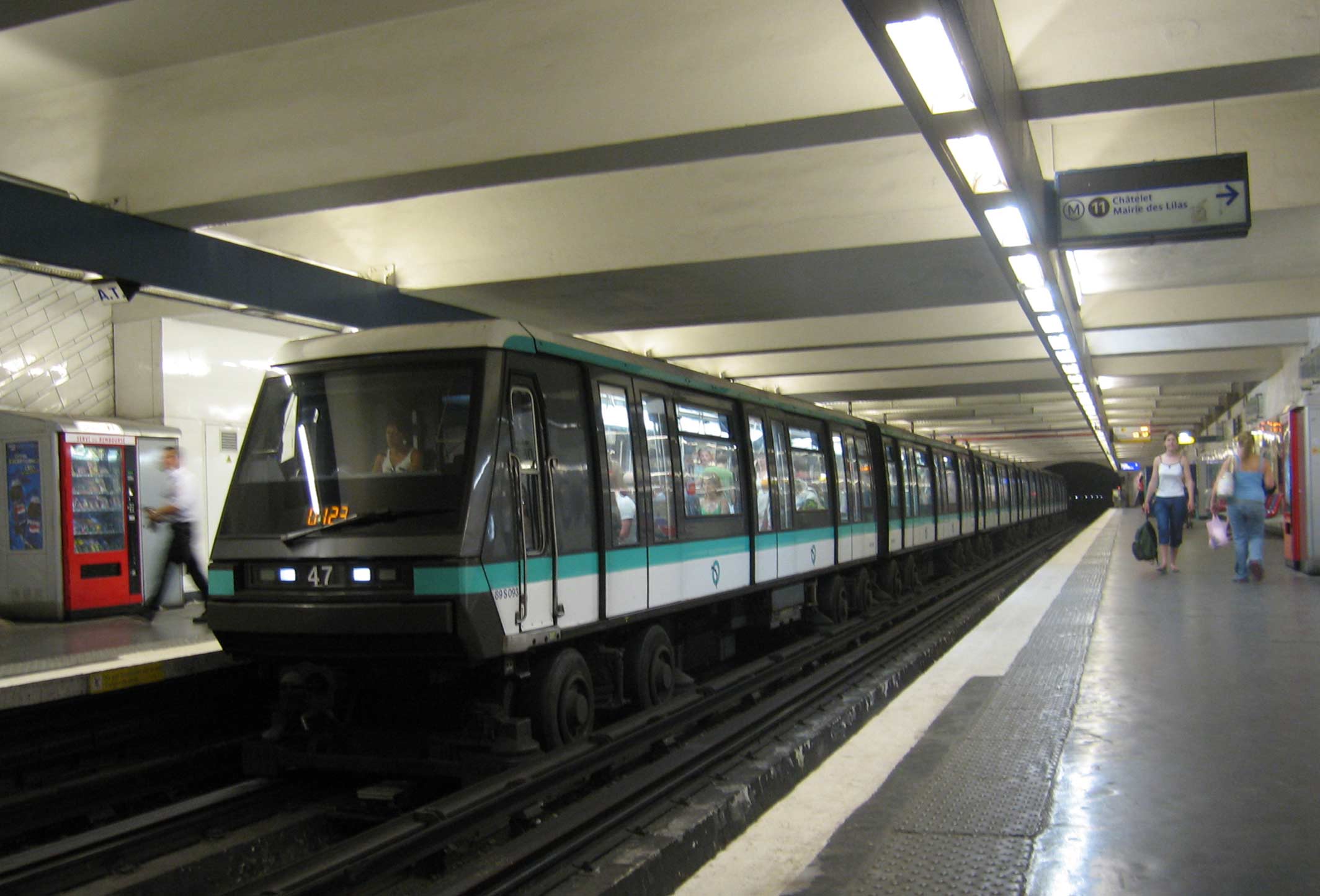
RollingStock=MP 89
StationsServed=25
LengthKm=16.6
AverageInterstation=692
LengthMiles=10.3
AnnualPassengers=165,921,408Paris Métro Line 1 was the first line of the
Paris Métro inParis ,France . Line 1, whose first section was opened in 1900, now connects La Défense – Grande Arche to Château de Vincennes. With a 16.5 km length, it constitutes an "East-West" route transportation important for the City of Paris. ExcludingRER lines, it is the most utilised subway line network with 161 million travellers in 2004 and 561,000 people per day on average. [ [http://www.stif.info/IMG/pdf/STIF_Les_chiffres_2005.pdf STIF statistical analysis] "STIF" Retrieved2007-11-24 ]History
In November 1898, Paris decided to undertake preliminary work of the metro network with the construction of the first line of the Parisian subway system. Work lasted twenty months under the leadership of engineer
Fulgence Bienvenüe and was financed by the municipality of Paris. The line was divided into eight parts distributed between several companies. On19 July 1900 , the line was opened between Porte Maillot and Porte de Vincennes to connect the various sites of the World Fair. Only eight stations were finalized and opened with the inauguration; ten more were gradually opened between6 August and1 September 1900 . The line followed the east-west monument axis in Paris. These eighteen stations were entirely built under the control of engineer Fulgence Bienvenüe, the majority of them 75 metres long and 4.10 metres wide. In March 1934, the first extension into the suburbs brought service to Château of Vincennes towards the east.Chronology
*
July 19 ,1900 : Inauguration of line 1 between Porte de Vincennes and Porte Maillot. Only 8 of the 18 planned stations were opened.
*August 6 andSeptember 1 ,1900 : The other 10 stations of the line opened.
*March 24 ,1934 : The line was extended to the east from Porte de Vincennes to the castle of Vincennes.
*November 15 ,
*April 29 ,1937 : The line was extended to the west from Porte Maillot to Pont de Neuilly.
*1963: The rails were converted in order to accommodate rubber-tyred trains. At the same time, stations were enlarged in order to accommodate 6-car trains instead of 5-car trains.
*April 1 ,1992 : The line was extended again to the west from Pont de Neuilly to La Défense business district.Future
It is planned to convert the line to a fully automated system (similar to Line 14) by the end of 2010. [cite news| url=http://www.infrasite.nl/news/news_article.php?ID_nieuwsberichten=7579&language=en| title=New section of Metro Line 14 opened| publisher=InfraSite.net| date=
2007-07-02 | accessdate=2007-07-06| ] It will be the first heavy duty line to be converted without interrupting traffic, with both automatic (MP 05 ) and manual (MP 89 CC) rolling stock running simultaneously till enough automatic rolling stock is available, thanks to theSAET system.A western extension of Line 1 from La Défense station to the center of
Nanterre is being considered. An eastern extension to Rigollots and later to Val de Fontenay is also being investigated.Facts
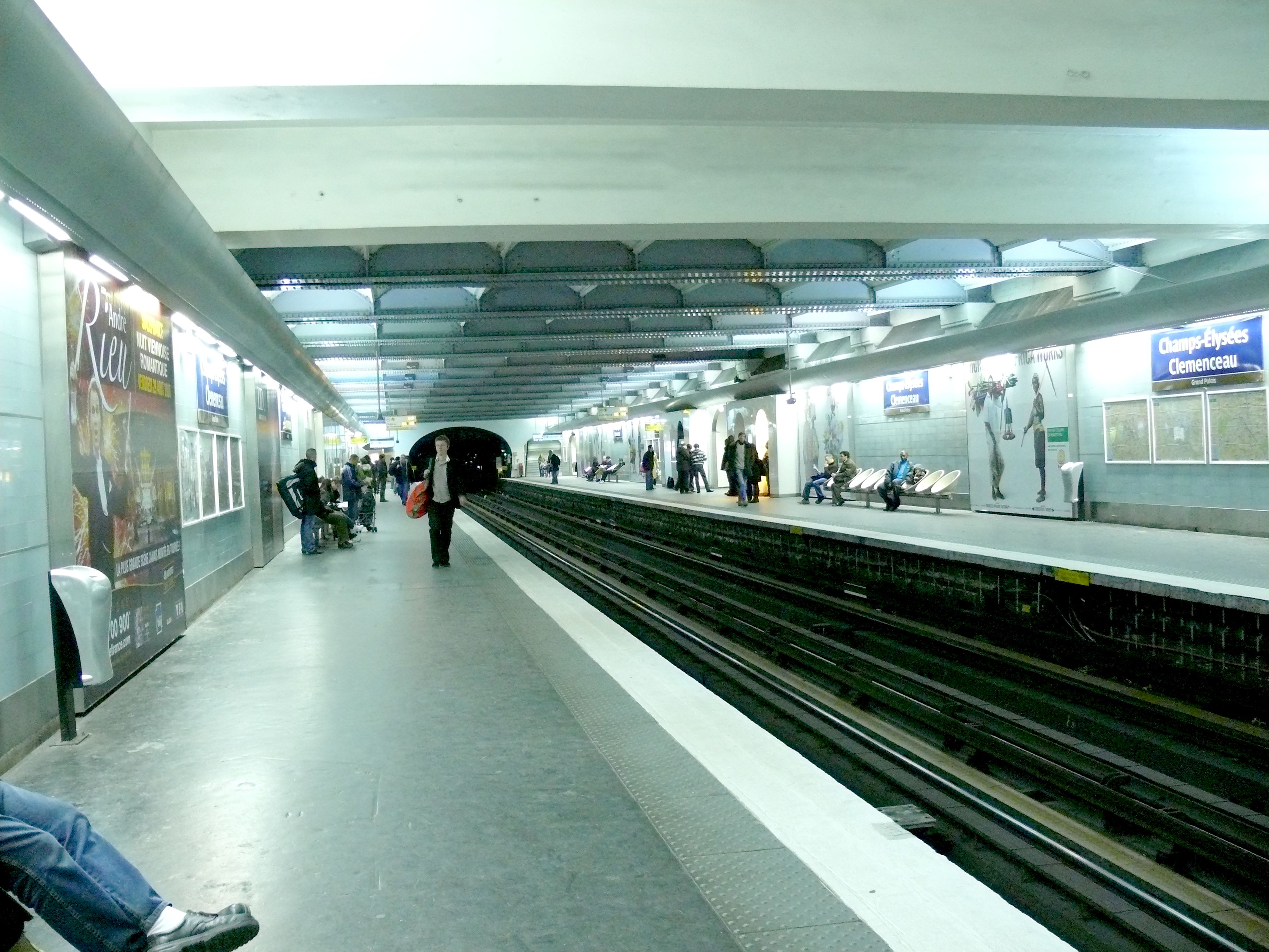
Because of less advanced building techniques of the 1900s, Line 1 of the Paris metro is the closest line to the surface; many stations have a steel beam structure with both arched and beam sections maintaining the large station roof. The line was constructed using the "
cut and cover " method and, as a result, follows the line of the streets above. This was done to both facilitate construction and avoid the adjacent buildings' cellars.Bastille station is located above the tunnel entrance of theCanal Saint-Martin , just below the pavement of the Place de la Bastille.Unlike older trains on other lines, the cars of line 1 trains are all interconnected, allowing people to move between cars. This reduces the number of seats per car and increases standing room.
Despite being almost entirely underground (except Bastille station and for the Seine-crossing at Pont de Neuilly), Line 1 is fully covered by mobile phone networks.
Map and Stations
tations renamed
*
May 27 ,1920 : Alma station renamed George V.
*May 5 ,1931 : Reuilly station renamed Reuilly-Diderot.
*May 20 ,1931 : Champs-Élysées renamed Champs-Élysées - Clémenceau.
*April 26 ,1937 : Tourelle renamed Tourelle – Saint-Mandé.
*October 6 ,1942 : Marbeuf renamed Marbeuf - Rond-Point des Champs-Élysées.
*October 30 ,1946 : Marbeuf - Rond-Point des Champs-Élysées renamed Franklin D. Roosevelt.
*May 25 ,1948 : Obligado renamed Argentine.
*1970: Étoile renamed Charles-de-Gaulle - Étoile.
*1989: Palais Royal renamed Palais Royal - Musée du Louvre after the entrance to the museum was moved with the building of theLouvre Pyramid . At the same time,Louvre station renamed Louvre - Rivoli.
*1997: Grande Arche de la Défense station renamed La Défense.
*July 26 2002 : Saint-Mandé - Tourelle renamed Saint-Mandé.Tourism
Line 1 passes near several places of interest:
*La Défense Paris high-rise district which is dominated by theGrande Arche .
*TheArc de Triomphe at Charles de Gaulle-Étoile. A 289 step staircase is open to the public and leads to the top of the Arch. There is also a museum on the top floor.
*L'Avenue des Champs-Élysées.
*ThePlace de la Concorde dominated by the Obelisk, Tuileries garden and Louvre museum.
*TheLouvre station has copies of works of art from the museum and has historical information. The station's benches are made of glass and the Western portal has Roman-inspired arches along the platform edge.
*The Hôtel de Ville (Paris City Hall) and the Marais district.
*Bastille and the nearby Opera.
*Gare de Lyon train station.
*The Place de la Nation.
*TheBois de Vincennes (Vincennes Wood) and Vincennes Zoo.
*TheChâteau de Vincennes . A medieval castle to the east of Paris.Gallery

Bastille station
 ">
">
Champs-Élysées - Clemenceau
Gare de Lyon

">
Hotel de Ville
Nation
 ">
">
Pont de Neuillyee also
*
List of stations of the Paris Métro
*List of stations of the Paris RER References
External links
* [http://ratp.fr/ RATP official website]
** en icon [http://www.ratp.info/informer/anglais/index.php# RATP english speaking website]
** en icon [http://www.ratp.info/orienter/cv/carterer.php Interactive Map of the RER (from RATP's website)]
** en icon [http://www.ratp.info/orienter/cv/carteparis.php Interactive Map of the Paris métro (from RATP's website)]
* [http://www.metro-pole.net/ Metro-Pole website, dedicated to Paris public transports (unofficial)]
Wikimedia Foundation. 2010.

