- Chinyingi
-
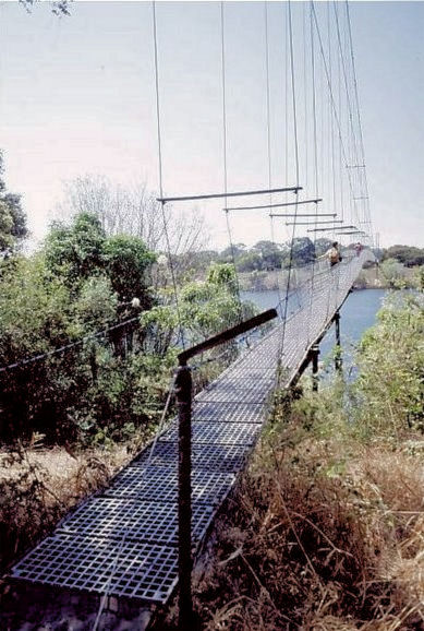
 The Chinyingi suspension bridge
Chinyingi is a Capuchin mission and hospital in the sparsely populated North-Western Province of Zambia, on the west bank of the Zambezi River. An estimated 500 people live within a seven kilometer radius of the Chinyingi mission. The mission's hospital, Chinyingi Mission Hospital, serves the local community with a 52-bed hospital and several health outreach programs, providing everything from first aid to services for people with HIV/AIDS AIDS, which affects some 25% of Zambia's population. The mission also operates a school.
In the 1970s, a Capuchin brother named Crispin Valeri constructed a simple suspension bridge over the Zambezi. Valeri was inspired by the death of four locals, who drowned in the Zambezi while trying to ferry a sick person to the hospital for care. He solicited donations of material from the copper mines of Zambia's Copperbelt, and employed local unskilled labor to construct the bridge, which despite Valeri's lack of training or expertise, proved sturdy and reliable and still spans the river as of 2005[update]. At the time, the bridge Valeri constructed was one of only five crossings along the 2,574 kilometer length of the Zambezi. A pontoon bridge was later constructed underneath it to allow vehicles to cross.
Chinyingi's elevation above sea level is 1,100 meters.
External links
References
- McIntyre, Chris. "Chapter 17: The Western Provinces". Guide to Zambia (online edition). Bradt Travel Guides. 3rd edition: November 2004.
- "A Life of Heartbreaking Beauty and Sadness" (2002). Capuchin Franciscan Friars Province of Stigmata of St. Francis. Retrieved August 10, 2005.
- "Chinyingi, Zambia Page". Falling Rain Genomics, Inc. Retrieved August 10, 2005.
Coordinates: 13°31′20″S 23°05′30″E / 13.52222°S 23.09167°E
Categories:- Populated places in Zambia
- Missions in Zambia
Wikimedia Foundation. 2010.