- Charing Cross, Lahore
-


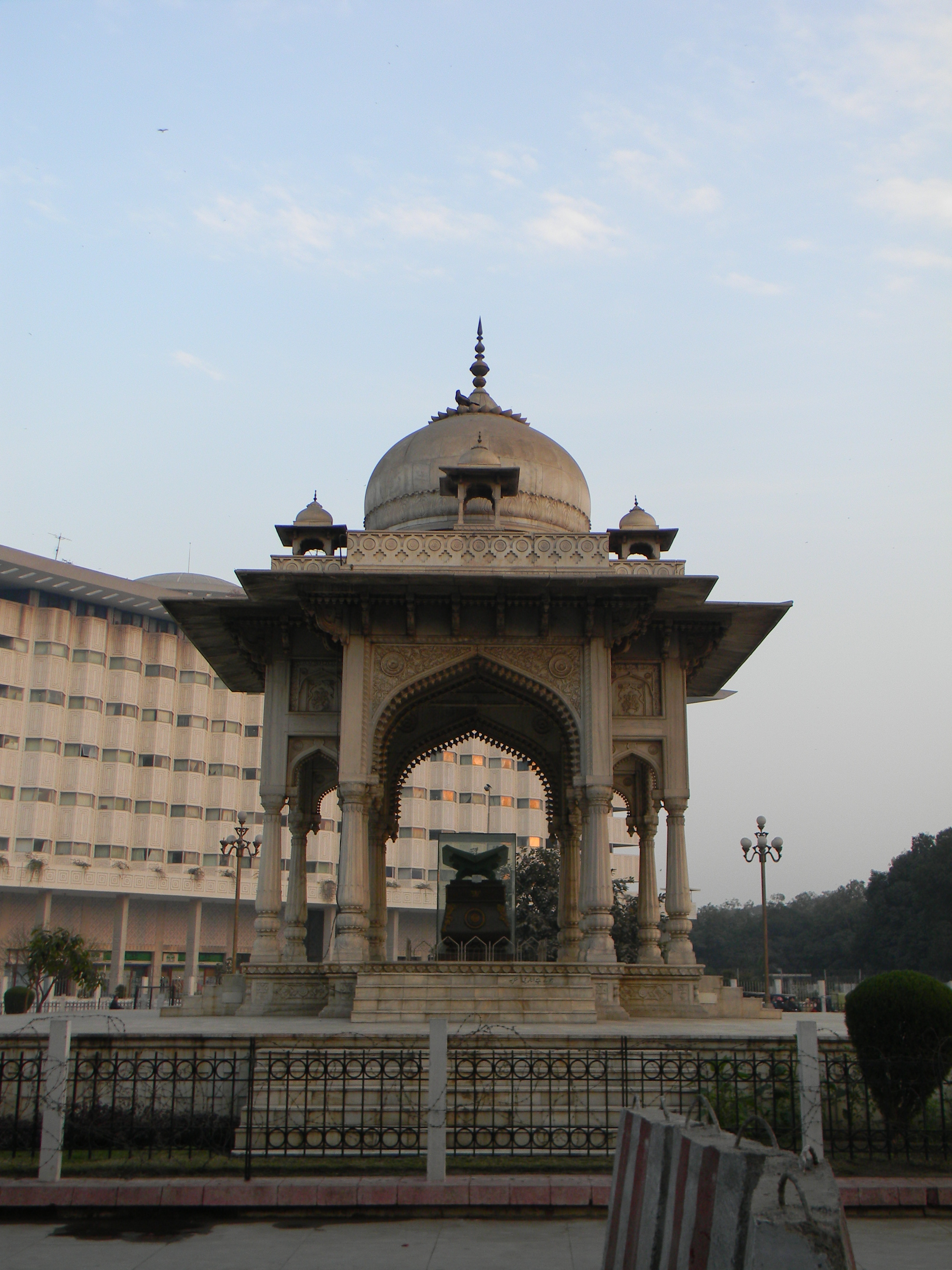
Charing Cross, renamed Faisal Square ("Faisal Chowk" in Urdu and Punjabi), and now officially renamed as Shahrah-e-Quaid-e-Azam to honour the founder of the nation of Pakistan, is a neighbourhood of Lahore, Pakistan, located on Mall Road. Laid out during the British period, it is named for Charing Cross in London.[1][2]
Until 1951 a marble pavilion at Charing Cross displayed a bronze statue of Queen Victoria, but now the statue's place in the pavilion is occupied by a bronze replica of the Quran.[3]
Contents
Etymology
Although it has been thought that the term Charing derived from the French term chere reine (dear Queen), it is more likely to stem from the Old English, cearring, meaning a bend in the river (In London, at the site of the village of Charing, coming from Westminster, the Thames makes a dramatic 90-degree turn to the east).[4]
History of name
The area was earlier known as Donald Town, which was named after Donald McLeod, who was later to become the lieutenant governor of the Punjab (1865-70), and after whom, people even today, call McLeod Road. He was earlier the president of the Lahore Improvement Committee, which then became the Lahore Improvement Trust, later to be renamed the Lahore Development Authority. However, the term "Charing Cross" was first used in the context of Lahore, in 1908 in a publication by G.R. Elmslie titled “Thirty Five Years in the Punjab” (1908, Edinburgh). A 1918-19 ‘B&R Report’ refers to it as the ‘Charing Cross Scheme’.
References
- ^ N. Naz and Z. Ashraf, Transformation of Urban Open Spaces of Lahore: From Charing Cross to Faisal Square, Pak. J. Engg. & Appl. Sci. Vol. 2, Jan 2008, pp. 65-78
- ^ Jan Morris and Simon Winchester (2005). Stones of Empire: The Buildings of the Raj. Oxford University Press. pp. 203–205. ISBN 978-0192805966. http://books.google.com/books?id=8zD1Ugfq9KwC&pg=PA203.
- ^ Mariam Qureshi, Now you see them, now you don’t, Daily Times (Pakistan), Friday, August 6, 2004
- ^ [http://www.uet.edu.pk/export/sites/UETWebPortal/research/researchinfo/journal/volume2/9.pdf Transformation of Urban Open Spaces of Lahore: From Charing Cross to Faisal Square]
Lahore topics History Origins • Etymology • Hindu rule • Muhammadan period • Mughal rule • Sikh rule • British rule • Lahore Resolution • 1965 War • Lahore DeclarationGeography Economy Stock market • Water supply and sanitation • Transport • Health care • Education • Tallest buildings • Sister citiesCulture Architecture • Cinema • Cuisine • Festivals • Language • Music • People • Religion • Shopping • SportsPlaces Category • Commons External links
- Majid Sheikh, Walking to Charing Cross, Dawn.com
Coordinates: 31°33′32″N 74°19′26″E / 31.559°N 74.324°E
Lahore topics History Origins • Etymology • Hindu rule • Muhammadan period • Mughal rule • Sikh rule • British rule • Lahore Resolution • 1965 War • Lahore DeclarationGeography Economy Stock market • Water supply and sanitation • Transport • Health care • Education • Tallest buildings • Sister citiesCulture Architecture • Cinema • Cuisine • Festivals • Language • Music • People • Religion • Shopping • SportsPlaces Category • Commons Categories:- Neighbourhoods of Lahore
Wikimedia Foundation. 2010.