- Chapman Peak
-
Chapman Peak 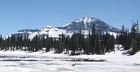
Chapman Peak from Summit Lake (Alberta)Elevation 9,406 ft (2,867 m) [1] Prominence 2,206 ft (672 m) [1] Location Location Flathead County, Montana, Glacier County, Montana, USA Range Livingston Range Coordinates 48°57′47″N 114°01′26″W / 48.96306°N 114.02389°WCoordinates: 48°57′47″N 114°01′26″W / 48.96306°N 114.02389°W[2] Topo map USGS Mount Carter, MT Chapman Peak (9,406 feet (2,867 m)) is located in the Livingston Range, Glacier National Park in the U.S. state of Montana. Chapman Peak is situated along the Continental Divide.[3]
See also
Cited references
- ^ a b "Chapman Peak, Montana". Peakbagger.com. http://www.peakbagger.com/peak.aspx?pid=4722. Retrieved 2010-08-07.
- ^ "Chapman Peak". Geographic Names Information System, U.S. Geological Survey. http://geonames.usgs.gov/pls/gnispublic/f?p=gnispq:3:::NO::P3_FID:769758. Retrieved 2010-08-07.
- ^ "Chapman Peak, Montana" (Map). TopoQuest (USGS Quad). http://www.topoquest.com/place-detail.php?id=769758. Retrieved 2010-08-07.
Categories:- Mountains of Flathead County, Montana
- Mountains of Glacier County, Montana
- Mountains of Glacier National Park (U.S.)
- Montana geography stubs

Wikimedia Foundation. 2010.