- Livingston Range
Geobox|Range
name=Livingston Range
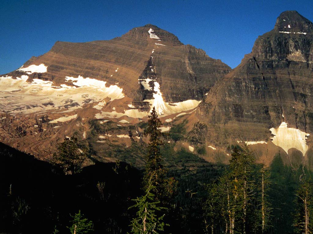
image_caption=Kintla Peak
country=United States| country1=Canada
region=Montana| region1=British Columbia
parent=Rocky Mountains
geology= | orogeny=Lewis Overthrust | border=
length_imperial=36| length_orientation=
width_imperial= 28| width_orientation=
highest=Kintla Peak
highest_elevation_imperial=10101
highest_lat_d=48|highest_lat_m=56|highest_lat_s=38|highest_lat_NS=N
highest_long_d=114|highest_long_m=10|highest_long_s=16|highest_long_EW=W
map_caption=The Livingston Range is amountain range located primarily in Glacier National Park in theU.S. state ofMontana , and in the extreme southeastern section of the Canadian province ofBritish Columbia . The range is mi to km|36 long and mi to km|28 wide. Over 15 summits exceed convert|9000|ft|m|-2|abbr=on above sea level, and the highest point isKintla Peak at convert|10101|ft|m|0. (While these elevations are not particularly high forNorth America n mountains, they are high compared to the roughly 4,000 foot (1,200 m) elevation of the nearby valleys, making for particularly dramatic peaks.)The Livingston Range was initially uplifted beginning 170 million years ago when the
Lewis Overthrust fault pushed an enormous slap ofprecambrian rocks convert|3|mi|km|1|abbr=on thick, mi to km|50 wide and mi to km|160 long over newer rocks of thecretaceous period.External links
*
*
Wikimedia Foundation. 2010.