- Chakari, Afghanistan
-
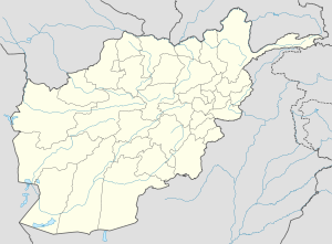
Chakari Location in Afghanistan Coordinates: 34°20′6″N 69°26′24″E / 34.335°N 69.44°ECoordinates: 34°20′6″N 69°26′24″E / 34.335°N 69.44°E Country  Afghanistan
Province Kabul Province District Khaki Jabbar District Elevation 7,730 ft (2,356 m) Time zone UTC+4:30 Chakari (Cakaray, Chakaray) was a village in Khaki Jabbar District, Kabul Province, Afghanistan. In the 1990s during the Afghan Civil War large portions of it were destroyed, and many people left.[1] As of 2002 many of the former inhabitants had not returned.[1]
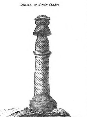
A Buddhist pillar, known as the "Minaret of Chakari" was located there,[2][3] and appears to have given the village its name.[4] The pillar was heavily damaged during the Afghan Civil War, and collapsed in March 1998.[5]
Notes
- ^ a b "Region District Profile:Khak-e-Jabbar" UNHCR Sub-Office Central, 31 July 2002
- ^ "Minaret of Chakari" Programme Management Information System Office of the UN Coordinator for Afghanistan, via Food and Agriculture Organization of the United Nations (FAO), with photograph
- ^ Ball, W.; McNicoll, A. W.; Rao, G. K. (1990) "The Minar-i Chakari: report on the Society's preservation work" South Asian Studies (London) 6: pp. 229-239
- ^ Dorneich, Christof M. (1999) Minar-i Chakari: Afghanistan's lost and unsolved architectural riddle of great antiquity (Spach library series #3) Society for the Preservation of Afghanistan's Cultural Heritage, Pestawar, Pakistan, page 12, OCLC 247507395, a translation of Dorneich, Christof M. (1968) Minar-i Tschakari : illustrierte Studie zur Geschichte und Kunstgeschichte der beiden buddhistischen Säulen bei Kabul University of Stuttgart, Stuttgart, Germany
- ^ Hunt, Luke (2 September 1999) "Afghan relics turn to dust amid war and neglect" Agence France Presse, via Lexis/Nexis subscription service
External links
- "Chakari, Afghanistan" Falling Rain Genomics, Inc.
- "Chakari Map — Satellite Images of Chakari" Maplandia
Categories:- Populated places in Kabul Province
Wikimedia Foundation. 2010.


