- Cerro Chato
-
Not to be confused with Cerro Chato, Paysandú.
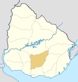
Cerro Chato — Town — 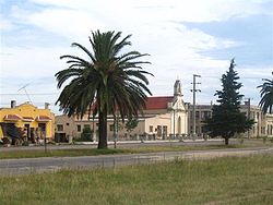 Location in Uruguay
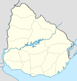
 Cerro Chato
Coordinates: 33°6′0″S 55°8′0″W / 33.1°S 55.133333°WCoordinates: 33°6′0″S 55°8′0″W / 33.1°S 55.133333°W Country  Uruguay
Departments Durazno Department
Florida Department
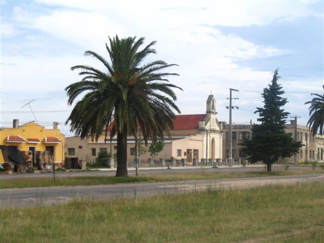
Treinta y Tres DepartmentPopulation (2004) - Total 1,099 Time zone UTC -3 Postal code 30204 Area code(s) +598 4466 3 ISO codes: UY-DU, UY-FD, UY-TT Cerro Chato (Spanish pronunciation: [ˈsero ˈtʃato], Plain Hill) is a town of central Uruguay, which is divided in three parts belonging to Durazno Department, Florida Department and Treinta y Tres Department respectively. It lies along Route 7, northeast by road from Valentines and southwest of Santa Clara de Olimar. Its status was elevated to "Villa" on 17 November 1964 by decree Ley No. 13.299.[1]
Contents
History
The Plebiscite of Cerro Chato of 1927
In 1927, a plebiscite took place in Cerro Chato to decide to which department it would belong: Durazno, Florida or Treinta y Tres. For this referendum, the women of the town were called to vote. That was the first time in Latin America that women exercised the right to vote.[2]
The Department of Durazno won the plebiscite, but this result was not accepted by the authorities. Therefore, Cerro Chato still belongs to the three departments.
Population
According to the 2004 census it had a total population of 3,278, of these 1,661 in Trenta y Tres[3], 1,099 in Durazno[4] and 518 in Florida.[5]
Year Population 1963 2,513 1975 2,582 1985 2,459 1996 2,945 2004 3,278 Source: Instituto Nacional de Estadística de Uruguay[6]
References
- ^ "LEY N° 13.299". República Oriental del Uruguay, Poder Legislativo. 1964. http://www.parlamento.gub.uy/leyes/AccesoTextoLey.asp?Ley=13299&Anchor=. Retrieved 27 June 2011.
- ^ "El voto femenino cumple ochenta años en Uruguay". El País. 2007. http://www.larepublica.com.uy/comunidad/263868-el-voto-femenino-cumple-ochenta-anos-en-uruguay. Retrieved 06 July 2011.
- ^ "2004 Census ofTrenta y Tres department" (XLS). INE. 2004. http://www.ine.gub.uy/fase1new/TreintayTres/Cuadro7_19.XLS. Retrieved 27 June 2011.
- ^ "2004 Census of Durazno department" (XLS). INE. 2004. http://www.ine.gub.uy/fase1new/Durazno/Cuadro7_06.XLS. Retrieved 27 June 2011.
- ^ "2004 Census of Florida department" (XLS). INE. 2004. http://www.ine.gub.uy/fase1new/Florida/Cuadro7_08.XLS. Retrieved 27 June 2011.
- ^ "1963–1996 Statistics / C" (DOC). Instituto Nacional de Estadística de Uruguay. 2004. http://www.ine.gub.uy/biblioteca/toponimico/TOPOletraC.doc. Retrieved 27 June 2011.
External links
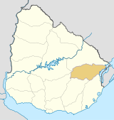
 Treinta y Tres Department of Uruguay
Capital: Treinta y Tres Towns and
villagesArrozal Treinta y Tres • Cerro Chato • Ejido de Treinta y Tres • Estación Rincón • General Enrique Martinez (La Charqueada) • Santa Clara de Olimar • Treinta y Tres • Vergara • Villa Sara
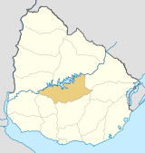
Sights  Durazno Department of Uruguay
Capital: Durazno Towns and
villagesBlanquillo • Carlos Reyles • Carmen • Centenario • Cerro Chato • Durazno • La Paloma • San Jorge • Santa Bernardina • Sarandí del Yí
Sights  Florida Department of Uruguay
Capital: Florida Towns and
villagesCapilla del Sauce • Cardal • Casupá • Cerro Chato • Cerro Colorado • Chamizo • Florida • Fray Marcos • La Cruz • Mendoza • Mendoza Chico • Nico Pérez • Sarandí Grande • Veinticinco de Agosto • Veinticinco de Mayo
Sights Categories:- Uruguay geography stubs
- Populated places in the Treinta y Tres Department
- Populated places in the Durazno Department
- Populated places in the Florida Department


Wikimedia Foundation. 2010.