- Monte Fitz Roy
-
Monte Fitz Roy 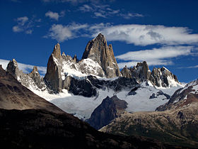
Monte Fitz Roy in 2006 with unusually good weatherElevation 3,359 m (11,020 ft) Prominence 1,951 m (6,401 ft) Listing Ultra Location 
 Monte Fitz Roy
Patagonia
 Argentina/
 Chile border
Range Andes Coordinates 49°16′16.6″S 73°02′35.6″W / 49.271278°S 73.043222°WCoordinates: 49°16′16.6″S 73°02′35.6″W / 49.271278°S 73.043222°W Geology Type Granite Climbing First ascent 1952 by Lionel Terray & Guido Magnone Easiest route Franco Argentina (650m., 6a+, 6c/A1) Monte Fitz Roy (also known as Cerro Chaltén, Cerro Fitz Roy, or simply Mount Fitz Roy) is a mountain located near El Chaltén village, in the Southern Patagonian Ice Field in Patagonia, on the border between Argentina and Chile. First climbed in 1952 by French alpinists Lionel Terray and Guido Magnone, it remains among the most technically challenging mountains on Earth for mountaineers. Monte Fitz Roy is the basis for the Patagonia clothing logo following Yvon Chouinard's ascent and subsequent film in 1968.
Contents
Discovery and naming
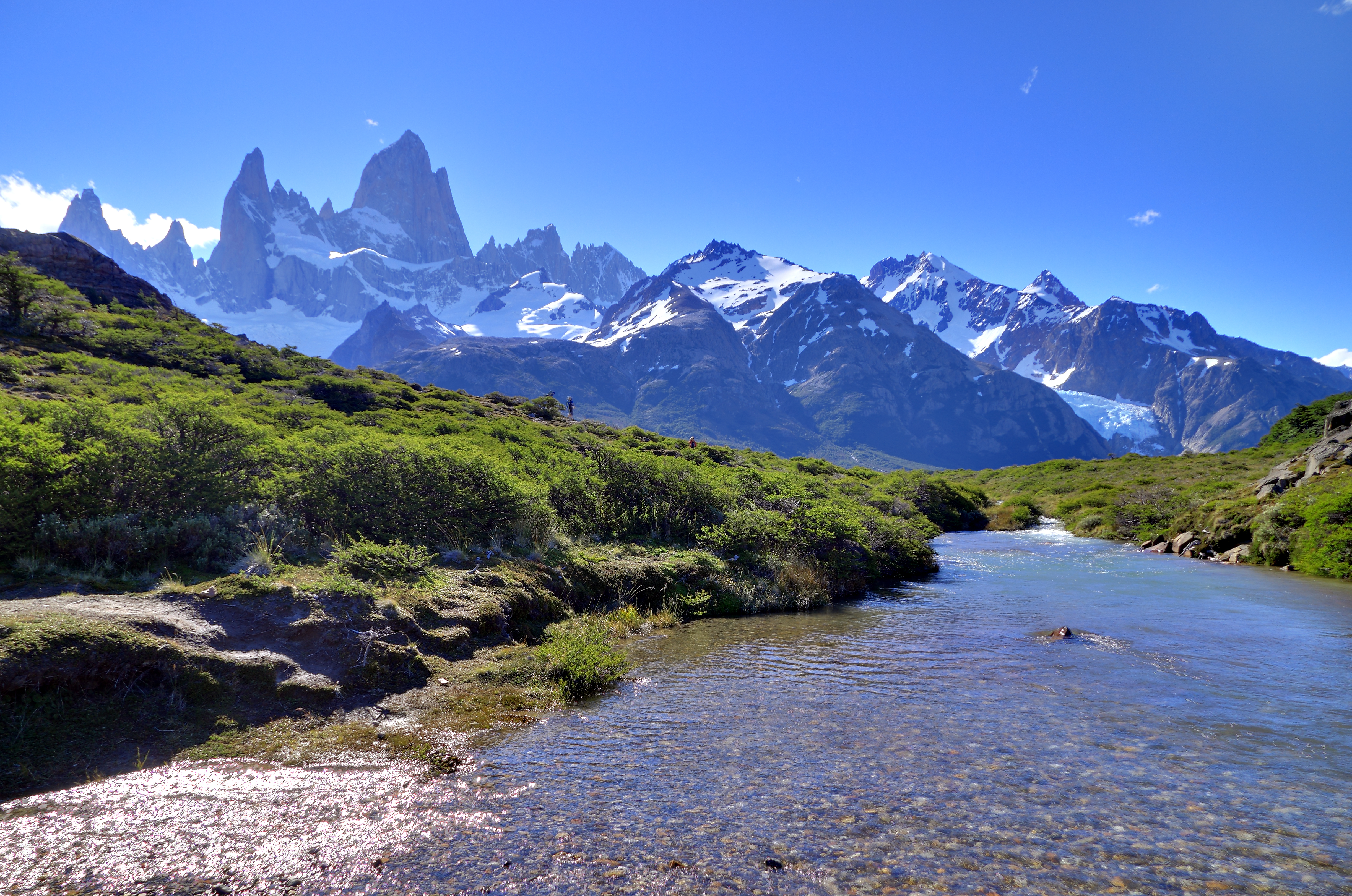
 Typical vegetation around Monte Fitz Roy
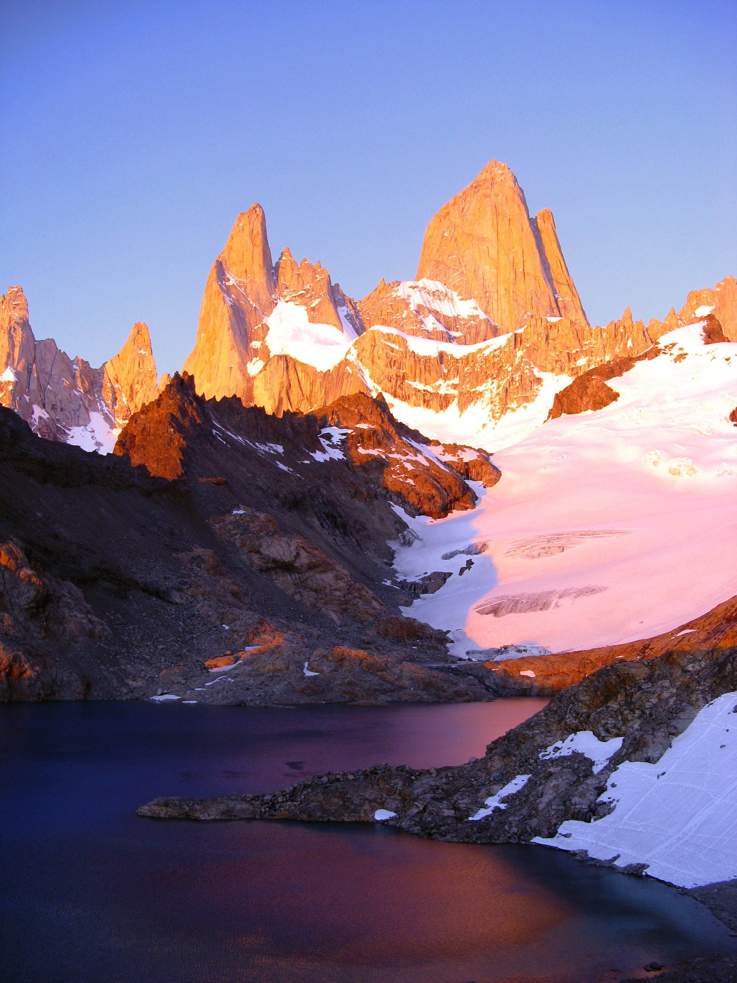
 Monte Fitz Roy at sunset
Francisco Moreno first saw the mountain on 2 March 1877. He named it Fitz Roy, in honour of Robert FitzRoy, who, as captain of the HMS Beagle had travelled up the Santa Cruz River in 1834 and charted large parts of the Patagonian coast.[1]
Cerro is a Spanish word meaning hill, while Chaltén comes from a Tehuelche (Aonikenk) word meaning "smoking mountain", due to a cloud that usually forms around the mountain's peak. Fitz Roy, however, was only one of a number of peaks the Tehuelche called Chaltén.[1]
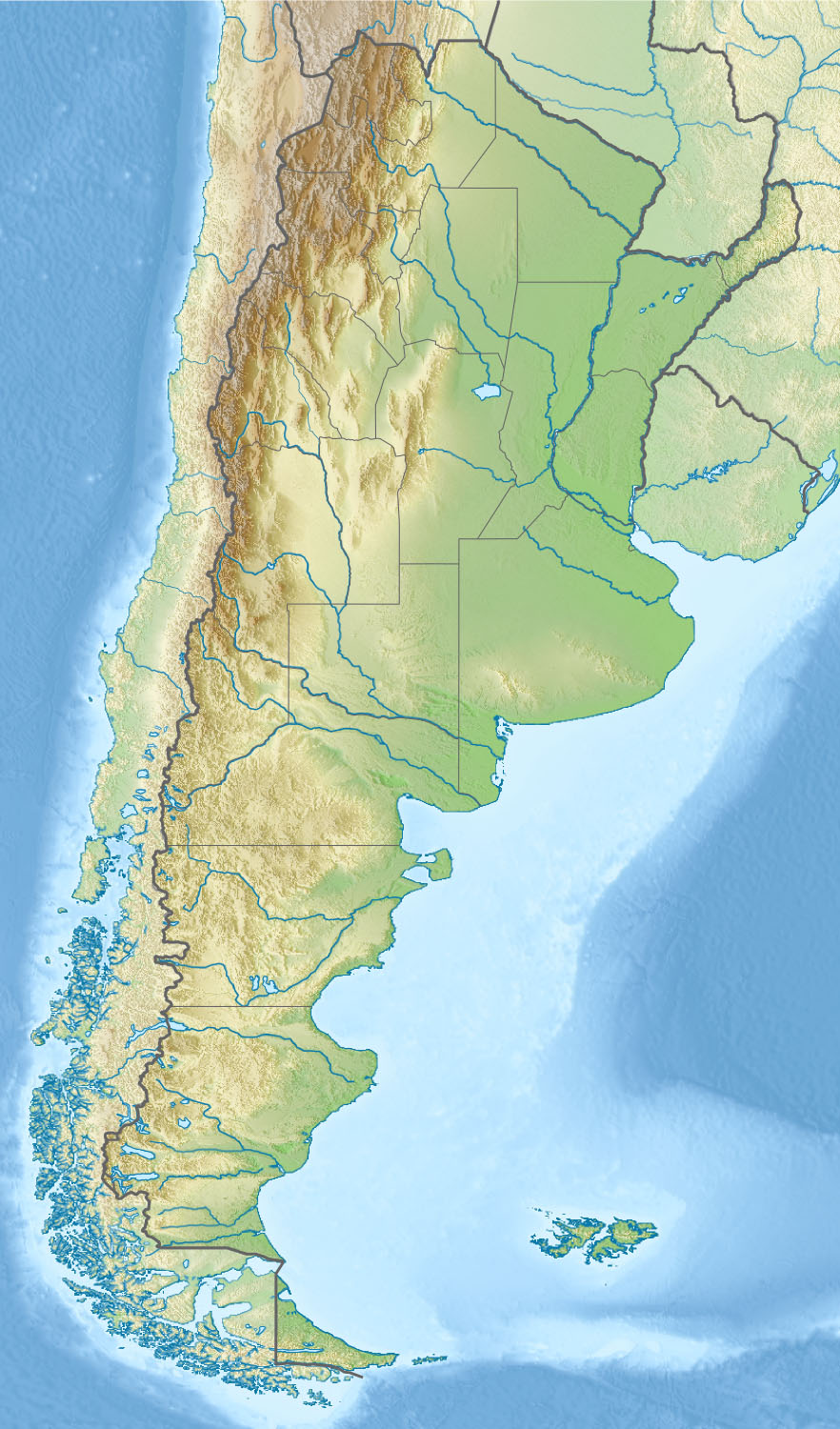
Geographical setting
 Panorama of Monte Fitz Roy in the morning
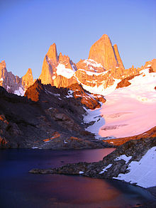 Monte Fitz Roy at sunrise
It has been agreed by Argentina and Chile that their international border detours eastwards to pass over the main summit,[2] but a large part of the border to the south of the summit, as far as Cerro Murallón, remains undefined.[3] The mountain is the symbol of the Argentine Santa Cruz Province, which includes its representation on its coat of arms.
Notable ascents
- 1952 Lionel Terray and Guido Magnone via Southeast Ridge (aka Franco-Argentine Ridge)(First Ascent - Feb 2, 1952)[4]
- 1965 Carlos Comesaña and José Luis Fonrouge (from Argentina) via Supercanaleta (1,600m, TD+ 5.10 90deg) in 2-1/2 days (Second Ascent)[5]
- 1968 Southwest Ridge aka The Californian Route (3rd ascent of peak). FA by Yvon Chouinard, Dick Dorworth, Chris Jones, Lito Tejada-Flores and Douglas Tompkins (all USA).[6]
- 2002 Dean Potter, solo Supercanaleta[5]
- 2009 Colin Haley, solo Supercanaleta[5]
The mountain has a reputation of being "ultimate", despite its average height (although being the highest peak in the Los Glaciares park, it is less than half the size of the Himalayan giants), because the sheer granite faces present long stretches of arduous technical climbing. In addition, the weather in the area is exceptionally inclement and treacherous. It also attracts many photographers thanks to its otherworldly shape. The area, while still fairly inaccessible, was even more isolated until the recent development of El Chaltén village and El Calafate international airport. The mountain climb, however, remains extremely difficult and is the preserve of very experienced climbers. Today, when a hundred people may summit Mount Everest in a single day,[7] Monte Fitz Roy may only be successfully ascended once a year.
See also
References
- ^ a b Moreno, FP (2006) [1879] (in Spanish). Viaje a la Patagonia Austral. La Nacion (Elefante Blanco). p. 2. ISBN 9879605470. "Como este volcan activo no ha sido mencionado por los navegantes ni viajeros, y como el nombre de Chalten que le dan los indios lo aplican tambien a otras montanas, me permito llamarle volcan Fitz Roy - English: Since this active volcano has not been mentioned by navigators or travellers, and since the name Chalten that the Indians call it is also applied to other mountains, I allow myself to name it Fitz Roy volcano"
- ^ "Border agreement between Chile and Argentina". 1998. Archived from the original on 2007-01-17. http://web.archive.org/web/20070117021516/http://www.difrol.cl/acuerdo_de_hielos.htm. Retrieved 2006-08-07.
- ^ "Map showing border between Chile and Argentina (partly undefined)". http://www.turistel.cl/v2/secciones/mapas/informacion/ruteros/aisen.htm. Retrieved 2006-08-07.
- ^ Silleck, H (2007-02-03). "Patagonia: Fitzroy". Summitpost.org. Summitpost.org. http://www.summitpost.org/mountain/rock/153622/fitzroy.html. Retrieved 2009-02-02.
- ^ a b c MacDonald, D (2009-01-15). "Haley Solos Fitz Roy's Supercanaleta". Climbing Hot Flashes. Climbing Magazine. http://www.climbing.com/news/hotflashes/haley_solos_fitz_roys_supercanaleta/. Retrieved 2009-02-02.
- ^ Thompkins, D; Carter, HA (1969). "Fitz Roy, 1968". American Alpine Journal 1969 16 (43): 263–9.
- ^ Jurgalski, E (2009-06-15). "Everest Ascents to 2008". 8000ers.com. http://www.8000ers.com/cms/everest-general-info-185.html. Retrieved 2009-11-06. "108 summits on 22 May 2008, 101 summits on 21 May 2007, 112 summits on 16 May 2007, 116 summits on 22 May 2003"
Further reading
- Kearney A, 1993. Mountaineering in Patagonia. Seattle, Washington: Cloudcap.
- Terray L, Conquistadors of the Useless, p.307-8, Victor Gollancz Ltd., 1963. ISBN 0-89886-778-9
External links
- Fitz Roy at Peakware
- (Spanish) Monte Fitz Roy in History
- (Spanish) News El Chaltén
Categories:- Mountains of Argentina
- Mountains of Chile
- Geography of Santa Cruz Province
- Última Esperanza Province
- Geography of Magellan and Chilean Antarctica Region
- Argentina–Chile border
- International mountains of South America


Wikimedia Foundation. 2010.