- Chengmai County
-
Chengmai County
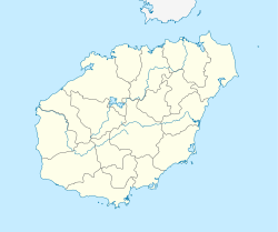
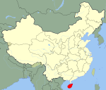
澄迈县— County-level city — Location in Hainan Location in China Coordinates: 19°45′7″N 110°0′57″E / 19.75194°N 110.01583°E Country China Province Hainan Area - Total 798.3 sq mi (2,067.6 km2) Population (2002) - Total 490,800 - Density 614.8/sq mi (237.4/km2) Time zone China standard time (UTC+8) Chengmai County (Chinese: 澄迈县; pinyin: Chéngmài Xiàn) is an administrative district in Hainan, the People's Republic of China. It is one of 4 counties of Hainan. Its postal code is 571900. In 2002, its population was 490,800.[1]
Contents
History
The first record of Chengmai County is in 110 BC, when it referred to as Guo County in one of Emperor Wu of Han's records. The county acquired its current name under the Sui Dynasty reorganisation of 607. It was also recorded during the Ming Dynasty.
Geography
Located in northwest Hainan, it is 56 km wide (east to west) and 70 km long (north to south). It has a total land area of 2067.6 km². Climate-wise, it is tropical with ample sunshine and moderate rainfall all year round; on average, the county receives 2060.5 hours of sunshine and 1756 mm of rain each year. The average annual temperature is 23.7 °C.[2]
With a total land area of 206,700 hectares, melons and other tropical crops are grown around the county.
More than 20 rivers flow through the county, providing 17.4 billion m³ of water per year.
Economy
The main industry is mining, with more than ten resources available within the county including quartz, stone, limestone, crystals, gold, silver, peat, zinc, aluminium, iron ore, kaolin, and manganese. Over 5 billion tonnes of quartz are still unmined in the county, with an average grade of 99.5% silicon. There are also nearly 11 million tonnes of limestone remaining in addition to crystal deposits 5.5 km long and 3 km wide and around 80,000,000 tonnes of kaolin.
Fishing also makes up a large part, with the county possessing 89.8 km of coastline. Mackerel, redfish, croaker fish, grouper, pomfret, tuna, squid, cuttlefish, lobster and shrimp all are fished in the harbour at Tu Beach. The diverse and populous fish are a result of a nutrient-rich sediment at the bottom of the harbour.
Demographics
The Han people account for 99.5% of the population of the county.
See also
Notes
- ^ "Chengmai County official website". Chengmai County People's Government. 2002. http://www.chengmai.hainan.gov.cn. Retrieved 2008-10-14.
- ^ "Chengmai County official website". Chengmai County People's Government. 2001. http://www.chengmai.hainan.gov.cn. Retrieved 2008-10-14.
References
External links
Hainan topics Haikou (capital) General Geography Dazhou Island • Haidian Island • Haitang Bay • Sanya Bay • Nandu River • Wanquan River • Songtao Reservoir • Wuzhizhou Island • Wuzhi Mountain • Yangpu Peninsula • Yongxing Island
Flora and fauna Hainan Yellow Lantern Chili • Hainan Gymnure • Hainan Partridge • Hainan Peacock-pheasant • Hainan black crested gibbon • Hainan HareMedia Transportation Hainan Eastern Ring Railway • Hainan Airlines • Haikou Meilan International Airport • Sanya Phoenix International Airport • Basuo Port • Haikou New Port • Haikou Xiuying Port • Macun PortEducation Hainan University • Hainan Medical College • Hainan Normal University • Qiongzhou UniversityDemographics Buildings and structures Cuisine Hainan chicken rice • Wenchang ChickenVisitor attractions Five Officials Temple • Statue of Guanyin • Leiqiong Global Geopark • Luobi Cave • Mission Hills Star Trophy • Monkey Island • Nanshan Temple • Phoenix Island • Temple of Five Lords • Tianya Haijiao • Yangpu Ancient Salt FieldPrefecture level (no intermediate County-level divisions, see Administration of Sanya)County level CountiesAdministration OfficeAdministration Office for Xisha Islands, Zhongsha Islands and Nansha IslandsSee also: Politics of Hainan Categories:- County-level divisions of Hainan
Wikimedia Foundation. 2010.


