- Mbarara
-
Mbarara
Land of Milk. Location in Uganda
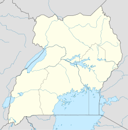
 Mbarara
Coordinates: 00°36′48″S 30°39′30″E / 0.61333°S 30.65833°E Country  Uganda
Region Western Uganda District Mbarara District Government - Mayor Population (2011 Estimate) - Total 83,700 Time zone +3 (East African Standard Time) Mbarara is a town in Western Uganda. It is the main municipal, administrative and commercial center of Mbarara District and the location of the district headquarters. It is also the largest urban centre in Western Uganda.
Contents
Location
Mbarara is located about 290 kilometres (180 mi), by road, southwest of Kampala, Uganda's capital and largest city.[1] Mbarara is an important transport hub, lying west of Masaka on the road to Kabale, near Lake Mburo National Park. The coordinates of Mbarara city center are:00 36 48S, 30 39 30E (Latitude:-0.6132; Longitude:30.6582).
Overview
The name 'Mbarara' has its roots in the English Colonialist's mispronunciation of the word 'Mburara'a certain type of grass; a favorite for the cows. Mbarara was formerly the capital for the southern region.
Mbarara is mainly divided in three divisions which are Kamukuzi, Nyamitanga and Kakoba. It is further sub-divided into six sub-divisions including Ruharo, Nyamitanga, Nyamityobora, Kamukuzi, Kakoba and Lutti.
Mbarara has a number of streets which include Mbarara High Street (named after one of the town's most prominent secondary schools, Mbaguta Street (named after a former prime minister of Ankole), Bishop Willis Street (named after Bishop Willis, one of the first whites to visit Ankole and Mbarara), Garage Street, Markhan Singh Street, Bulemba Road and Bucuku Street.
Human activity
The city of Mbarara has the largest number of of milk processing plants in Uganda. The majority of milk processed is transported to Kampala and other major cities in Uganda.
Mbarara is the home of Mbarara University of Science & Technology (MUST), founded in 1989. There were many educational institutions well before then, including Bishop Stewart Teacher Training College now known as Bishop Stuart University which is located on Kakoba Hill, southeast of downtown. Other institutions of learning in the town include Maryhill High School, an all-girl school. Mbarara High School (MHS) and Ntare School are both all-boys schools. Built during the colonial days, these three schools were state boarding schools whose graduates go on to make major contributions to today's Uganda. Alumni of these schools include President Museveni (Ntare), Mzee Boniface Byanyima (MHS), Sam Kutesa, Minister of Foreign Affairs (MHS), and the academic Sam Nahamya PhD (MHS). Winnie Byanyima, the current Director of Gender Issues at the UNDP headquarters in New York City is a native of Mbarara. She had her early education in area schools. She represented the town in the Ugandan Parliament from 1994 until 2004.
Population
In 2002, the national census estimated the population at 69,363. The Uganda Bureau of Statistics (UBOS), estimated the population of Mbarara at 82,000 in 2010. In 2011, UBOS estimated the mid-year population of the town at 83,700.[2]
Landmarks
The landmarks within the city limits or close to its edges include:
- The headquarters of Mbarara District Administration
- The offices of Mbarara Municipal Council
- Mbarara Central Market
- The headquarters of the 2nd Division of the Uganda People's Defense Force
- Mbarara National Referral Hospital - A 600 bed public hospital, administered by the Uganda Ministry of Health
- Mbarara Community Hospital - A private hospital that serves the community without regard to ability to pay.[3]
- Mayanja Memorial Hospital - A private 100-bed hospital[4]
- Holy Innocents Children's Hospital (HICH) - A private 100 bed general pediatric hospital, administered by the Roman Catholic Archdiocese of Mbarara
- Mbarara University of Science and Technology (MUST) - One of the five (5) public universities in Uganda
- Uganda Bible Institute.[5]
- Uganda Martyrs Primary School
- The Mbarara Campus of Uganda Martyrs University.
- The Western Campus of Uganda Management Institute.[6]
- Bishop Stuart University - A private Christian University, affiliated with the Church of Uganda
- Mbarara Airport - A public airport, located about 10 kilometres (6.2 mi), by road northwest of town
- A branch of Bank of Africa
- A branch of Bank of Baroda
- A branch of Barclays Bank
- A branch of Centenary Bank
- A branch of Crane Bank
- A branch of DFCU Bank
- A branch of Equity Bank
- A branch of Fina Bank
- A branch of Housing Finance Bank
- A branch of Kenya Commercial Bank
- A branch of PostBank Uganda
- A branch of Stanbic Bank
- A branch of Standard Chartered Bank
- A branch of United Bank for Africa
- A branch of Opportunity Uganda Limited, a Tier II Financial Institution
- A branch of Pride Microfinance Limited, a Tier III Financial Institution
- A branch of Uganda Finance Trust Limited, a Tier III Financial Institution
- A branch of the National Social Security Fund
External links
Photos
See also
- Mbarara District
- Ankole sub-region
- Western Region, Uganda
References
 Mbarara District
Capital: Mbarara Counties and
sub-countiesKashari · Bubaare · Bukiro · Kagongi · Kakiika · Kashare · Rubaya · Rubindi · Rwanyamahembe · Biharwe · Mbarara Municipality · Nyakayojo · Rugando · Kakoba · Kamukuzi · Nyamitanga · Rwampara · Bugamba · Mwizi · Ndaija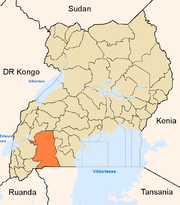
Towns and villages Mbarara · KakobaEconomy Bank of Africa · Bank of Baroda · Barclays Bank · Centenary Bank · Crane Bank · DFCU Bank · Equity Bank · Fina Bank · Housing Finance Bank · Kenya Commercial Bank · PostBank Uganda · Stanbic Bank · Standard Chartered Bank · United Bank for Africa · Pride Microfinance Limited · Uganda Finance Trust Limited · Opportunity Uganda LimitedNotable landmarks Mbarara Airport · Mbarara National Referral Hospital · Holy Innocents Children's Hospital · Mayanja Memorial Hospital · Lake Mburo National Park · Mbarara-Kikagati Road · Roman Catholic Archdiocese of MbararaEducation Mbarara University of Science and Technology · Bishop Stuart University · Ntare School · Mbarara High School · Mbarara Campus of Kampala International UniversityNotable people Davis Arinaitwe · Francis K. Butagira · Mugisha Muntu · Elly Tumwine · Urban Tibamanya · Winnie ByanyimaCategories:- Mbarara
- Mbarara District
- Western Region, Uganda
- Populated places in Uganda
- Cities in the Great Rift Valley


Wikimedia Foundation. 2010.