- Momostenango
-
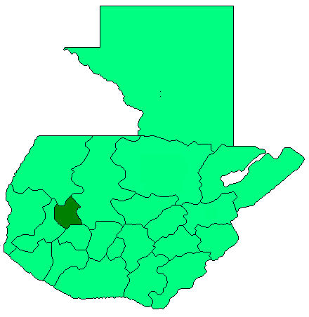
Momostenango — Municipality — Location in Guatemala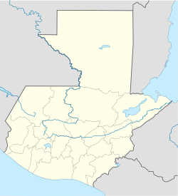
 Momostenango
Coordinates: 15°02′40″N 91°24′30″W / 15.04444°N 91.40833°WCoordinates: 15°02′40″N 91°24′30″W / 15.04444°N 91.40833°W Country  Guatemala
Department Totonicapán Municipality Momostenango Government - Type Municipal - Mayor Area - Municipality 305 km2 (117.8 sq mi) Elevation[1] 2,204 m (7,231 ft) Population (Census 2002)[2] - Municipality 87,340 - Density 286/km2 (740.7/sq mi) - Urban 27,718 - Ethnicities K'iche', Ladino - Religions Catholicism, Evangelicalism, Maya Momostenango is a municipality in the Totonicapán department of Guatemala. The municipality is situated in the North-West of Totonicapán, in the Western highlands of Guatemala.
Contents
Population
Momostenango's population is predominantly of Maya K'iche' descent. 70% of the population live in rural areas and most are small farmers growing maize and beans for their own consumption, as well as wheat.
The municipality is subdivided in the town of Momostenango, 14 villages and 169 smaller communities called caseríos or parajes.[3]
Momostenango is the birthplace of the Maya K'iche' poet Humberto Ak'ab'al (1952- ), who writes in K'iche' (Quiché) and in Spanish.
Geography
Momostenango borders to the North with the municipalities of Malacatancito (Huehuetenango, San Bartolo and Santa Lucía La Reforma, to its South with San Francisco El Alto and the municipality of Totonicapán, to the East with Santa María Chiquimula, and to the West with San Carlos Sija (Quezaltenango).
The municipality's territory of 305 km2 has a mountainous topography with elevations ranging from 1800 m in the North-East, to 3300 m (Cerro Tená) to the West. The mountains on its western border are a watershed for the Salinas and Samalá river basins. Most of the 49 waterflows are afluents of the Chixoy River in the Salinas river basin.[1]
Like most of the central highlands, the climate is relatively cold, and is marked by a rainy season starting half may, and a dry season starting in October. Yearly precipitation is around 1200 mm, except for the much dryer northern part of the municipality which receives 400–800 mm of rainfall.
References
- ^ a b "Momostenango - Estrategia para la reducción de la pobreza municipal" (PDF). SEGEPLAN. 2002. http://sinit.segeplan.gob.gt/images/Textos/RedPob/ERPM_QU_COT.pdf. Retrieved 2008.
- ^ "XI Censo Nacional de Poblacion y VI de Habitación (Censo 2002)". Instituto Nacional de Estadística (INE). 2002. http://www.ine.gob.gt/index.php?view=article&catid=42%3Ademografiaypoblacion&id=75%3Acenso2002&option=com_content&Itemid=69.
- ^ Vinicio Alonso, Mario (2007). "Municipio de Momostenango, departamento de Totonicapán: Costos y rentabilidad de unidades pecuarias (producción de huevos y galinas" (PDF). Facultad de Ciencias Económicas, USAC. http://biblioteca.usac.edu.gt/EPS/03/03_0646_v6.pdf. Retrieved 23 April 2009.
External links
Capital: Totonicapán Municipalities · Momostenango · San Andrés Xecul · San Bartolo · San Cristóbal Totonicapán · San Francisco El Alto · Santa Lucía La Reforma · Santa María Chiquimula · Totonicapán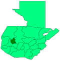 Categories:
- Municipalities of the Totonicapán Department
- Populated places in Guatemala

Wikimedia Foundation. 2010.