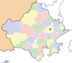
- Chhani Bari
-
Chhani Bari — village — Coordinates 29°11′0″N 75°20′0″E / 29.183333°N 75.333333°ECoordinates: 29°11′0″N 75°20′0″E / 29.183333°N 75.333333°E Country India State Rajasthan District(s) Hanumangarh Nearest city Hissar Time zone IST (UTC+05:30) Area
• Coastline
• 0 kilometres (0 mi)
Chhani Bari is a village in the Hanumangarh district in the Indian state of Rajasthan. Chhani Bari (5 Chn ) is a Village in Bhadra Mandal and a Sub Tehseel in Bhadra Tehseel , Hanumangarh District , Rajasthan State . Chhani Bari (5 Chn ) is 18.7 km distance from its Mandal Main Town Bhadra . Chhani Bari (5 Chn ) is 110.6 km distance from its District Main City Hanumangarh . And 256 km distance from its State Main City Jaipur.Commercially Hissar is the main city nearby this village. .
Bhadra , Ajeet Pura , Alayala , Bhanai , Bhangarh , Bhangwa , ... . are the villages along with this village in the same Bhadra Mandal
Near By Villages of this Village with distance are Ninan (6 Jgw )(6.3 k.m.) ,Biran (5 Ams)(7.7 k.m.) ,Jogiwala (11 Jgw )(8.9 k.m.) ,Gandhi Bari (6 Sdr )(14.5 k.m.) ,Bhojasar (1 Bhd)(14.7 k.m.) ,. Near By towns are Bhadra(18.7 k.m.) ,Nohar(55.1 k.m.) ,Rawatsar(90.6 k.m.) ,Tibbi(90.9 k.m.) , Schools near by Chhani Bari (5 Chn )
1 .GOVT HIGH SCHOOL CHHANI BARI
2 .GOVT PRIMARY SCHOOL (GYAN MANDIR SCHOOL) CHHANI BARI
3 .SARVODAYA HIGH SECONDARY SCHOOL
4 .R.N.T. PUBLIC SCHOOL
5 .MAHRISHI DAYANAND SEC.SCHOOL
6 .D.A.V.SR.SEC.SCHOOL BHADRA RAJSTHAN
7 .Nehru Modern Senior Secondary School
Colleges near by Chhani Bari (5 Chn )
1 .CHANDURAM SUTHAR MEMORIAL COLLEGE
2 .Vivekanand College Address : bhadra.
3 .Sardar Vallabh Bhai Patel Mahavidyalaya Address : bhadra.
4 .Bal Gangadhar Tilak Shiksha Sansthan College Address : bal gangadhar tilak shiksha sansthan bhadra.]]
References
http://www.onefivenine.com/india/villages/Hanumangarh/Bhadra/Chhani-Bari-_3a5-Chn-_4aCategories:- Rajasthan geography stubs
- Villages in Hanumangarh district
Wikimedia Foundation. 2010.


