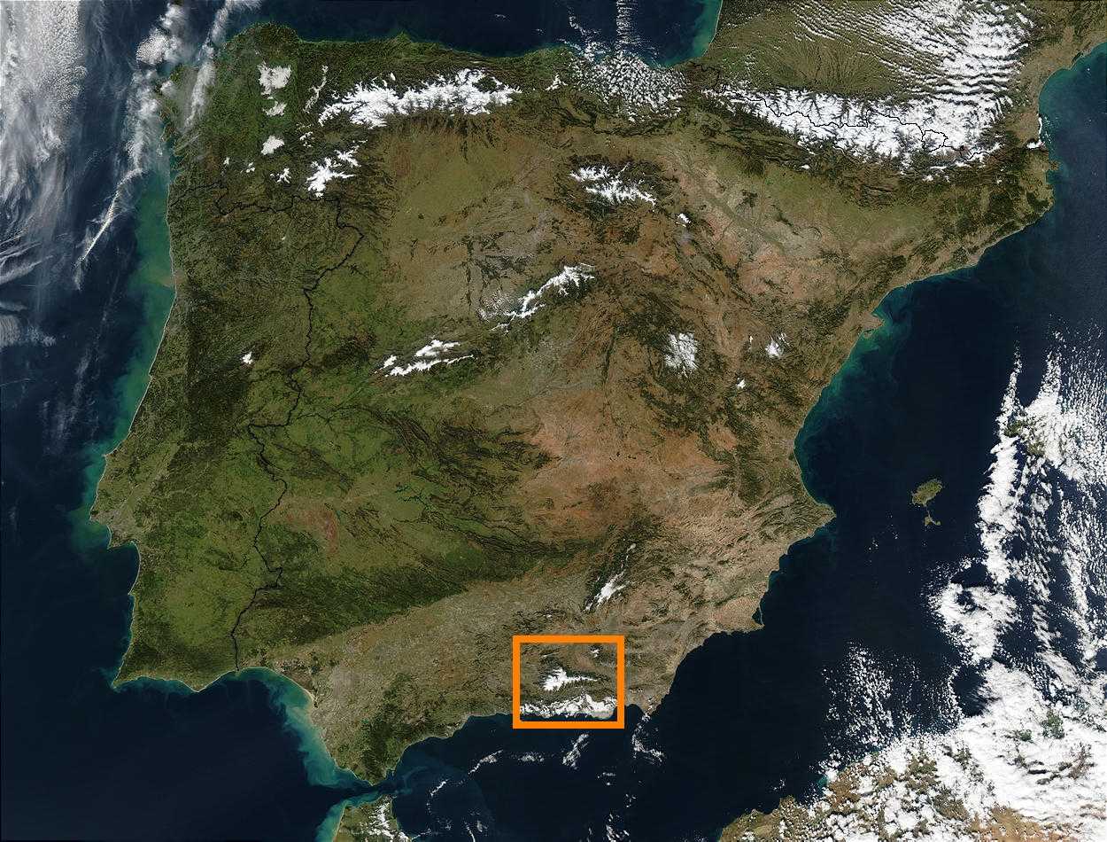
- Sierra Nevada (Spain)
Geobox|Range
name=Sierra Nevada
image_caption=Sierra Nevada general view from the West
country=Spain
region_type=Communities
region=Andalusia
unit= |border=
area= | length= | length_orientation=
width= | width_orientation=
highest=Mulhacén
highest_elevation=3478
highest_lat_d=37|highest_lat_m=03|highest_lat_s=12|highest_lat_NS=N
highest_long_d=03|highest_long_m=18|highest_long_s=41|highest_long_EW=E
geology= |period=Tertiary| orogeny=Alpine

map_caption=Situation of Sierra Nevada in the Iberian PeninsulaThe Sierra Nevada, meaning "snowy range" in Spanish, is a
mountain range in the region ofAndalusia inSpain . It contains the highest point of continental Spain,Mulhacén at convert|3479|m|ft|0.It is a popular tourist destination, as its high peaks make
skiing possible in Europe's most southernski resort in an area along theMediterranean Sea predominantly known for its warm temperatures and abundant sunshine. At its foothills is found the city ofGranada and, a little farther,Málaga andAlmería .Parts of the range have been included in the Sierra Nevada National Park. The range has also been declared a
biosphere reserve . TheSierra Nevada Observatory is located on the northern slopes at 2800 m.Formation
The Sierra Nevada were formed during the
Alpine Orogeny , a mountain-building event that also formed the EuropeanAlps to the east and theAtlas Mountains of northern Africa across the Mediterranean Sea to the south. The Sierra as observed today formed during theTertiary Period (65 to 1.8 million years ago) from the collision of the African and Eurasiancontinental plate s.Geography
Central to the mountain range is a ridge running broadly west-south-west - east-north-east. For a substantial distance, the watershed stays consistently above 3000m in altitude.
On the southern side of the range, several long but narrow river valleys lead off towards the south-west, separated by a number of subsidiary ridges.
On the steeper and craggier northern side, the valleys have less regular orientations. This side is dominated by the
Rio Genil which starts near Mulhacén and into which many of the other rivers flow.Highest peaks
*
Mulhacén
* Veleta
* Alcazabaport
*
Sierra Nevada Ski Resort See also
*
Alpujarras
*Geography of Spain External links
* [http://maps.google.com/maps?q=Granada,+Spain&ll=37.058465,-3.183975&spn=0.395104,0.726677&t=h&hl=en Google Maps Satellite Photo]
* [http://www.maps.data-spain.com/autonomous_communities/andalucia/ Maps of the Sierra Nevada]
* [http://www.nevasport.com/nevablogs/d/la-xvii-semana-deportiva-en-sierra-nevada/1402 XVII sport week -Old Pictures -]
* [http://www.cetursa.com/ Sierra Nevada Official Website (In Spanish)]
*es [http://www.juntadeandalucia.es/medioambiente/servtc5/ventana/mostrarFicha.do?idEspacio=7418 Natural Park Sierra Nevada]
* [http://www.costatropicalnews.com English language magazine for the region]References
*cite web | url=http://earthobservatory.nasa.gov/Newsroom/NewImages/images.php3?img_id=17169 | title=Sierra Nevada, Spain | publisher=
NASA Earth Observatory | accessdate=2006-04-28
* [http://www.costatropicalnews.com English language magazine for the region]Bibliography
* Francisco Pérez Raya, Joaquín Molero Mesa, Francisco Valle Tendero, 1992: "Parque Natural de Sierra Nevada. Paisaje, fauna, flora, itinerarios". Ed. Rueda. Madrid. ISBN 84-7207-067-0 (Spanish)
* "Flora de la Tundra de Sierra Nevada". Pablo Prieto Fernández, Ed. Universidad de Granada. ISBN ISBN 84-600-1810-5 (Spanish)
* "Sierra Nevada: Guía de Montaña". Aurelio del Castillo y Antonio del Castillo. Ed. Penibética, 2003. ISBN 84-932022-3-1 (Spanish)
Wikimedia Foundation. 2010.
