- Colotenango
-
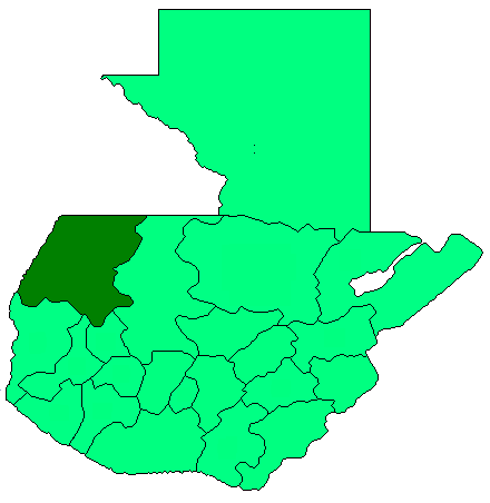
Colotenango is a municipality in the Guatemalan department of Huehuetenango. It is situated at 1,590 m (5,220 ft) above sea level. It contains 14,000 people. It covers a terrain of 71 km2 (27 sq mi). The annual festival is February 12-15.
Colotenango has two holy sites called Tuikalajan and Tuisanmarcos.
Demographics
Colotenango is traditionally a Maya community whose residents speak the Mayan Mam language.[1] Two-thirds of the residents are Catholic, while about thirty percent are Evangelica.
Aldeas
Colotenango includes the following aldeas (towns): Caniche, Colotenango (el pueblo), El Granadillo, Ical, Ixconlaj, La Barranca, La Lagunita, La Vega, Llano Grande, Los Naranjales, Luminoche, Sacuil, Siete Caminos, Tixel, Tohlac, Tuitzloch, Tuitzquian and Xemal.
External links
- in Spanish
- [2] Municipal map.
Capital: HuehuetenangoMunicipalities · Aguacatán · Chiantla · Colotenango · Concepción Huista · Cuilco · Huehuetenango · Jacaltenango · La Democracia · La Libertad · Malacatancito · Nentón · San Antonio Huista · San Gaspar Ixchil · San Ildefonso Ixtahuacán · San Juan Atitán · San Juan Ixcoy · San Mateo Ixtatán · San Miguel Acatán · San Pedro Necta · San Pedro Soloma · San Rafael La Independencia · San Rafael Petzal · San Sebastián Coatán · San Sebastián Huehuetenango · Santa Ana Huista · Santa Bárbara · Santa Cruz Barillas · Santa Eulalia · Santiago Chimaltenango · Tectitán · Todos Santos Cuchumatán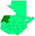 Categories:
- Guatemala geography stubs
- Municipalities of the Huehuetenango Department
- Populated places in Guatemala
Wikimedia Foundation. 2010.