- Nentón
-
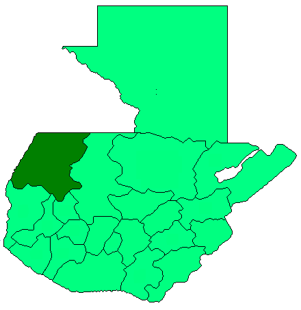
Nentón is a municipality in the Guatemalan department of Huehuetenango. Its territory extends 762.85 km2 and has 9,113 inhabitants. It became a municipality on December 5, 1876 and was formally known as San Benito Nentón.[1] It is surrounded by the following: Mexico to the north and west, San Mateo Ixtatán to the east, San Sebastián Coatán, San Miguel Acatán and Jacaltenango to the south. The population here speaks Spanish and Chuj.
The Nentón town fair is from January 12 to the 15th in honor of Santo Cristo de Esquipulas.
Archeological sites
Nentón's territory includes the following sites:
1. K'atepan (Chanhk'ejelb'e)
2. Cimarrón
3. Chaculá
4. Onh (El Aguacate)
5. Ixb'u'ul (Gracias a Dios)
6. Miramar
7. Pájaros
8. Paluwa'
9. Piedra Redonda
10. K'en Santo
11. K'ixal
12. Samran (San Francisco)
13. Tres Lagunas
14. Wajxak K'annha
15. Yalanhb'ojoch
Notes and references
- ^ Stzolalil Stz'ib' Chaj Ti' Chuj, p. 32, ALMG
Capital: HuehuetenangoMunicipalities · Aguacatán · Chiantla · Colotenango · Concepción Huista · Cuilco · Huehuetenango · Jacaltenango · La Democracia · La Libertad · Malacatancito · Nentón · San Antonio Huista · San Gaspar Ixchil · San Ildefonso Ixtahuacán · San Juan Atitán · San Juan Ixcoy · San Mateo Ixtatán · San Miguel Acatán · San Pedro Necta · San Pedro Soloma · San Rafael La Independencia · San Rafael Petzal · San Sebastián Coatán · San Sebastián Huehuetenango · Santa Ana Huista · Santa Bárbara · Santa Cruz Barillas · Santa Eulalia · Santiago Chimaltenango · Tectitán · Todos Santos Cuchumatán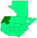
Coordinates: 15°48′N 91°45′W / 15.8°N 91.75°W
Categories:- Municipalities of the Huehuetenango Department
- Populated places in Guatemala
- Guatemala geography stubs
Wikimedia Foundation. 2010.