- Dépôt-Échouani, Quebec
-
Dépôt-Échouani — Unorganized territory — 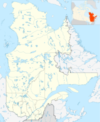
 Dépôt-Échouani
Coordinates: 47°50′N 75°35′W / 47.833°N 75.583°WCoordinates: 47°50′N 75°35′W / 47.833°N 75.583°W Country  Canada
Province  Ontario
Region Outaouais Regional county La Vallée-de-la-Gatineau Established January 1, 1986 Government – Type Unorganized territory Area[1][2] – Total 333.70 km2 (128.8 sq mi) – Land 308.24 km2 (119 sq mi) Population (2006)[2] – Total 0 – Density 0/km2 (0/sq mi) Time zone EST (UTC-5) – Summer (DST) EDT (UTC-4) Dépôt-Échouani is an unorganized territory in the Outaouais region of Quebec, Canada. It is the smallest and northern-most of the five unorganized territories in the La Vallée-de-la-Gatineau Regional County Municipality. Its territory surrounds Échouani Lake and stretches along the western banks of the upper Gatineau River.
The territory is named after the Échouani Depot, a former logging camp of the Canadian International Paper Company near the confluence of the Chouart and Gatineau Rivers, abandoned since 1962. The name is known since the nineteenth century and several variants have been used on maps and plans: Eshwaham (1873), Eskwahani (1924), Eshwahani (1926), Échouani (1933), as well as Eshawan and Askwahani (dates unknown). The exact origin and significance of this name is unknown, but one possibility is that the word comes from Echoam, a tributary of the Gatineau, and this in turn is a derivative of echohamok, which is from the Algonquin language probably meaning "to prepare to leave by water". [3]
Demographics
Population:[4]
- Population in 2006: 0
- Population in 2001: 0
- Population in 1996: 0
- Population in 1991: 0
References
- ^ Ministère des Affaires Municipales et Régions - Répertoire des municipalités: Dépôt-Échouani
- ^ a b Statistics Canada 2006 Census - Dépôt-Échouani community profile
- ^ "Lac Échouani" (in French). Commission de toponymie du Québec. http://www.toponymie.gouv.qc.ca/ct/topos/carto.asp?Speci=20311&Latitude=47,75&Longitude=-75,7&Zoom=1700. Retrieved 2008-08-26.
- ^ Statistics Canada: 1996, 2001, 2006 census

Senneterre La Tuque Lac-Moselle 
Lac-de-la-Bidière  Dépôt-Échouani

Lac-Oscar Subdivisions of La Vallée-de-la-Gatineau Regional County Municipality Cities Municipalities Aumond • Blue Sea • Bois-Franc • Bouchette • Cayamant • Déléage • Denholm • Egan-Sud • Grand-Remous • Kazabazua • Lac-Sainte-Marie • Low • Messines • Moncerf-Lytton • Sainte-Thérèse-de-la-GatineauUnorganized territories Other RCMs in Outaouais: Pontiac • Les Collines-de-l'Outaouais • Papineau • Gatineau (Independent city)Categories:- Unorganized areas in Outaouais

Wikimedia Foundation. 2010.