- Mount Erebus
-
Mt. Erebus 
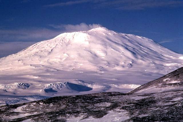
Mount Erebus, 1972Elevation 3,794 m (12,448 ft) [1] Prominence 3,794 m (12,448 ft) [1]Ranked 34th Listing Ultra Location Location of Mount Erebus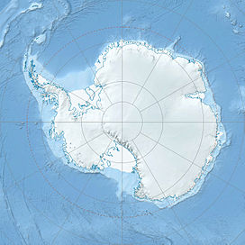
 Mount Erebus
Location Ross Island, Antarctica Coordinates 77°31′47″S 167°09′12″E / 77.52972°S 167.15333°ECoordinates: 77°31′47″S 167°09′12″E / 77.52972°S 167.15333°E[2] Topo map Ross Island C Geology Type Stratovolcano (composite cone). Age of rock About 1,000,000 years Last eruption 2011 (continuing) Climbing First ascent 1908 by Edgeworth David and party[3] Easiest route Basic snow & ice climb Mount Erebus in Antarctica is the southernmost historically active volcano on Earth, the second highest volcano in Antarctica (after Mount Sidley), and the 6th highest ultra mountain on an island.[1] With a summit elevation of 3,794 metres (12,448 ft), it is located on Ross Island, which is also home to three inactive volcanoes, notably Mount Terror. Mount Erebus is part of the Pacific Ring of Fire, which includes over 160 active volcanoes.
The volcano has been observed to be continuously active since 1972 and is the site of the Mount Erebus Volcano Observatory run by the New Mexico Institute of Mining and Technology.[4]
Contents
Discovery and naming
Mount Erebus was discovered on January 27, 1841 (and observed to be in eruption)[5] by polar explorer Sir James Clark Ross who named it Mount Erebus after his ships, Erebus and Terror (which were also used by Sir John Franklin on his disastrous Arctic expedition). Erebus was a primordial Greek god of darkness, the son of Chaos.
Climbing
Mount Erebus was first climbed (to the rim) by members of Sir Ernest Shackleton's party in 1908. Its first known solo ascent and the first winter ascent was accomplished by British mountaineer Roger Mear in March 1985, a member of Robert Swan's "In the Footsteps of Scott" expedition.[6] On January 19–20, 1991, Charles J. Blackmer, an iron-worker for many years at McMurdo Station and the South Pole, accomplished a solo ascent in approximately seventeen hours via snow mobile.[7][8]
Robotic Exploration
In 1992 the inside of the volcano was explored by Dante I, an eight legged tethered robotic explorer.[9] Dante was designed to acquire gas samples from the magma lake inside the inner crater of Mount Erebus in order to understand the chemistry better through the use of the on-board gas chromatograph as well as measuring the temperature inside the volcano and the radioactivity of the materials present in such volcanoes. Dante successfully scaled a significant portion of the crater before technical difficulties emerged with the fibre-optic cable used for communications between the walker and base station. Unfortunately, Dante I had not reached the bottom of the crater and as such the mission was cancelled with no data of volcanic significance recorded. However, the expedition proved to be highly successful in terms of robotic and computer science, and was possibly the first ever expedition by a robotic platform to Antarctica.
Geology and volcanology
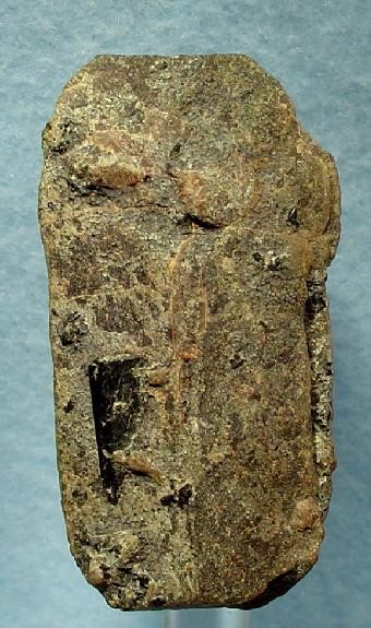
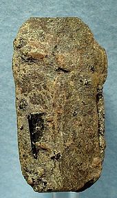 Anorthoclase crystal from Mt. Erebus. These are coveted souvenirs at McMurdo Station.
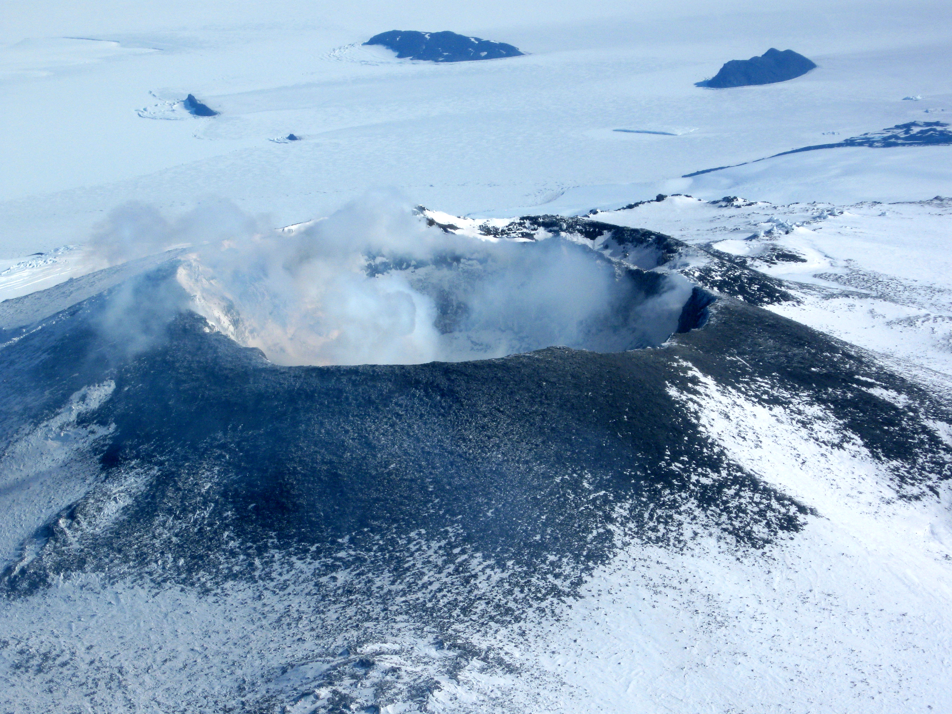
Mount Erebus is currently the most active volcano in Antarctica and is the current eruptive zone of the Erebus hotspot. The summit contains a persistent convecting phonolitic lava lake, one of five long-lasting lava lakes on Earth. Characteristic eruptive activity consists of Strombolian eruptions from the lava lake or from one of several subsidiary vents, all lying within the volcano's inner crater.[10][11] The volcano is scientifically remarkable in that its relatively low-level and unusually persistent eruptive activity enables long-term volcanological study of a Strombolian eruptive system very close (hundreds of metres) to the active vents, a characteristic shared with only a few volcanos planetarily, such as Stromboli in Italy. Scientific study of the volcano is also facilitated by their proximity to McMurdo Station (U.S.) and Scott Base (N.Z.), both sited on Ross Island approximately thirty-five kilometres away.
Mount Erebus is classified as a polygenetic stratovolcano. The bottom half of the volcano is a shield and the top half is a stratocone (Mount Etna is like this as well). The composition of the current eruptive products of Erebus is anorthoclase-porphyric tephritic phonolite and phonolite, which constitute the bulk of exposed lava flow on the volcano. The oldest eruptive products consist of relatively undifferentiated and non-viscous basanitic lavas that form the low, broad platform shield of the Erebus edifice. Slightly younger basanite and phonotephrite lavas crop out on Fang Ridge — an eroded remnant of an early Erebus volcano — and at other isolated locations on the flanks of the Erebus edifice.
Lava flows of more viscous phonotephrite, tephriphonolite and trachyte erupted after the basanite. The upper slopes of Mount Erebus are dominated by steeply dipping (−30°) tephritic phonolite lava flows with large scale flow levees. A conspicuous break in slope at approximately 3,200 metres calls attention to a summit plateau representing a caldera less than one hundred millennia old. The summit caldera itself is filled with small volume tephritic phonolite and phonolite lava flows. In the center of the summit caldera is a small, steep-sided cone composed primarily of decomposed lava bombs and a large deposit of anorthoclase crystals known as Erebus Crystals. It is within this summit cone that the active lava lake continuously degasses.
Researchers spent more than three months during the 2007-08 field season installing an array of seismometers around Mount Erebus to listen to waves of energy generated by small, controlled blasts from explosives they buried along its flanks and perimeter. Seismometers measure and record the size and force of underground energy, or seismic, waves. By studying the refracted and reflected seismic waves, the scientists attempted to map the interior of the volcano, much as a CT scan images the inside of an object using X-rays, to understand its deep "plumbing" and how the magma rises to the lava lake.[12]
Air disaster
Main article: Air New Zealand Flight 901Air New Zealand Flight 901 was a scheduled sightseeing service from Auckland Airport in New Zealand to Antarctica and return, without an intermediate stop. The Air New Zealand flyover service, for the purposes of Antarctic sightseeing, was operated with McDonnell Douglas DC-10-30 aircraft and began in February 1977. The flight crashed into Mount Erebus in sector whiteout conditions on November 28, 1979, killing all 257 people aboard. Air New Zealand discontinued the service after the crash.
During the Antarctic summer, snow melt on the flanks of Mount Erebus continually brings debris from the crash to the surface of the snow; it is plainly visible from the air.
Gallery
-
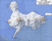
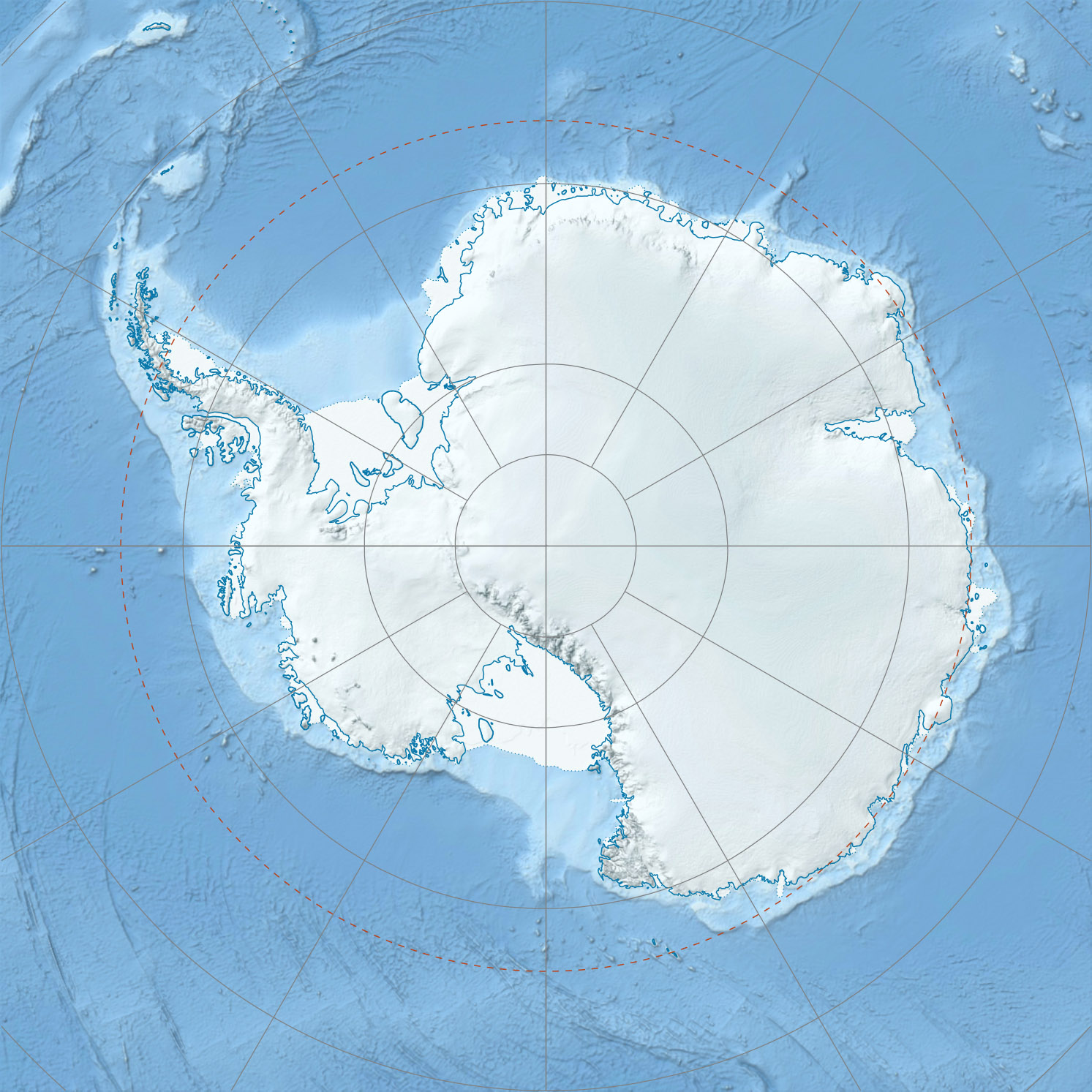
Topographic map of Ross Island (1:250,000 scale) from USGS Ross Island
-

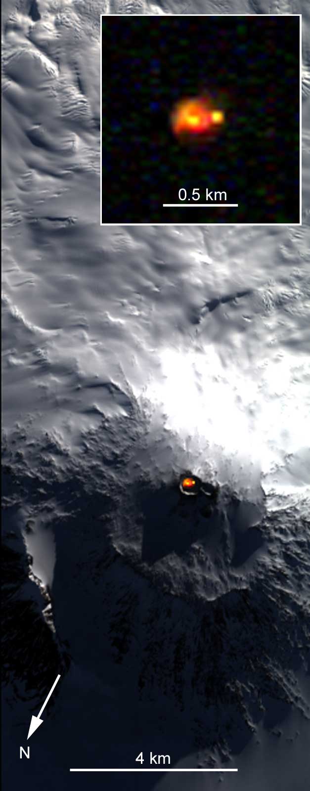
Satellite picture of Mount Erebus showing glow from its persistent lava lake
-
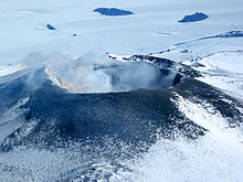
Mount Erebus, 2009
See also
- Erebus Glacier
- Erebus Ice Tongue
- List of volcanoes in Antarctica
- Lower Erebus Hut – home of MEVO
- Nimrod Expedition – first ascent of Mount Erebus
- List of islands by highest point
- Volcanic Seven Summits#Volcanic Seven Second Summits
References
- ^ a b c "Mount Erebus". Global Volcanism Program, Smithsonian Institution. http://www.volcano.si.edu/world/volcano.cfm?vnum=1900-02=. Retrieved 2008-12-29.
- ^ "Mount Erebus". Geographic Names Information System, U.S. Geological Survey. http://geonames.usgs.gov/pls/gnispublic/f?p=gnispq:5:::NO::P5_ANTAR_ID:4558. Retrieved 2011-07-30.
- ^ "Antarctic explorers". Australian Antarctic Division. http://www.aad.gov.au/default.asp?casid=6740. Retrieved 2008-12-29.
- ^ "Mount Erebus Volcano Observatory". New Mexico Tech. http://erebus.nmt.edu. Retrieved 2008-12-29.
- ^ Ross, Voyage to the Southern Seas, vol. i, pp. 216–8.
- ^ Mear, Roger and Robert Swan, In the Footsteps of Scott, pp. 95–104.
- ^ Wheeler, Sara. Terra Incognita.
- ^ Johnson, Nicholas. Big Dead Place.
- ^ Wettergreen, David; Chuck Thorpe and William Whittaker (1993). "Exploring Mount Erebus by Walking Robot". International Conference of Intelligent Autonomous Systems: 72–81.
- ^ Kyle, P. R. (Ed.), Volcanological and Environmental Studies of Mount Erebus, Antarctica, Antarctic Research Series, American Geophysical Union, Washington DC, 1994.
- ^ Aster R., Mah, S., Kyle, P., McIntosh, W., Dunbar, N., and J. Johnson, Very long period oscillations of Mount Erebus volcano, J. Geophys. Res., 108, 2522, doi:10 .1029/2002JB002101, 2003.
- ^ Plumbing Erebus:Scientists use seismic technique to map interior of Antarctic volcano (http://antarcticsun.usap.gov/science/contenthandler.cfm?id=1355)
- General
- LeMasurier, W. E.; Thomson, J. W. (eds.) (1990). Volcanoes of the Antarctic Plate and Southern Oceans. American Geophysical Union. pp. 512 pp. ISBN 0-87590-172-7.
- The Mount Erebus Volcano Observatory (includes live camera images of the volcano's lava lake, video clips of eruptions, and other information)
External links
Categories:- Active volcanoes
- Extreme points of Earth
- Stratovolcanoes
- Volcanoes of Ross Island
- VEI-2 volcanoes
- Hotspot volcanoes
-

Wikimedia Foundation. 2010.